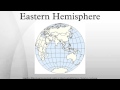
Navigating The Eastern Hemisphere: Geography, History And Cultural Significance
Interactive Video
•
Geography, History, Science
•
9th - 12th Grade
•
Practice Problem
•
Hard

Patricia Brown
FREE Resource
Read more
8 questions
Show all answers
1.
MULTIPLE CHOICE QUESTION
30 sec • 1 pt
Which continents are typically included in the Eastern Hemisphere?
North and South America
Europe, Asia, Africa, and Australia
Only Asia and Africa
Antarctica and Oceania
2.
MULTIPLE CHOICE QUESTION
30 sec • 1 pt
What is the significance of the prime meridian in dividing the hemispheres?
It divides the northern and southern hemispheres.
It is a natural boundary like the equator.
It is an arbitrary convention for dividing eastern and western longitudes.
It was established by the United Nations.
3.
MULTIPLE CHOICE QUESTION
30 sec • 1 pt
When was the convention for the prime meridian established?
In 1900 at the Greenwich Conference
In 1984 at the Global Time Summit
In 1884 at the International Meridian Conference
In 1784 at the Paris Conference
4.
MULTIPLE CHOICE QUESTION
30 sec • 1 pt
What is a consequence of using the prime meridian and anti-meridian as boundaries?
It includes all of Africa in the Western Hemisphere.
It makes the Eastern Hemisphere larger than the Western Hemisphere.
It excludes all of Europe from the Eastern Hemisphere.
It places parts of Western Europe and Africa in the Western Hemisphere.
5.
MULTIPLE CHOICE QUESTION
30 sec • 1 pt
Which alternative meridians are sometimes used for more accurate geopolitical constructs?
40° W and 180° E
30° W and 170° E
20° W and 160° E
10° W and 150° E
6.
MULTIPLE CHOICE QUESTION
30 sec • 1 pt
Before the global adoption of standard time, how was time defined?
By the position of the moon
By local noon and various prime meridians
By the International Date Line
By the equator
7.
MULTIPLE CHOICE QUESTION
30 sec • 1 pt
Which hemisphere has a larger landmass?
The Eastern Hemisphere
The Western Hemisphere
It varies depending on the season
Both have equal landmass
Access all questions and much more by creating a free account
Create resources
Host any resource
Get auto-graded reports
Continue with Google

Continue with Email
Continue with Microsoft
or continue with

%20(1).png)
Apple
Others
Already have an account?
