Mapping Heights and Landforms Through Color and Contour Lines
Interactive Video
•
Geography, Science, Mathematics
•
6th - 7th Grade
•
Practice Problem
•
Hard

Patricia Brown
FREE Resource
Read more
8 questions
Show all answers
1.
MULTIPLE CHOICE QUESTION
30 sec • 1 pt
What color is used to represent areas on a map that are between 0 and 50 meters in height?
Blue
Green
Dark brown
Light brown
2.
MULTIPLE CHOICE QUESTION
30 sec • 1 pt
Which color is used to indicate heights between 101 and 150 meters on a physical map?
Yellow
Dark brown
Green
Light brown
3.
MULTIPLE CHOICE QUESTION
30 sec • 1 pt
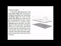
What do contour lines on a map represent?
Water bodies
Points of equal height
Different types of vegetation
Road networks
4.
MULTIPLE CHOICE QUESTION
30 sec • 1 pt
How do contour lines appear on a map when representing a flat plain?
In a zigzag pattern
Very close together
Far apart
In a circular pattern
5.
MULTIPLE CHOICE QUESTION
30 sec • 1 pt
How do contour lines appear on a map when representing a mountainous area?
In a straight line
Far apart
Very close together
In a grid pattern
6.
MULTIPLE CHOICE QUESTION
30 sec • 1 pt
Why is it important to know the height of the land when constructing a road?
To determine the type of soil
To find the shortest route
To understand the slope and terrain
To avoid water bodies
7.
MULTIPLE CHOICE QUESTION
30 sec • 1 pt
What is one reason for knowing the height of land when building a dam?
To determine the amount of land submerged
To locate nearby towns
To calculate the water flow
To find the best construction materials
Access all questions and much more by creating a free account
Create resources
Host any resource
Get auto-graded reports
Continue with Google

Continue with Email
Continue with Classlink
Continue with Clever
or continue with
Microsoft
%20(1).png)
Apple
Others
Already have an account?
