Geography of South America
Interactive Video
•
Geography, Science, Social Studies
•
4th - 5th Grade
•
Practice Problem
•
Hard

Patricia Brown
FREE Resource
Read more
8 questions
Show all answers
1.
MULTIPLE CHOICE QUESTION
30 sec • 1 pt
What is the purpose of the narrated PowerPoint presented by Mr. Wilson?
To teach students about European countries
To introduce new topics in geography
To help students study for a South America map quiz
To provide a history lesson on South America
2.
MULTIPLE CHOICE QUESTION
30 sec • 1 pt
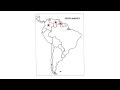
Which country is located at the northernmost part of South America?
Argentina
Brazil
Colombia
Chile
3.
MULTIPLE CHOICE QUESTION
30 sec • 1 pt
Which country is directly south of Venezuela?
Guyana
Ecuador
Peru
Brazil
4.
MULTIPLE CHOICE QUESTION
30 sec • 1 pt
Which country is known for its long coastline along the Pacific Ocean?
Chile
Uruguay
Paraguay
Bolivia
5.
MULTIPLE CHOICE QUESTION
30 sec • 1 pt
What is the name of the mountain range that runs along the western side of South America?
Rocky Mountains
Alps
Himalayas
Andes Mountains
6.
MULTIPLE CHOICE QUESTION
30 sec • 1 pt
Which large rainforest is located over the Amazon River?
Amazon Rainforest
Sundarbans
Daintree Rainforest
Congo Rainforest
7.
MULTIPLE CHOICE QUESTION
30 sec • 1 pt
What is the name of the desert located in northern Chile?
Atacama Desert
Gobi Desert
Kalahari Desert
Sahara Desert
Access all questions and much more by creating a free account
Create resources
Host any resource
Get auto-graded reports
Continue with Google

Continue with Email
Continue with Classlink
Continue with Clever
or continue with
Microsoft
%20(1).png)
Apple
Others
Already have an account?
