Understanding Contour Lines and Landforms
Interactive Video
•
Science, Geography, Physical Ed
•
6th - 8th Grade
•
Practice Problem
•
Hard

Patricia Brown
FREE Resource
Read more
9 questions
Show all answers
1.
MULTIPLE CHOICE QUESTION
30 sec • 1 pt
Who is the speaker in the video and what is his background?
Joseph Kirksey, a former US Geological Survey employee
John Doe, a geography teacher
Jane Smith, a cartographer
Michael Brown, a geologist
2.
MULTIPLE CHOICE QUESTION
30 sec • 1 pt
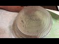
What is one of the main materials needed for the tracing activity?
Metal plates
Cardboard sheets
Transparent salad trays
Plastic bottles
3.
MULTIPLE CHOICE QUESTION
30 sec • 1 pt
Where can you obtain the transparent salad trays for the activity?
At a library
At a hardware store
At a grocery or craft store
Online only
4.
MULTIPLE CHOICE QUESTION
30 sec • 1 pt
What is the purpose of tracing contour lines onto the salad trays?
To make a map of the local area
To build a 3D model of a landscape
To create a colorful art piece
To design a new type of map
5.
MULTIPLE CHOICE QUESTION
30 sec • 1 pt
How do the traced contour lines help in understanding landforms?
They show the elevation of different areas
They create a 2D representation of the landscape
They illustrate the movement of tectonic plates
They highlight the vegetation in the area
6.
MULTIPLE CHOICE QUESTION
30 sec • 1 pt
What can students learn by tipping the 3D model upside down?
The color variations in maps
How isolines represent 3D landforms
The concept of gravity
The model's weight distribution
7.
MULTIPLE CHOICE QUESTION
30 sec • 1 pt
What educational concepts does this activity help illustrate?
Map reading and geomorphology
Biology and chemistry
Physics and astronomy
History and archaeology
Access all questions and much more by creating a free account
Create resources
Host any resource
Get auto-graded reports
Continue with Google

Continue with Email
Continue with Classlink
Continue with Clever
or continue with
Microsoft
%20(1).png)
Apple
Others
Already have an account?
