Plate Tectonics and Boundaries
Interactive Video
•
Science, Geography, Other
•
9th - 10th Grade
•
Practice Problem
•
Hard

Patricia Brown
FREE Resource
Read more
10 questions
Show all answers
1.
MULTIPLE CHOICE QUESTION
30 sec • 1 pt
What is the primary focus of plate tectonics?
The behavior of ocean currents
The study of weather patterns
The movement of Earth's continents and ocean basins
The formation of mountains
2.
MULTIPLE CHOICE QUESTION
30 sec • 1 pt
What is a key skill to learn in an introductory geology lab?
Identifying rock types
Mapping weather systems
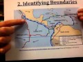
Identifying plate boundaries on a map
Calculating mineral hardness
3.
MULTIPLE CHOICE QUESTION
30 sec • 1 pt
How are convergent plate boundaries typically represented on a map?
As dotted lines
As lines with teeth
As dashed lines
As solid lines
4.
MULTIPLE CHOICE QUESTION
30 sec • 1 pt
What geological feature is often associated with the overriding plate at a convergent boundary?
A mountain range
A volcano
A river
A desert
5.
MULTIPLE CHOICE QUESTION
30 sec • 1 pt
What is the typical appearance of divergent plate boundaries on a map?
Solid lines through an ocean
Dashed lines through a continent
Lines with teeth
Dotted lines
6.
MULTIPLE CHOICE QUESTION
30 sec • 1 pt
Where can divergent plate boundaries exist besides oceans?
In the atmosphere
Within continents
In the mantle
In the core
7.
MULTIPLE CHOICE QUESTION
30 sec • 1 pt
How are transform plate boundaries often represented on maps?
As dashed lines
As dotted lines
As lines with teeth
As solid lines
Access all questions and much more by creating a free account
Create resources
Host any resource
Get auto-graded reports
Continue with Google

Continue with Email
Continue with Classlink
Continue with Clever
or continue with
Microsoft
%20(1).png)
Apple
Others
Already have an account?
Similar Resources on Wayground

3 questions
Vertical and Adjacent angles, Parallel lines and Angle relations
Interactive video
•
9th Grade
6 questions
CLEAN : Ghani makes first Pakistan trip with eye on Taliban talks
Interactive video
•
9th - 10th Grade
6 questions
CLEAN : Ugandans comment on internet shutdown and hopes for change
Interactive video
•
9th - 10th Grade
8 questions
Listening Practice: Can Married People Stay Friends with Someone they Might be Attracted to?
Interactive video
•
9th - 10th Grade
6 questions
Charities distribute relief supplies to people in Nablus
Interactive video
•
9th - 10th Grade
6 questions
Michael Barrymore at the Oxford Union - Part 6
Interactive video
•
9th - 10th Grade
6 questions
CLEAN: Philippine MPs visit Spratlys despite China warning
Interactive video
•
9th - 10th Grade
Popular Resources on Wayground
15 questions
Fractions on a Number Line
Quiz
•
3rd Grade
20 questions
Equivalent Fractions
Quiz
•
3rd Grade
25 questions
Multiplication Facts
Quiz
•
5th Grade
29 questions
Alg. 1 Section 5.1 Coordinate Plane
Quiz
•
9th Grade
22 questions
fractions
Quiz
•
3rd Grade
11 questions
FOREST Effective communication
Lesson
•
KG
20 questions
Main Idea and Details
Quiz
•
5th Grade
20 questions
Context Clues
Quiz
•
6th Grade
Discover more resources for Science
8 questions
Momentum and Collisions
Lesson
•
9th - 12th Grade
25 questions
Naming Ionic and Covalent Compounds
Quiz
•
9th Grade
10 questions
Exploring Weathering, Erosion, and Deposition Processes
Interactive video
•
6th - 10th Grade
10 questions
Cladogram Practice
Quiz
•
9th Grade
12 questions
The Respiratory System
Lesson
•
9th - 12th Grade
14 questions
Natural Selection and Adaptation
Lesson
•
9th - 12th Grade
10 questions
Exploring the Rock Cycle and Plate Tectonics
Interactive video
•
6th - 10th Grade
10 questions
calculating work
Quiz
•
9th Grade