Geography Concepts and Map Skills
Interactive Video
•
Geography
•
4th - 5th Grade
•
Practice Problem
•
Hard

Patricia Brown
FREE Resource
Read more
10 questions
Show all answers
1.
MULTIPLE CHOICE QUESTION
30 sec • 1 pt
Which of the following is NOT one of the seven continents?
Australia
Greenland
Europe
Africa
2.
MULTIPLE CHOICE QUESTION
30 sec • 1 pt
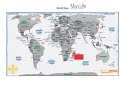
What is the main reason the Mercator map is distorted?
It is outdated.
It uses incorrect colors.
It is drawn on a flat surface.
It omits certain countries.
3.
MULTIPLE CHOICE QUESTION
30 sec • 1 pt
Why did Mercator place Europe at the center of his map?
Europe is the largest continent.
He was from Europe.
Europe is the most populated.
It was a random choice.
4.
MULTIPLE CHOICE QUESTION
30 sec • 1 pt
Which ocean lies between North America and Europe?
Pacific Ocean
Indian Ocean
Atlantic Ocean
Arctic Ocean
5.
MULTIPLE CHOICE QUESTION
30 sec • 1 pt
What does the compass rose help you determine on a map?
Climate zones
Population density
Direction
Distance between countries
6.
MULTIPLE CHOICE QUESTION
30 sec • 1 pt
How far is Madagascar from Australia according to the map scale?
3,000 miles
5,000 miles
7,000 miles
9,000 miles
7.
MULTIPLE CHOICE QUESTION
30 sec • 1 pt
Which ancient civilization is NOT mentioned as being part of Central America?
Incas
Mayas
Aztecs
Romans
Access all questions and much more by creating a free account
Create resources
Host any resource
Get auto-graded reports
Continue with Google

Continue with Email
Continue with Classlink
Continue with Clever
or continue with
Microsoft
%20(1).png)
Apple
Others
Already have an account?
