Geography Concepts and Features
Interactive Video
•
Geography
•
6th - 7th Grade
•
Practice Problem
•
Hard

Patricia Brown
FREE Resource
Read more
10 questions
Show all answers
1.
MULTIPLE CHOICE QUESTION
30 sec • 1 pt
What are the four main cardinal points?
North, South, East, West
Up, Down, Left, Right
Forward, Backward, Sideways, Diagonal
Above, Below, Beside, Across
2.
MULTIPLE CHOICE QUESTION
30 sec • 1 pt
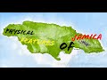
Which mountain range is considered the tallest in Jamaica?
Rocky Mountains
Himalayas
Andes Mountains
Blue Mountain Range
3.
MULTIPLE CHOICE QUESTION
30 sec • 1 pt
What is a characteristic of lowlands?
Volcanic activity
Steep slopes
Flat land near sea level
High elevation
4.
MULTIPLE CHOICE QUESTION
30 sec • 1 pt
Which of the following is NOT a physical feature?
Internet
Mountains
Rivers
Climate
5.
MULTIPLE CHOICE QUESTION
30 sec • 1 pt
What is the purpose of a physical map?
To highlight physical features like rivers and mountains
To display population density
To indicate economic activities
To show political boundaries
6.
MULTIPLE CHOICE QUESTION
30 sec • 1 pt
How do lines of latitude run across the Earth?
Vertically
East-West
North-South
Diagonally
7.
MULTIPLE CHOICE QUESTION
30 sec • 1 pt
What is the main use of latitude and longitude?
To measure temperature
To predict weather patterns
To describe the location of places on Earth
To calculate time zones
Access all questions and much more by creating a free account
Create resources
Host any resource
Get auto-graded reports
Continue with Google

Continue with Email
Continue with Microsoft
or continue with

%20(1).png)
Apple
Others
Already have an account?
