Understanding Map Symbols and Directions
Interactive Video
•
Geography
•
5th - 6th Grade
•
Practice Problem
•
Hard

Thomas White
FREE Resource
Read more
15 questions
Show all answers
1.
MULTIPLE CHOICE QUESTION
30 sec • 1 pt
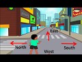
If Aman is facing the sun at 6 o'clock, which direction is he facing?
East
South
West
North
2.
MULTIPLE CHOICE QUESTION
30 sec • 1 pt
What direction is directly opposite to East?
South
North
Northeast
West
3.
MULTIPLE CHOICE QUESTION
30 sec • 1 pt
Which direction is between North and East?
Northwest
Northeast
Southeast
Southwest
4.
MULTIPLE CHOICE QUESTION
30 sec • 1 pt
How many meters does one stick represent on Aman's map?
5 meters
4 meters
3 meters
2 meters
5.
MULTIPLE CHOICE QUESTION
30 sec • 1 pt
If the length of a house is 9 sticks, what is its length in meters?
36 meters
28 meters
45 meters
32 meters
6.
MULTIPLE CHOICE QUESTION
30 sec • 1 pt
What is the width of Aman's house if it is 7 sticks wide?
28 meters
35 meters
42 meters
21 meters
7.
MULTIPLE CHOICE QUESTION
30 sec • 1 pt
What is the main entrance direction of Aman's house on the map?
East
North
West
South
Access all questions and much more by creating a free account
Create resources
Host any resource
Get auto-graded reports
Continue with Google

Continue with Email
Continue with Classlink
Continue with Clever
or continue with
Microsoft
%20(1).png)
Apple
Others
Already have an account?
