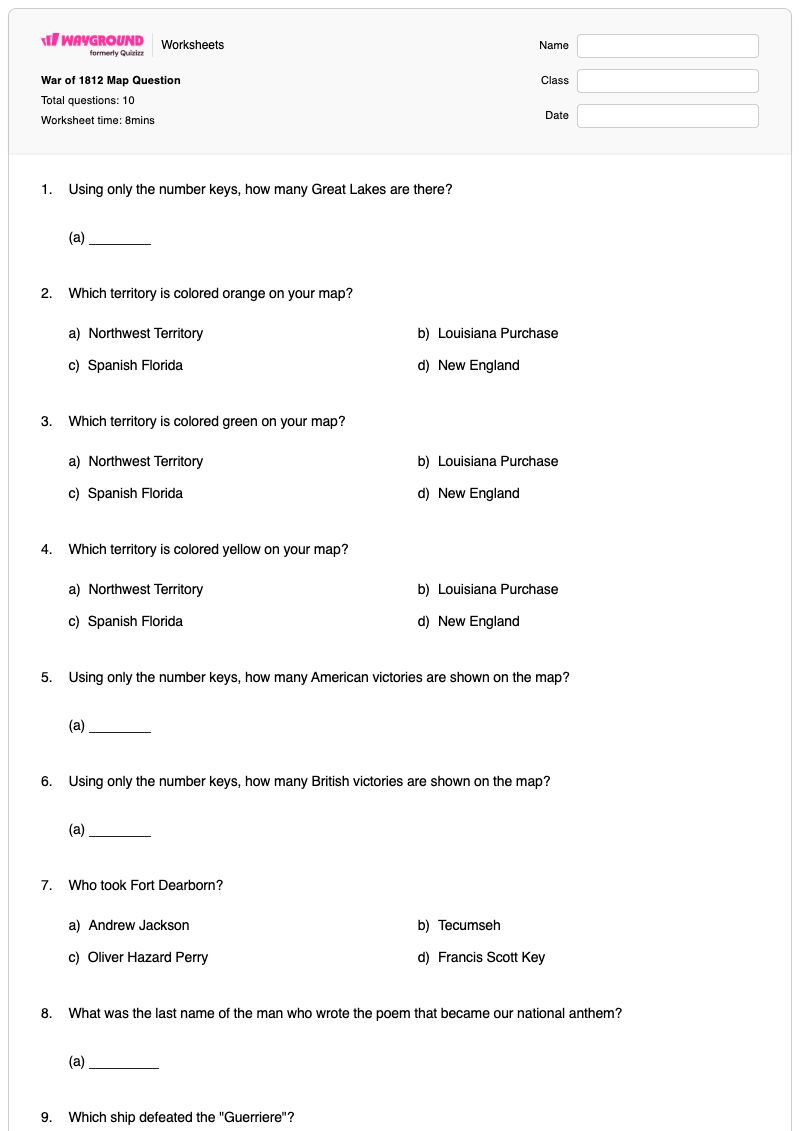
This Grade 8 social studies worksheet builds map-reading and historical recall skills related to the War of 1812. Students interpret colored territories, identify the number of Great Lakes, count American and British victories shown on the map, and locate the Ohio River alongside the Mississippi River. The worksheet also connects map evidence with key people, places, and events from the conflict, including Fort Dearborn, Francis Scott Key, and the USS Constitution.
The 10 questions include six fill-in-the-blank items and four multiple-choice questions. Students must enter numerical counts, supply names and locations, and distinguish among historical figures, territories, and ships. This free printable worksheet is designed for Grade 8 social studies review, guided practice, or a brief assessment of students’ ability to read a historical map and recall connected War of 1812 facts. It includes a complete answer key for efficient checking.
Worksheet settings
Font size
S
M
L
XL
Worksheets
War of 1812 Map Question
Total questions: 10
Name
Class
Date
1.
Using only the number keys, how many Great Lakes are there?
(a)
2.
Which territory is colored orange on your map?
a)
Northwest Territory
b)
Louisiana Purchase
c)
Spanish Florida
d)
New England
3.
Which territory is colored green on your map?
a)
Northwest Territory
b)
Louisiana Purchase
c)
Spanish Florida
d)
New England
4.
Which territory is colored yellow on your map?
a)
Northwest Territory
b)
Louisiana Purchase
c)
Spanish Florida
d)
New England
5.
Using only the number keys, how many American victories are shown on the map?
(a)
6.
Using only the number keys, how many British victories are shown on the map?
(a)
7.
Who took Fort Dearborn?
a)
Andrew Jackson
b)
Tecumseh
c)
Oliver Hazard Perry
d)
Francis Scott Key
8.
What was the last name of the man who wrote the poem that became our national anthem?
(a)
9.
Which ship defeated the "Guerriere"?
(a)
10.
Which river is labeled besides the Mississippi River?
(a)
Answer Key
War of 1812 Map Question
Total questions: 10
1.
5
2.
c)
Spanish Florida
3.
b)
Louisiana Purchase
4.
a)
Northwest Territory
5.
7
6.
5
7.
b)
Tecumseh
8.
Key
9.
Constitution, constitution, The constitution, The USS Constitution, the constitution, USS Constitution
10.
Ohio, ohio, Ohio River, ohio river, Ohio river
140 %
Browse by subjects
Browse by grades
Browse by format
FAQs
What does the War of 1812 Map Question worksheet cover?
This Grade 8 worksheet combines historical map interpretation with War of 1812 knowledge. Its six fill-in-the-blank and four multiple-choice questions ask students to identify colored territories, count Great Lakes and map-marked victories, locate the Ohio River, and recall figures and events such as Tecumseh, Francis Scott Key, and the USS Constitution.
How can I use this worksheet to teach students about the War of 1812?
First, review the map’s color-coded territories and labeled locations, then model how to use visual evidence to answer one territory or counting question. Have students complete the remaining items independently or in pairs, and discuss how the map counts and identification questions connect with the historical prompts about Fort Dearborn, the national anthem’s author, and the USS Constitution.
What mistakes should I watch for when students complete this War of 1812 map worksheet?
Students may confuse the colored territories, especially when selecting among the Northwest Territory, Louisiana Purchase, Spanish Florida, and New England. They may also miscount the American or British victories, enter a variation of the required name for the Ohio River or USS Constitution, or confuse Tecumseh with the other historical figures listed in the Fort Dearborn question.
How do I assign and grade this War of 1812 worksheet?
On Wayground, assign the worksheet as a printable PDF or as a digital quiz, depending on whether students will work from the historical map on paper or on screen. The worksheet includes a complete answer key, and printable submissions can be graded by scanning student work with the Wayground for Teachers app.
How can I differentiate this War of 1812 map worksheet for my students?
In the worksheet’s Advanced Settings, adjust font spacing or choose a larger font size to make the territory choices, map-related prompts, and fill-in-the-blank responses easier to read. You can also apply a dyslexia-friendly font or translate the worksheet into another language while preserving its map-identification and historical recall format.
Where can I find more free worksheets like this on Wayground?
Wayground offers a broad collection of free printable worksheets and practice problems across subjects, with downloadable PDFs and answer keys to support essential skills and concepts. Browse more resources at https://wayground.com/en-us/worksheets.

 Worksheets