Free Printable Boundary Exploration Worksheets for Grade 6
Grade 6 boundary exploration worksheets from Wayground help students master geographic borders and territorial divisions through engaging printables, practice problems, and comprehensive answer keys for effective social studies learning.
Explore printable Boundary Exploration worksheets for Grade 6
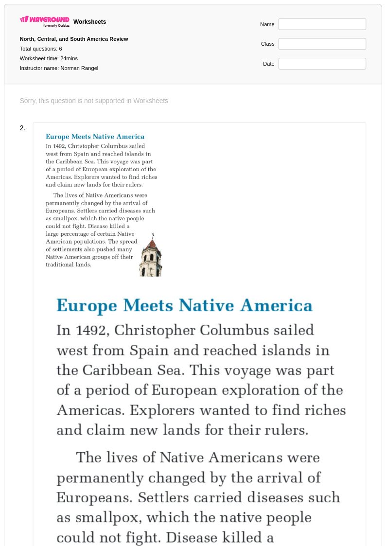
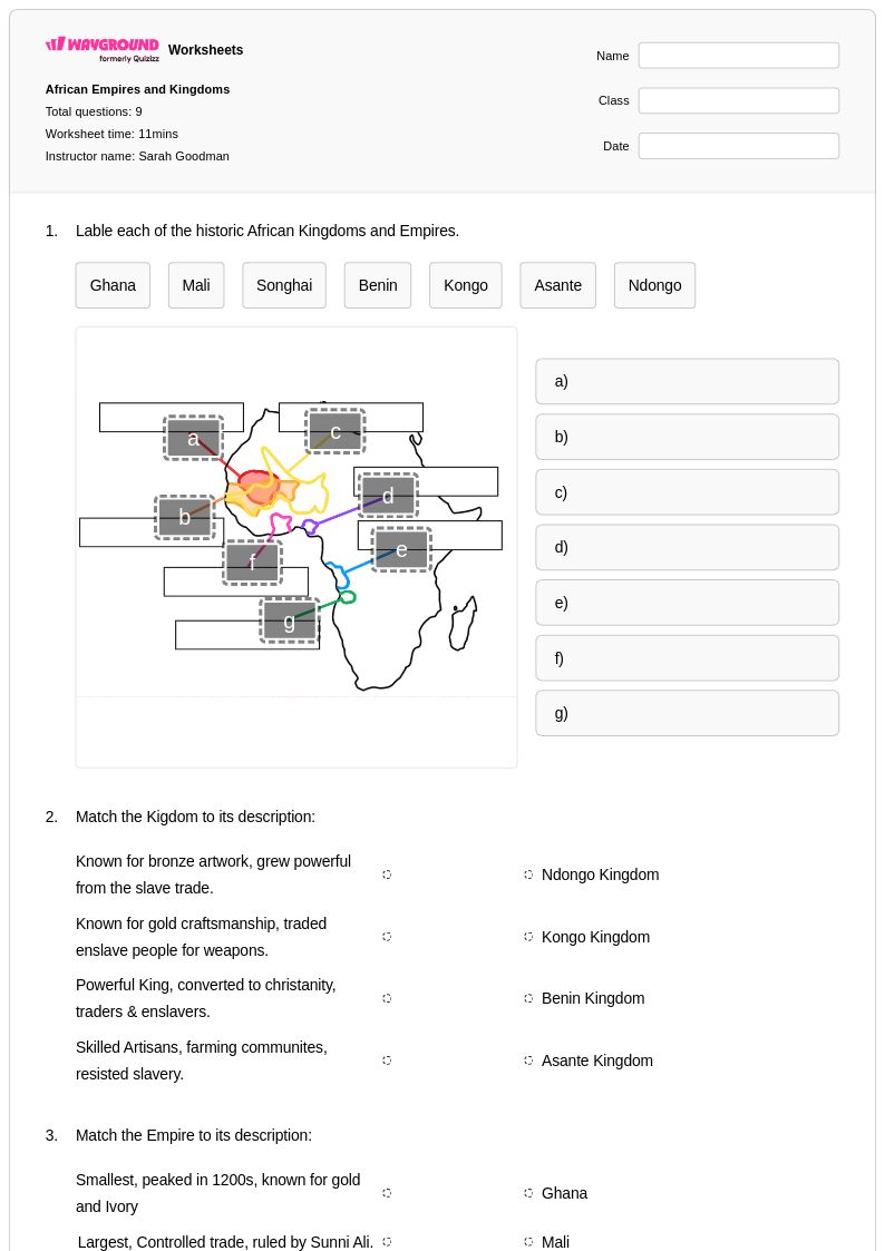
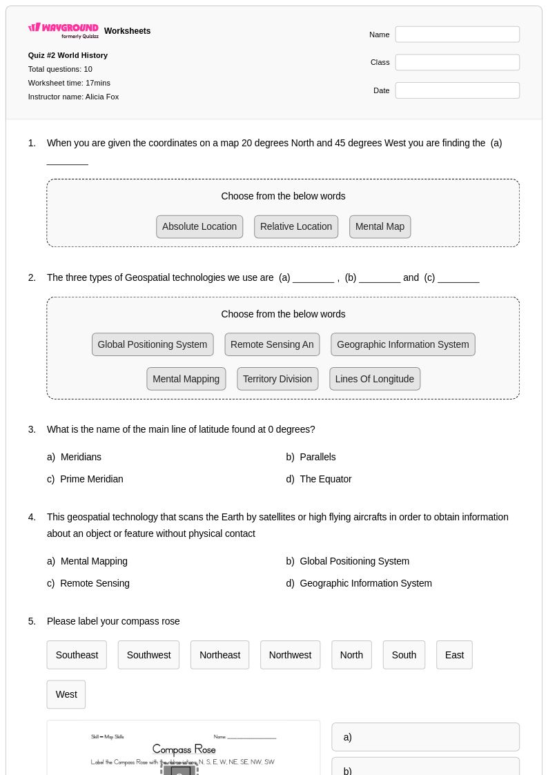
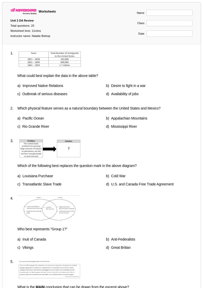
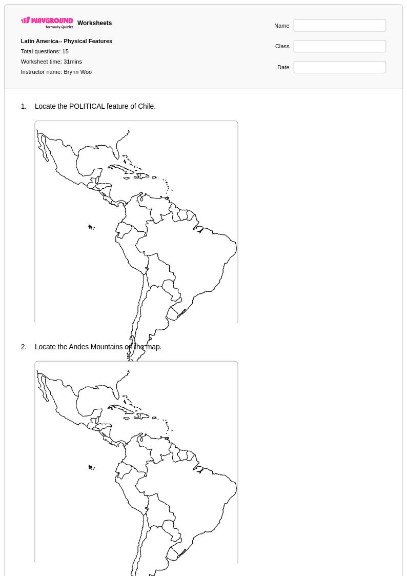
Boundary exploration worksheets for Grade 6 students available through Wayground (formerly Quizizz) provide comprehensive practice in understanding how political and physical boundaries are formed, changed, and maintained across different regions and time periods. These educational resources strengthen students' analytical skills as they examine various types of boundaries including natural features like rivers and mountains, artificial constructions such as walls and fences, and invisible political divisions between countries, states, and municipalities. The worksheets feature practice problems that challenge students to identify boundary types on maps, analyze historical boundary changes, and evaluate the impact of boundaries on human settlement patterns and resource distribution. Each printable resource includes detailed answer keys and free pdf downloads, making it simple for educators to implement meaningful boundary exploration activities that develop critical thinking about geographic concepts and spatial relationships.
Wayground (formerly Quizizz) supports educators with an extensive collection of teacher-created boundary exploration materials, drawing from millions of resources that undergo careful standards alignment to meet Grade 6 social studies curriculum requirements. The platform's advanced search and filtering capabilities allow teachers to locate specific boundary-focused content by difficulty level, geographic region, or historical period, while differentiation tools enable customization for diverse learning needs and ability levels. These flexible worksheets are available in both printable and digital formats, including downloadable pdf versions, making them ideal for classroom instruction, homework assignments, remediation sessions, and enrichment activities. Teachers can easily modify existing materials or combine multiple resources to create comprehensive lesson sequences that guide students through progressively complex boundary analysis tasks, from basic identification exercises to sophisticated comparative studies of international border disputes and their resolutions.
FAQs
How do I teach boundary exploration in a geography class?
Teaching boundary exploration effectively starts with distinguishing between the three main types of boundaries: political, physical, and cultural. Begin with concrete local examples, such as neighborhood or district lines, before scaling up to state, national, and international borders. From there, introduce how boundaries form through treaties, geographic features, and historical conflicts, helping students understand that borders are dynamic rather than fixed. Case studies involving disputed territories or historical boundary shifts give students meaningful context for geographic reasoning.
What exercises help students practice analyzing geographic boundaries?
Effective practice exercises include map annotation tasks where students identify and label political versus physical boundaries, as well as comparative activities that ask students to examine how a border changed over time and explain why. Boundary dispute analysis prompts, where students read about a territorial conflict and evaluate competing claims using geographic evidence, build both critical thinking and content knowledge. These exercises develop spatial reasoning and the ability to connect geographic factors to real-world human activity.
What are the most common misconceptions students have about geographic boundaries?
One of the most persistent misconceptions is that borders are natural and permanent when in fact most political boundaries are human constructs that have shifted significantly throughout history. Students also frequently conflate physical boundaries, such as rivers or mountain ranges, with political borders, assuming the two always align. Another common error is treating boundary disputes as purely geographic when they are often rooted in cultural, ethnic, or economic factors. Addressing these misconceptions early helps students develop more nuanced geographic thinking.
How do boundary exploration worksheets support geographic literacy development?
Boundary exploration worksheets build geographic literacy by giving students structured practice in reading and interpreting maps, analyzing territorial divisions, and evaluating the factors that shape borders. Repeated exposure to boundary analysis tasks helps students internalize spatial thinking skills and connect abstract political concepts to physical geography. Over time, this practice strengthens students' ability to reason about how borders influence human activity at scales ranging from local neighborhoods to international frontiers.
How can I use Wayground's boundary exploration worksheets in my classroom?
Wayground's boundary exploration worksheets are available as printable PDFs for traditional classroom use and in digital formats for technology-integrated learning environments, giving teachers flexibility depending on their classroom setup. Teachers can also host the worksheets as a quiz directly on Wayground, enabling interactive student engagement and streamlined assessment. Each worksheet includes a complete answer key, making it straightforward to use for guided practice, independent work, or formative assessment.
How can I differentiate boundary exploration instruction for students at different skill levels?
Differentiation in boundary exploration can involve adjusting the complexity of the maps or source materials students analyze, ranging from simple continent-level borders to nuanced regional boundary disputes. On Wayground, teachers can apply student-level accommodations such as reduced answer choices to lower cognitive load for students who need additional support, or enable Read Aloud for students who benefit from audio delivery of question content. These settings can be applied individually or to the whole class and are saved for reuse across future sessions, making ongoing differentiation practical rather than time-consuming.