Free Printable Regions of the United States Worksheets for Class 5
Class 5 students explore the five regions of the United States with our comprehensive collection of free geography worksheets, featuring engaging printables, practice problems, and detailed answer keys in PDF format.
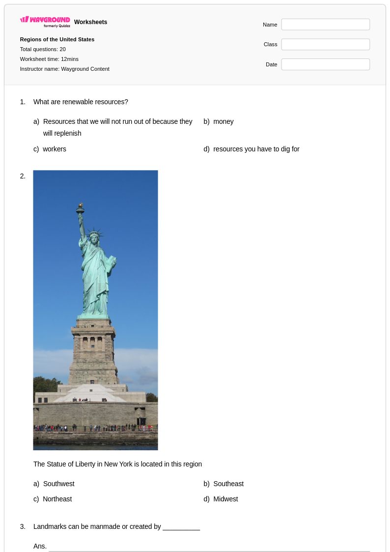
Explore printable Regions of the United States worksheets for Class 5
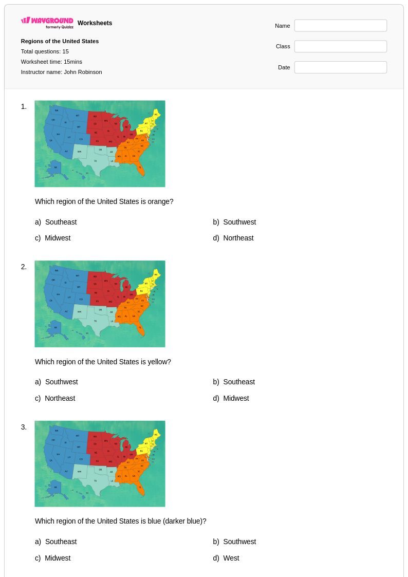
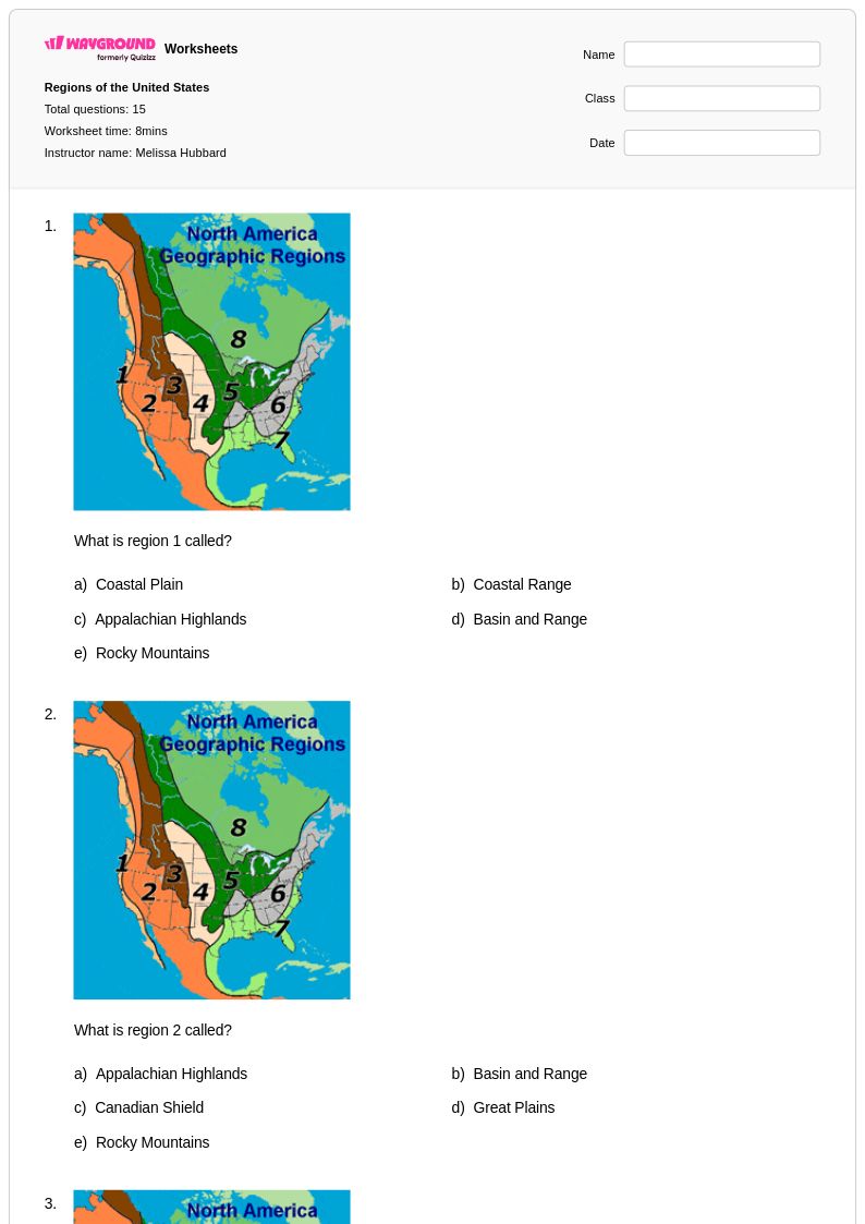
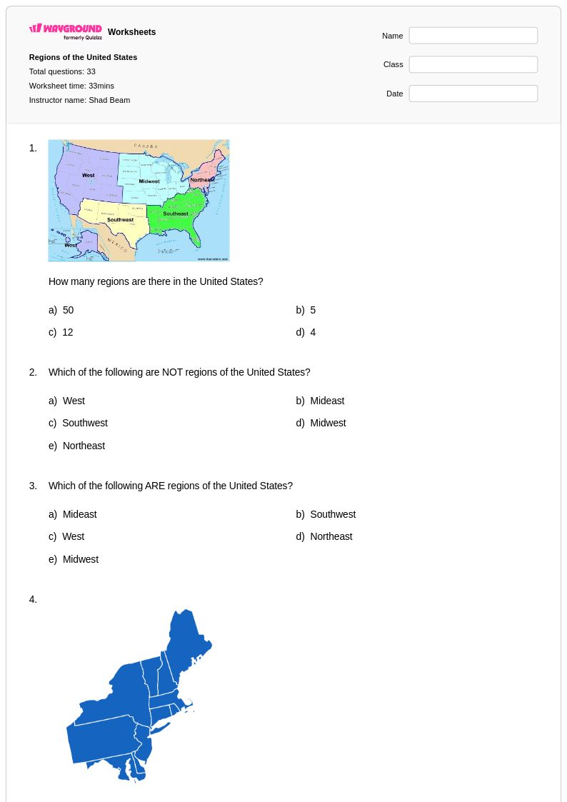
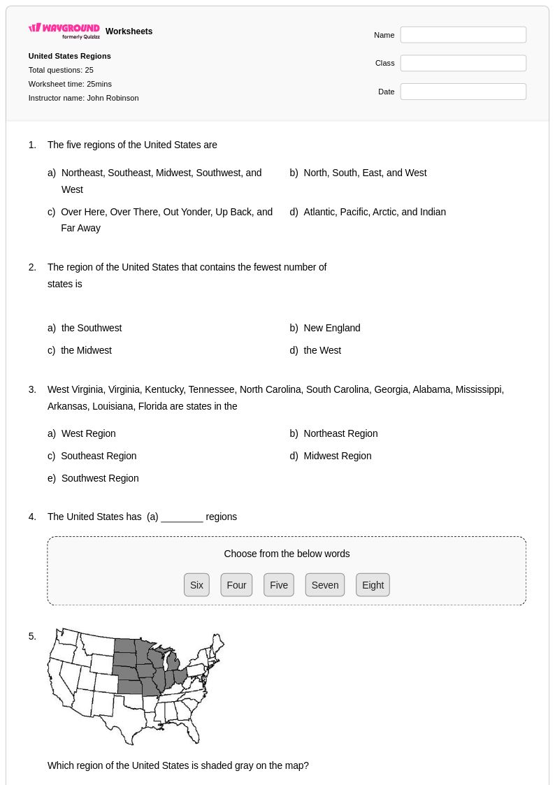
Regions of the United States worksheets for Class 5 provide comprehensive coverage of America's diverse geographical areas, helping students master essential social studies concepts about regional characteristics, boundaries, and distinctive features. These educational resources strengthen critical thinking skills as students analyze the Northeast, Southeast, Midwest, Southwest, and West regions, examining how geography influences culture, economy, and daily life in each area. The practice problems guide learners through identifying state locations, comparing regional climates, and understanding how natural resources shape regional development. Each printable worksheet includes detailed answer keys that support both independent study and classroom instruction, while the free pdf format ensures easy access and distribution for effective learning reinforcement.
Wayground, formerly Quizizz, empowers educators with an extensive collection of teacher-created resources focused on United States regions, drawing from millions of high-quality materials developed by experienced classroom professionals. The platform's robust search and filtering capabilities allow teachers to quickly locate worksheets aligned with specific curriculum standards and learning objectives, while built-in differentiation tools enable customization for diverse student needs and ability levels. Whether seeking remediation activities for struggling learners or enrichment challenges for advanced students, educators can access both printable and digital formats that seamlessly integrate into lesson planning. This flexibility supports targeted skill practice and comprehensive assessment preparation, helping teachers create engaging geographical learning experiences that deepen students' understanding of how regional diversity shapes American identity and development.
FAQs
How do I teach the regions of the United States to students?
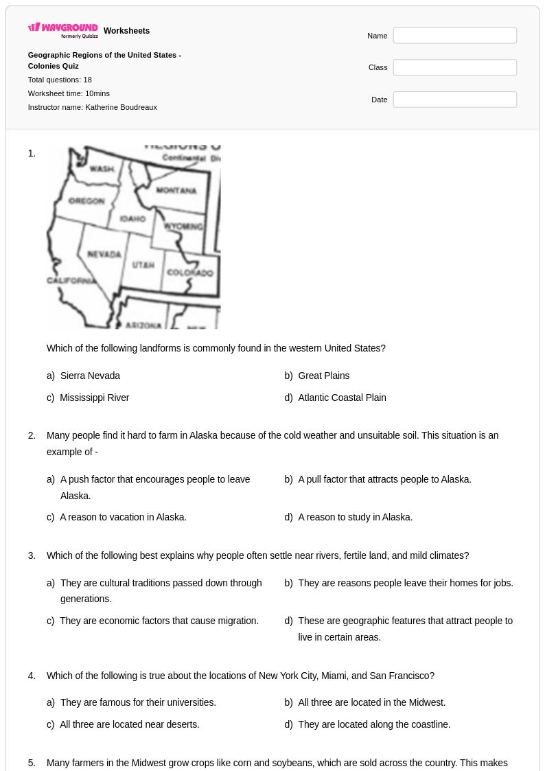
Start by introducing the five major regions — Northeast, Southeast, Midwest, Southwest, and West — using physical maps that highlight landforms, climate zones, and natural resources. Anchor each region to concrete examples like the Great Plains, the Appalachian Mountains, or the Gulf Coast so students build mental geography rather than rote labels. Comparing regions side by side using graphic organizers or Venn diagrams helps students see how geography shapes human settlement, economic activity, and cultural identity.
What exercises help students practice identifying U.S. regions?
Effective practice tasks include labeling blank U.S. maps with regional boundaries, matching states to their regions, and analyzing data sets that compare climate, natural resources, and population across regions. Compare-and-contrast activities that ask students to explain why the Midwest is suited for agriculture while the Northeast is more industrialized push students beyond memorization into geographic reasoning. Worksheets that incorporate real map reading and data interpretation are especially useful for building the spatial thinking skills central to this topic.
What mistakes do students commonly make when learning about U.S. regions?
The most common error is treating regional boundaries as fixed political lines rather than geographic and cultural zones that can vary by classification system. Students often confuse states near regional borders — placing states like Missouri or Oklahoma in the wrong region depending on the framework used. Another frequent misconception is assuming all parts of a region share identical characteristics, when in fact physical features, climate, and economic activity vary considerably even within a single region.
How does geography influence the cultural and economic differences between U.S. regions?
Geography directly shapes the economic activities and cultural patterns of each U.S. region. The Midwest's fertile plains support large-scale agriculture, while the Northeast's coastal access historically drove trade and manufacturing. The Southwest's arid climate influences water policy and land use, and the West's varied terrain — from coastline to mountain ranges — supports industries from technology to timber. Teaching students to trace these cause-and-effect relationships between physical geography and human activity is central to regional geography instruction.
How can I use Regions of the United States worksheets in my classroom?
Regions of the United States worksheets on Wayground are available as printable PDFs for traditional classroom use and in digital formats for technology-integrated or remote learning environments, and can also be hosted as a quiz directly on Wayground. Teachers can use them for direct instruction support, independent practice, map-based activities, or formative assessment. Each worksheet includes a complete answer key, making them efficient for both in-class work and homework assignments.
How can I differentiate U.S. regions instruction for students at different skill levels?
For students who struggle with the volume of regional detail, reduce the scope by focusing on two or three contrasting regions before expanding to all five. Wayground supports student-level accommodations including reduced answer choices to lower cognitive load, read aloud for students who benefit from audio support, and adjustable font sizes and themes through reading mode. These settings can be assigned individually so advanced students continue working at full complexity while others receive targeted support — all without singling anyone out.