wayground logo

Free Printable Worksheets

NEW

Font size

S
M
L
XL
Worksheets

Test Review Topic 9 and 10

Total questions: 36

Worksheet time: 30mins

Name
Class
Date
1.
A satellite image of an area in Florida shows a river with slight bends along its length. A second satellite image taken of the same area 10 years later shows the same river with  a different course. What is the best explanation for the difference in the shape of the river's course between the two satellite images?
a)
Wind blew waves across the water surface, eroding away the bank on one side of the river until the river's course changed its shape
b)
Regular freezing and thawing of the river split the soil along the river banks, changing the shape of the river
c)
Water eroded the banks of the river and deposited the eroded soil on opposite banks, causing the river to form tighter bends
d)
Acid rain chemically weathered the banks along the river, forcing the river to wind back and forth
2.
What is mechanical weathering?
a)
Process through which rocks are physically broken into smaller pieces.
b)
Rocks are broken down through chemical changes.
c)
Rocks are worn away from acid in plant roots.
d)
Rocks broken down by machinery.
3.
An avalanche is an example of which process?
a)
Weathering
b)
Erosion
c)
Deposition
d)
Volcanic Eruption
4.
What causes the greatest erosion effect on our beaches?
a)
Waves
b)
Gravity
c)
Glaciers
d)
Wind
5.
Layers of sediment forming at the bottom of the ocean floor is an example of
a)
Weathering
b)
Erosion
c)
Deposition
d)
Awesome Science
6.

the section of a river near an ocean or lake that is fan-shaped is called a

a)

stream

b)

delta

c)

flood plain

d)

meander

7.
What is formed when the curve of a river is separated and becomes its own body of water?
a)
Meander
b)
Tributary
c)
Flood plain
d)
Oxbow lake
8.
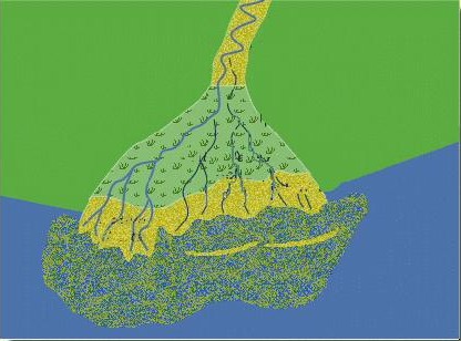
The type of landform shown is at the mouth of the Mississippi River. What is it called?
a)
coastal erosion
b)
a delta
c)
a loess
d)
sand dunes
9.
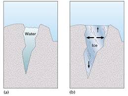
Ice wedging will
a)
wear down rocks as they bounce together 
b)
break up rocks when the water in cracks freezes and thaws
c)
peel away loosened material from the surface of rocks. 
10.
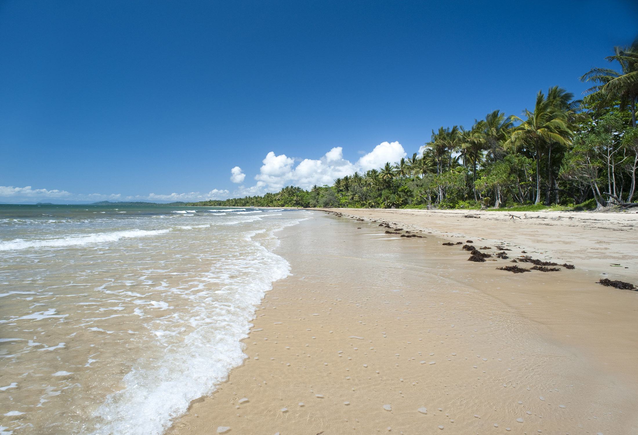
Sand settles on the beach after waves dropped it there. This is an example of...
a)
Weathering 
b)
Erosion
c)
Deposition
d)
Dragging
11.
Wind blows sand onto rocks and slowly breaks down the rock
a)
Mechanical Weathering
b)
Chemical Weathering
c)
Erosion
d)
Deposition
12.
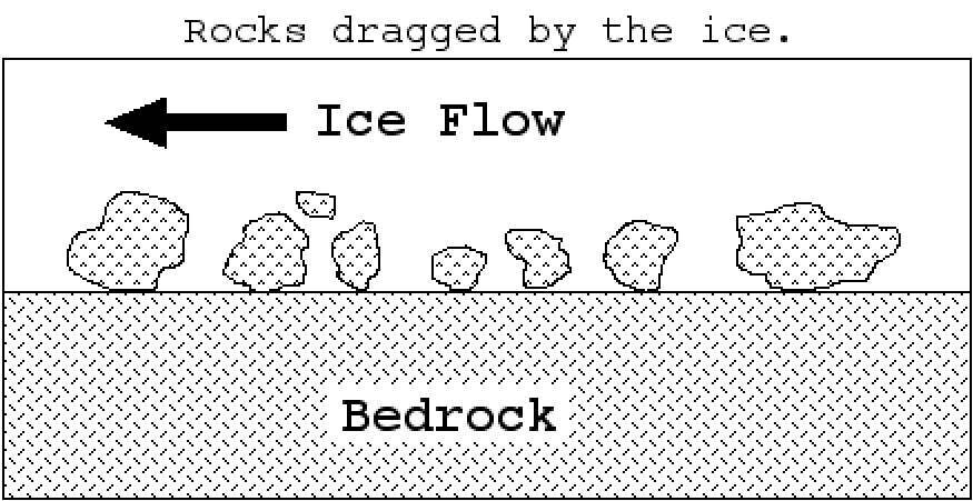
_____ is rock debris embedded in base of ice create polishing, grooves and striations.
a)
Plucking
b)
Abrasion
c)
Weathering
d)
Erosion
13.
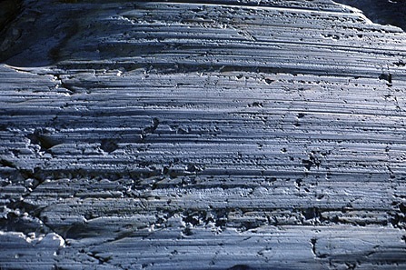
_____ are parallel scratch marks on bedrock
a)
Plucking
b)
Abrasion
c)
Straitions
d)
Till
14.
_____ are are lines deposited at bottom or along sides of glaciers.
a)
Eskers
b)
Till
c)
Erratics
d)
Moraines
15.
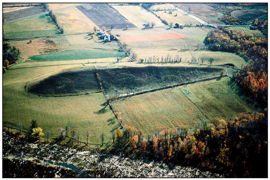
A _____ is a tear-drop-shaped hill created by ice flow over and around till deposit.
a)
drumlin
b)
esker
c)
moraine
d)
erratic
16.
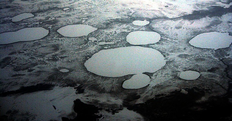
A _____ are depressions formed as stranded ice blocks melt in outwash.
a)
erratics
b)
eskers
c)
kettles
d)
drumlin
17.
The deposit at the furthest point the glacier ever gets.
a)
moraine
b)
ground moraine
c)
recessional moraine
d)
terminal moraine
18.
All of the following were formed by glaciers EXCEPT _____.
a)
Long Island
b)
Niagra Falls
c)
Great Lakes
d)
Grand Canyon
19.
In some desert settings, the wind erodes bedrock by sandblasting tiny __________ grains onto it. This can produce streamlined landforms called yardangs as well as a wide variety of textures on the bedrock. 
a)
sediment
b)
sand
c)
dunes
d)
gravity
20.
__________ are hills formed by the deposition of sand by the wind.  They come in a variety of shapes and are common in deserts and along coastal areas. 
a)
Striations
b)
Dunes
c)
Moraines
d)
Drifts
21.
An __________ plain refers to the broad, flat area in front of a glacier where large volumes of sediment are deposited by glacial meltwater. 
a)
overdrift
b)
anthill
c)
outwash
d)
eastle
22.
What is the apron of sediment that forms where a stream flows from a steep, narrow canyon onto a plain called?  
a)
talus
b)
outwash
c)
alluvial fan
23.

What landforms are created by glacial erosion and glacial deposition?

a)

U-shaped valley and moraine

b)

hoodoo and dune

c)

loess and outwash

24.

Which of the following words correctly pair the agent of erosion and the erosional features they make.

a)

Rivers and striations

b)

glaciers and meanders

c)

wind and abraded rocks

d)

waves and sandbars

25.

Which of the following words correctly pair the agent of erosion and the depositional features they make?

a)

Glaciers and U-shaped valleys

b)

Rivers and meanders

c)

Wind and beaches

d)

Ocean waves/currents and beaches

26.

Which of the following words correctly pair the agent of erosion and the depositional features they make?

a)

Wind and kettle lakes

b)

Glaciers and Straiations

c)

Rivers and oxbow lakes

d)

gravity and avalanches

27.

Which of the following words correctly pair the agent of erosion and the depositional features they make?

a)

Rivers and sand bars

b)

Glaciers and beaches

c)

Wind and deltas

d)

Ocean Waves and dunes

28.

Which of the following words correctly pair the agent of erosion and the erosional features they make?

a)

Glaciers and V-shaped valleys

b)

Rivers and V-shaped valleys

c)

Glaciers and Moraines

d)

Wind and Dunes

29.
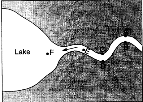
The map below represents a river as it enters a lake. 
At which locations is the amount of deposition greater than the amount of erosion?
a)
A,C and E
b)
B, D and F
c)
B, C, and F
d)
A, D and E
30.
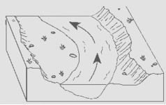
The diagram below shows a section of a meander in a stream. The arrow shows the direction of stream flow. The stream bank on the outside of this meander is steeper than than the stream bank on the inside of this meander because the water on the outside of the meander is moving
a)
Slower, causing deposition
b)
Faster, causing deposition
c)
Slower, causing erosion
d)
Faster, causing erosion
31.
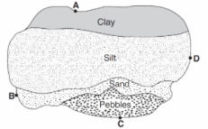
The map below shows an overhead view of sediments that have accumulated at the bottom of a lake. Points A through D represent locations on the shoreline of the lake. A river most likely flows into the lake nearest to location
a)
A
b)
B
c)
C
d)
D
32.
The diagram below shows a section of a meander in a stream. The arrow shows the direction of stream flow. The stream bank on the outside of this meander is steeper than than the stream bank on the inside of this meander because the water on the outside of the meander is moving
a)
Slower, causing deposition
b)
Faster, causing deposition
c)
Slower, causing erosion
d)
Faster, causing erosion
33.
A stream’s velocity decreases from 100 cm/s to 5cm/s. Which size sediment particles will still be transported by the stream?
a)
pebbles, sand, silt and clay
b)
sand, silt and clay only
c)
silt and clay only
d)
clay only
34.
Which type of climate will have faster chemical weathering?
a)
Hot and Wet
b)
Cold and Dry
c)
Hot and Cold
d)
Cold and Wet
35.
__________ is the most important agent of chemical weathering.
a)
erosion 
b)
water
c)
iron
d)
oxygen
36.
What is the relationship between surface area and the rate of weathering?
a)
As surface area increases, the rate of weathering decreases
b)
As surface area increases, the rate of weathering increases
c)
As surface area decreases, the rate of weathering increases
d)
There is no relationship