Worksheets
Air Masses and Fronts
Total questions: 71
Worksheet time: 1hrs 27mins



cT air mass is
tropical maritime
polar maritime
tropical continental
polar continental
a cP air mass is a
Arctic Continental
Polar Maritime
Polar Continental
Tropical Continental
Which is the correct symbol for an occluded front?


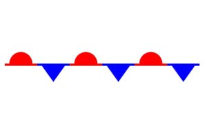

Which is the correct symbol for a stationary front?


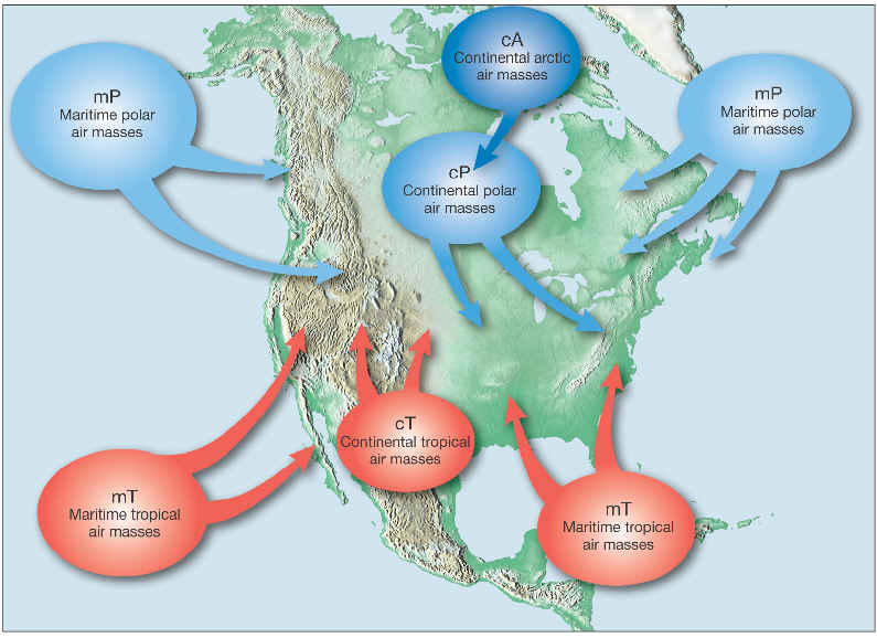
An air mass is a large mass of air that is defined by its temperature and ____________________.
Elevation (altitude)
Water vapor content (humidity)
Strength
Weather

Hurricanes form in which type of air mass?
Continental polar
Continental tropical
Maritime polar
Maritime tropical

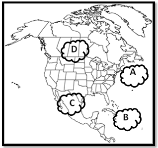
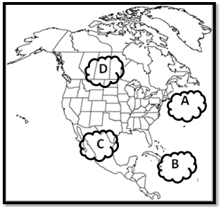
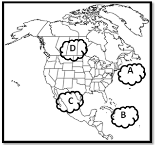
Which type of air mass is pictured in letter "C" (northeastern U.S., around NYC)?
Continental polar
Continental tropical
Maritime polar
Maritime tropical

A _____________ weather front occurs two cold air masses meet and push/force the warm air in the middle upwards.
Cold
Warm
Stationary
Occluded

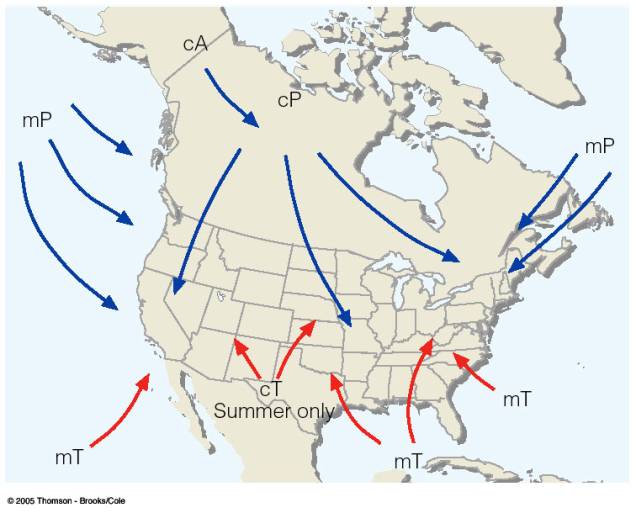
Applying what you know about air masses, which air mass would you expect to find here in Chad, Africa? (circled on the picture **hint: find the equator line**)
Continental polar
Continental tropical
Maritime polar
Maritime tropical

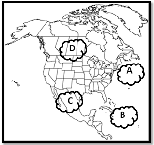
Which type of air mass is found at B?
Continental polar
Maritime polar
continental tropical
Maritime tropical

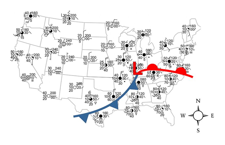
Which type of front is NOT pictured in the weather map?
High pressure
Low Pressure
stationary front
Occluded front
Warm front


A high pressure area will most likely result in which type of weather? S6E4.d
stormy weather
clear weather
cloudy weather
snowy weather
Which situation best describes how a thunderstorm is formed? S6E4.d
Thunderstorms typically occur, when warm, moist air meets cool, dry air.
This is the result of incorrectly thinking air masses of different temperatures do not need to collide in order for thunderstorms to be likely.
This is the result of incorrectly thinking air masses of different temperatures do not need to collide in order for thunderstorms to
be likely.
This is the result of incorrectly thinking air masses of different temperatures do not need to collide in order for thunderstorms to
be likely.


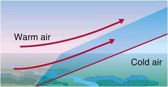
Does this diagram show a warm front or a cold front?
Cold front
Warm front

will be hotter
will be windy
will be relatively calm
will be cold


Why do you see precipitation near the L? (select 2 answers)
because that is low pressure and that is where air rises, forming clouds
because that is where air is falling and it brings rain with it
because southern Ohio is always rainy this time of year
because the cold front is meeting the warm front which forces warm air to rise rapidly forming clouds

Cold air is approaching Location A
Warm air is approaching Location A
Cold air is approaching Location B
Warm air is approaching Location B

Cold air is approaching Location A
Warm air is approaching Location A
Cold air is approaching Location B
Warm air is approaching Location B

Cold air is approaching Location A
Warm air is approaching Location A
Cold air is approaching Location B
Warm air is approaching Location B