
 Worksheets
Yr 7 Geography Revision Quiz
Total questions: 60
Worksheet time: 43mins


A compass tells us...
Direction
Distance
Temperture
Weight

A map scale tells us...
Direction
Distance
Temperture
Weight

Which of these is appropriate for remembering the points on a compass?
Never Wear Silly Neckties
Never Spit Watermelon Ever
Never Eat Salami Waffles
Never Eat Soggy Eggs

If a map scale is 1cm = 3km
What does 4cm = ???
3km
9km
12km
15km

If a map scale is 2cm = 4m
What does 1cm = ???
2m
4m
6m
8m

What is the name of the person who makes maps?
Mapologist
Physicist
Meteorologist
Cartographer
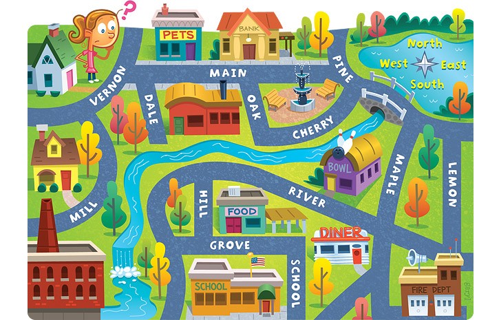
What is a drawing of places around the Earth called?
map
globe
the world
dictionary
Which tool would you NOT find on a map?
title
planets
legend
compass rose
What map tool would you use to measure the distance from one place to another?
map scale
title
legend
compass rose
What type of map would you use to find the population of the area?
physical map
climate map
political map
population map
What type of map shows landforms, rivers and valleys?
climate map
political map
population map
physical map
What is the study of weather over time?
coordinates
climate
compass rose
population
What is the purpose of coordinates on a map?
to show the climate of an area
to find the location of a place
to find the distance between two places
to show the meaning of symbols on a map.


Washington (WA).
Which of the following has a Maximum of 90 Degrees?
Latitude
Longitude
What is the name of the city that the Prime Meridian runs through?
Greenville, Alabama
Greenwich, England
Paris, France
Moscow, Russia
How long does it take the Earth to rotate 15 Degrees?
1 hour
2 hours
3 hours
4 hours

5
Northeast.

If sea level always equals (0), and the contour interval is 10 feet how tall is this mountain?
30 ft
40 ft
50 ft
60 ft

Which side of the hill is steepest?
ASSUME: North is top, South is bottom, West is left, & East is right
North side
South side
West side
East side

Match the topographic map to its topographic profile picture.



How many individual peaks are seen on the map? (hill tops)
4
3
2
1

What type of map is shown in this image?
Political
Physical
Special Purpose
Thematic

Based on the map, the central part of Africa can be described as mostly
Humid
Hyper-Arid
Arid
Dry Subhumid
The tilt of earth's axis and revolution results in the
day changing
time zones
season changes
map distortion
_______________ is the study of the world’s physical features-it’s landforms, bodies of water, climates, soils and plants.
Physical geography
Human geography
Catography
Meteorologist
_____________________ is the study of the world’s people, communities, and landscapes.
Human geography
Physical geography
Globe
Summary
Volcanoes are part of....
Physical geography
Human Geography

Florida had its hottest day so far this year at 97 degrees Fahrenheit.
In the U.S. northern states, each winter brings cold temperatures and snowy conditions.


Sometimes when traveling in an airplane your ears may pop, why?
your eardrum busted
as the airplane goes up it gets colder.
the humidity decreased
the change in altitude effected air pressure
Tropical Rainforests are found
a. towards the poles
b.towards the equator
c. towards the temperate zone

Temperature changes according to the seasons.
polar
temperate
tropical
It has a great diversity of flora.
polar
temperate
tropical
The temperature is hot.
polar
temperate
tropical
The are penguins, polar bears, and artic foxes.
polar
temperate
tropical
It shows great diversity of birds, insects and mammals.
polar
temperate
tropical

