wayground logo

Free Printable Worksheets

NEW

Font size

S
M
L
XL
Worksheets

Geography Terms

Total questions: 55

Worksheet time: 30mins

Name
Class
Date
1.

This imaginary line runs from the North to the South Pole and separates the Earth into the East and West hemispheres.

a)

Prime Meridian

b)

Equator

c)

Arctic Circle

d)

Tropic of Cancer

2.

This imaginary line circles the Earth and divides into the Northern and Southern hemispheres.

a)

Arctic Circle

b)

Prime Meridian

c)

Equator

d)

Tropic of Capricorn

3.

How many oceans are there?

a)

3

b)

9

c)

7

d)

5

4.

How many continents are there?

a)

7

b)

1

c)

5

d)

10

5.

What is shown in the picture?

a)

Compass Rose

b)

Inset Map

c)

Map Key/Legend

d)

Locator

6.

Which directions are North, South, East, and West?

a)

Cardinal Directions

b)

Intermediate Directions

c)

Good Directions

d)

Bad Directions

7.

Which directions are Northeast, Southeast, Northwest, and Southwest?

a)

Cardinal Directions

b)

Good Directions

c)

Bad Directions

d)

Intermediate Directions

8.

This is a.....

a)

Volcano

b)

Basin

c)

Gulf

d)

Mountain Range

9.

This is a....

a)

Savanna

b)

Volcano

c)

Mountain

d)

Marsh

10.

This is a(an)....

a)

Isthmus

b)

Glacier

c)

Inlet

d)

Source of River

11.

Which continent is pictured?

a)

North America

b)

South America

c)

Africa

d)

Europe

12.

Which continent is pictured?

a)

Africa

b)

Antarctica

c)

Europe

d)

Asia

13.

Which continent is pictured?

a)

Australia

b)

Europe

c)

South America

d)

Africa

14.

Which continent is pictured?

a)

Africa

b)

Antarctica

c)

North America

d)

Asia

15.

Which continent is pictured?

a)

Africa

b)

Asia

c)

South America

d)

Europe

16.

Which continent is pictured?

a)

Australia

b)

Asia

c)

Europe

d)

Antarctica

17.

Which continent is pictured

a)

Europe

b)

Asia

c)

Antarctica

d)

South America

18.
The study of the physical features of the Earth and the people that live here.
a)
Astronomy
b)
Geography
c)
Physics
d)
Geothermal
19.
The angular distance of a place north or south of the Equator.
a)
Equator
b)
Latitude
c)
Longitude
d)
Prime Meridian
20.
The angular distance of a place east or west of the Prime Meridian.
a)
Latitude
b)
Longitude
c)
Scale
d)
Projection
21.
The unit of measurement of angles
a)
latitude
b)
longitude
c)
projection
d)
degree
22.
The longitude line that runs through Greenwich, England (0° longitude)
a)
Prime Meridian
b)
Equator
c)
latitude
d)
longitude
23.
A large area of flat land with few trees and a lot of space.
a)
mountain
b)
plate
c)
plain
d)
projection
24.
The ratio of the distance on a map to the actual distance on the Earth.
a)
key
b)
degree
c)
scale
d)
compass rose
25.
An object on a map that displays the principal directions.
a)
key
b)
scale
c)
compass rose
d)
globe
26.
The four main points of the directions north, south, east and west.
a)
scale
b)
cardinal directions
c)
compass rose
d)
key
27.
The strip of land connecting North America to South America.
a)
isthmus
b)
Island of Hispaniola
c)
Isthmus of Panama
d)
Gulf of Mexico
28.
A flat, elevated landform that is raised much higher than the surrounding area.
a)
piedmont
b)
peninsula
c)
isthmus
d)
plateau
29.
Narrow piece of land with water on three sides.
a)
peninsula
b)
plateau
c)
isthmus
d)
piedmont
30.

An area of land that receives very little rain.

a)

Plateau

b)

Basin

c)

Coastal Plain

d)

Desert

31.

Desert

a)

Isolated peaks

b)

a length of water wider than a strait, joining two larger areas of water, especially two seas

c)

Very, very high, with trees all over it

d)

a dry, barren area of land, especially one covered with sand

32.
a)

Ocean

b)

River

c)

Delta

d)

Bay

33.

Plateau is ...

a)

an area of relatively level high ground

b)

a large underground chamber, typically of natural origin, in a hillside or cliff.

c)

a deep gorge, typically one with a river flowing through it.

d)

an area of land overgrown with dense forest and tangled vegetation, typically in the tropics.

34.

a mountain or hill, typically conical, having a crater or vent through which lava, rock fragments, hot vapor, and gas are being or have been erupted from the earth's crust.

a)

Mountain

b)

Volcano

c)

Gulf

d)

Mesa

35.

Which one is the highest?

a)

Mountain

b)

Hill

c)

Valley

d)

Forest

36.
a)

Island

b)

Peninsula

c)

Atoll

d)

Archipelago

37.

Which one is different from others?

a)

Isthmus

b)

Glacier

c)

Iceberg

d)

Lake

38.

The distance north or south of the equator measured in degrees

a)

lines of longitude

b)

coordinates

c)

equator

d)

lines of latitude

39.
A body of salt water larger than a sea is a ...
a)
bay
b)
lake
c)
ocean
d)
glacier
40.
Land surrounded by water on three sides is a...
a)
mountain
b)
island
c)
lake
d)
peninsula
41.
An opening in the earth through which lava, rock, ashes, and gases are forced out is a...
a)
mountain
b)
volcano
c)
geyser
d)
bay
42.
A large stream of water that flows across land is a ...
a)
sea
b)
ocean
c)
river
d)
lake
43.
A chain or cluster of small islands is a ...
a)
foothill
b)
archipelago
c)
island
d)
coast
44.
Huge sheets of ice that move and shape the land are...
a)
iceburgs
b)
mountains
c)
mountain ranges
d)
glaciers
45.
A body of water with land on all sides is a ...
a)
ocean
b)
lake
c)
bay
d)
gulf
46.
Land that has water on all sides is an...
a)
inlet
b)
archipelago
c)
island
d)
isthmus
47.
A stream or river that runs into another river is a...
a)
delta
b)
tributary
c)
channel
d)
stream
48.
Traingle shaped area of land at the mouth of a river is a ...
a)
tributary
b)
canyon
c)
sea
d)
delta
49.
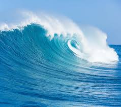
What is this landform?
a)
ocean
b)
bay
c)
coast
d)
river
50.
What is this landform
a)
valley
b)
mountain
c)
hill
d)
glacier
51.
What land form is this?
a)
valley
b)
canyon
c)
plain
d)
mountain
52.
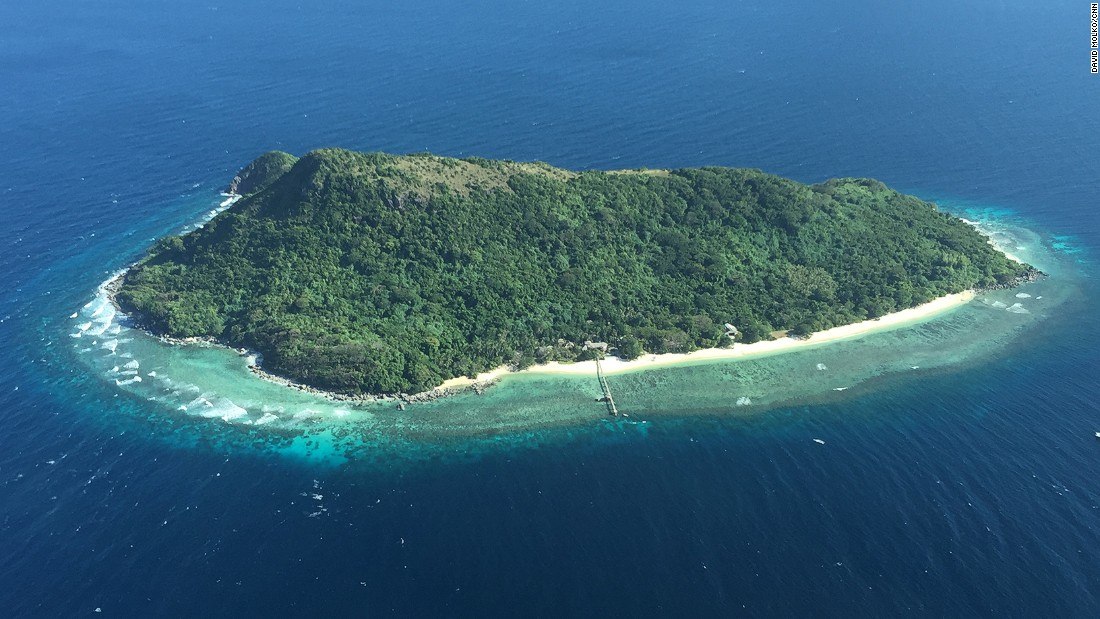
What land form is this?
a)
island
b)
valley
c)
plain
d)
mountain
53.
What land form is this?
a)
valley
b)
plain
c)
volcano
d)
mountain
54.
Name this landform
a)
peninsula
b)
plain
c)
river
d)
lake
55.
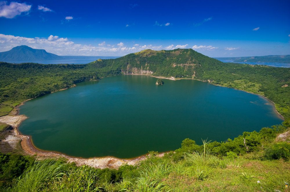
Name this body of water
a)
lake
b)
valley
c)
island
d)
plain