
 Worksheets
Unit One Study Guide for World Geography
Total questions: 45
Worksheet time: 35mins







This type of map shows elevation:
Physical Map
Political Map
Global Map

This type of map shows the borders between places:
Physical Map
Political Maps
Thematic Map

This type of map is:
Political Map
Physical/Elevation Map
Thematic Map

This type of map is:
Political Map
Physical Map
Thematic Map
What type of map focuses on rivers?
Physical Map
Political Map
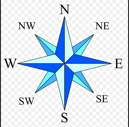
Cardinal directions
what sailors called the constellations when sailing
directions a cardinal uses to fly over the prime meridian
NE, SE, SW, NW
the four main directions on a compass rose: north, south, east, and west
the pattern of weather over a long period of time
Climate
Economic Activity
Landform
Physical Feature
any action that relates to the making, buying, and selling of goods and services
Climate
Economic Activity
Landform
Physical Feature
any natural feature of Earth’s surface that has a distinct shape
Climate
Economic Activity
Landform
Physical Feature
any natural characteristic of Earth’s surface, such as landforms and bodies of water
Climate
Economic Activity
Landform
Physical Feature
the average number of people who live in a unit of area, such as a square mile
population density
region
Thematic Map
Vegetation
a map that shows a particular theme, or topic
population density
region
Thematic Map
Vegetation
all the plants and trees in an area
population density
region
Thematic Map
Vegetation
an area defined by one or more natural or cultural characteristics that set it apart from other areas
population density
region
Thematic Map
Vegetation
Temperatures in the TEMPERATE ZONES are...
cold all year
always warm
warm in summer and cold in winter
A raised area of land, such as a hill or mountain, with a flat top is a
(a)
the average number of people who live in a unit of area, such as a square mile. This measures how crowded an area is.
(a)
a map that shows a particular theme, or topic
political map
thematic map
physical map

According to this map what Region of the world do we live in?
Latin America
Monsoon Asia
Oceania and Australia
Canada and the United States
A (a) is an area with one or more features that set it apart from other areas.

Maps like this one show us
physical lines of a country
how many people live in this area
patterns of land use, or the way people use the land they live on to meet their needs
Match the following
Basin
A section of land eroded by water
Plain
Flat areas of land
Isthmus
narrow land strip connects two land mass
Peninsula
land surrounded on three sides by water
Plateau
A tableland that is fairly flat
Label the areas correctly
Waterfall
Ocean
Cape
Forest
Plateau
Island
Tributary
Volcano
Glaciers
Changes in the appearance of the moon throughout the month known as (a) phases
The Earth (a) around the sun, taking a year or about 365 days, to make one revolution.
The Earth spins or (a) on its axis, which is tilted slightly
A (a) is the types of living organisms that can live in a location. (b) is defined as a variety of organisms that live in an ecosystem.
The prime meridian splits the world into the (a) hemisphere and the (b) hemisphere. The Equator separates the world into (c) hemisphere and the (d) hemisphere.
(a) are special drawings. They explain how something (b) , show (c) in a process or point out partners of an (d)
(a) are more useful than a map because they show distances more accurately.

