
 Worksheets
Earth and it's changing features Review
Total questions: 61
Worksheet time: 53mins
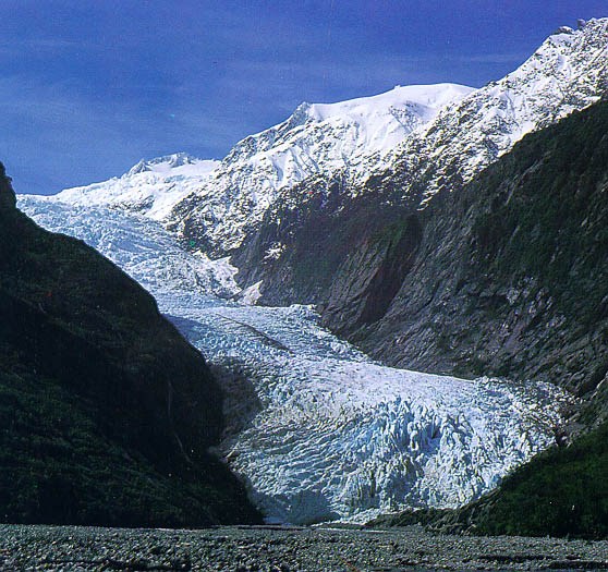


The movement of soil, dirt, and rock.
glacier
wind
erosion
tectonic plate
What happens when hardened lava builds up over a long period of time?
a landslide
a flood
rivers form
mountains form
What body of water covers most of the earth?
lakes
ponds
oceans
puddles

What landform is this?
plain
ocean
mountain
valley


What happens first when a fossil is created?
Bone turns to rock
Soft body parts decay
Years sediment pile up
An animal dies

What was the environment for Layer W like?
A forest
Underwater
A desert
A jungle
________________________ rocks are formed by layers of broken down rocks being pressed together over time.
igneous
metamorphic
sedimantary
fossil
A scientist who studies fossil is called a
psychiatrist
physical education teacher
paleontologist
_________ is the preserved remains of an animal, plant, or organism from the past.
Imprinting
Mold/Cast
Fossil

The diagram shows rock layers next to a road. Layer F contains many plant fossils. Layer F most likely formed in which of these environments?
Ocean
Tundra
Desert
Forest
Which explains why scientists study fossils?
Fossils help predict climate changes
Fossils help understand about past organisms and their environment
Fossils help understand what to expect in the future
Fossils help keep species from becoming extinct.


What is an island?
land that borders the sea or ocean
land that has water all around it
land with water touching 3 sides
a body of water surrounded by land
What are landforms?
Landforms are how the land changes.
Landforms shape the surface of the Earth.
Landforms are cool
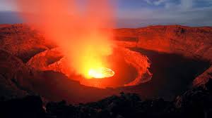
An opening in Earth's surface from which lava flows.
mountain
plateau
volcano
island
What is a topographic map?
shows elevation of an are using lines
an opening in the earth's surface where gas and rock are forced out
a sudden movement of the earth's crust
a large landmass
What is a continent?
a physical feature on the earth's surface
a large landmass
used to describe how far east and west a place is from the Prime Meridian
shows elevation of an area using lines
What is latitude?
used to describe how far east or west a place is from the Prime Meridian
shows elevation of an area using lines
used to describe how far north or south a place is from the equator
a sudden movement of the earth's crust
What is longitude?
a large landmass
used to describe how far east or west a place is from the prime meridian
a physical feature of the earth's surface
used to describe how far north or south a place is from the equator

The map that is using contour lines to show stepper land from flat land is.......
Political map
Local attraction map
Physical map
Topographic map
The lines on the map or globe that run up and down.
latitude lines
longitude lines
The lines that run left to right, they go around and around a map or globe.
latitude lines
longitude lines
Chemical Weathering
is when rock is broken into smaller pieces, and the material that makes up the rock or soil also changes.
is when only the size of the rocks is changed.
is when nothing changes.
chemicals from hair spray hits rock
How would a map of the land and the ocean be similar?
Both maps show plant life.
Both maps show earthquakes.
Both maps show valleys and mountains.
A river, delta, mountain, valley, plains, and plateau are all examples of ________________.
the Earth's mantle.
landforms.
the hydrosphere.
......... are long mountains that stretch in the middle of the ocean.
mid-ocean ridges
rift valley
abyssal plain
trench
A physical feature on Earth's surface
continent
landform
earthquake
fault
volcano
What shows the elevation of an area using contour lines?
vegetation
rain shadow
topographical map
cartographer
To find out the elevation of an area, you would use a _____________ ,
relief map
population map
climate map
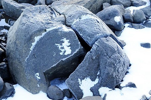
How does freezing water cause the weathering of rocks? The freezing water—
keeps the rocks in place.
makes the rocks last longer.
expands cracks and breaks rocks.
causes rocks to fall in landslides.
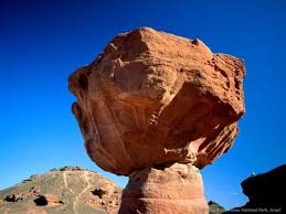
The process that breaks down rocks and other materials on Earth's surface is called
Weathering
Erosion
Deposition
Decomposition

A cliff formed near the ocean. Which statement best describes how this cliff formed?
Warm air melted the rock.
Sun rays evaporated the rock.
Ocean waves washed away rock.
Plant roots pushed away the rock.

What is an enormous mass of ice moving over land, causing weathering of rock and soil?
A glacier
An iceberg
An ice wedge
A sand dune

Rocks being picked up and carried downstream is an example of ____________.
weathering
erosion
deposition

Plant roots splitting apart large roots as they grow deeper into the ground is an example of _________________.
weathering
erosion
deposition

What are the two types of weathering?
Acid rain and chemical
Physical and Chemical
Root and Ice wedging

