
 Worksheets
Introduction to GIS
Total questions: 50
Worksheet time: 50mins
Which of the following is not a hardware component of GIS?
A computer screen
GPS coordinates
A plotter
A scanner

Select all the examples of line data shown in the image.
Arterial Route
Contour Line
Telephone Line
Row of trees
Spatial data is ...
data that describes the shape and location on an entity.
data that describes the characteristics of an entity.
A disadvantage of secondary data is...
that it takes time to collect.
that it is expensive to obtain.
that map projections may differ.
The spacial resolution of an image is low if...
the image is clear and detailed.
the image is unclear and lacks detail.
An orthophoto is an example of ...
raster data
vector data
The conventional sign for cultivated land on a topographic map is an example of ...
point data
line data
polygon data
Vector data is easier to store on a computer as it takes less file space.
TRUE
FALSE
Meta data would describe....
who collected a set of data.
how the data was collected.
when the data was collected.
all of the above are true.
Attribute data could be collected via a survey.
True
False

What is an example of modern mapmaking?
Mapmakers using repeated, first-hand experience of the landscape to create a map.
Mapmakers and scientists using photos from airplanes or satellites to create a map.
Mapmakers and scientists using historic and modern data by traveling on foot.
Mapmakers using pictures taken when traveling to create a map of the landscape.
You can add information onto a GIS map by...
Choosing different layers
Choosing different laminates
Adding data from a table
Researching from the internet
Which of these is not a component of a GIS?
Hardware
Software
Users
Maps
Data
why the Use of GIS is necessary
Saves Times
Handle large datasets
Maps can be created and edited faster
All of the above
By ‘spatial data’ we mean data that has:
Complex values
Location/coordinate values
Graphic values
Decimal values
What is ‘Attribute data’?
Specifies characteristics at that location, natural or human-created
Can be stored in a database table
Both A and B
None of the above
What are different components of ESRI ArcGIS Desktop Software?
ArcMap
ArcGIS Pro
ArcGIS Enterprise
ArcCatalog
What is meant by GIS?
It is an identification of earth system.
It is an information about the places on earth surface features
It contains only attribute data
It contains only spatial data
Numerous employees in your organization need access to the streets data that your team is responsible for maintaining in an enterprise database. From the options given below, what is the best way to handle access to these data? (Choose the best response)
Set the streets layer’s permissions to allow everyone in your enterprise full control
Set the streets layer’s permission to allow full control only to your team
Set the streets layer’s permission to allow full control only to your team and read-only access to the remainder of your enterprise
No action needed
What is GIS in the most encompassing sense?
A software to make maps
System designed to capture, store, manipulate, analyze, manage and present all types of geographic
Application to collect data on the field and store in database
Tool to edit and design maps for visualization
By 'spatial data', we mean data that has
Complex values
Positional values
Graphic values
Decimal values
What is 'Metadata'?
It is 'data about data'
It is 'meteorological data'
It is 'oceanic data'
It is 'contour data'
Key components of 'spatial data' quality include
Positional accuracy
Temporal accuracy
Lineage and completeness
Logical consistency
All of the above
Successful spatial analysis needs
Appropriate software
Appropriate hardware
Competent user
All of the above
Which of the following do geographers use to compare a variety of spatial data by creating digitized representations of the environment by combining layers of spatial data, and creating maps in which patterns and processes are superimposed?
GPS
GIS
Scale
Maps
Pick the most accurate statement.
GPS locates places while GIS displays them.
GPS can only show locations but GIS provides a lot more information related to locations.
GPS shows one layer of data whereas GIS always shows multiple layers.
GPS does more than GIS as more people use GPS.
Vector data is easier to store on a computer as it takes less file space.
TRUE
FALSE
Lines of equal longitude are called ...............
Meridians
Parallels
Distortion
Stations


Globes provide a three-dimensional view of the Earth. They provide the most accurate view of the world, but have limitations in their use.
True
False
All world map projections create distorted images of the Earth to some degree. These distortions relate to size, shape, direction, and distance.
True
False
Why is it difficult to project the Earth onto a flat surface?
it distorts the sizes and shapes of the landmasses
the technology to do so does not exist
it cuts the Earth into 2 hemispheres
it's actually not the difficult

This is a Mercator projection map. Why is this map projection not be the greatest to use when determining land size?
Places at the poles, like Greenland and Antarctica, are extremely distorted in their size, appearing larger than they really are.
Africa appears too large on this map.
All the continents are smaller than they actually are.
Places by the equator are highly distorted and appear much larger than they really are.

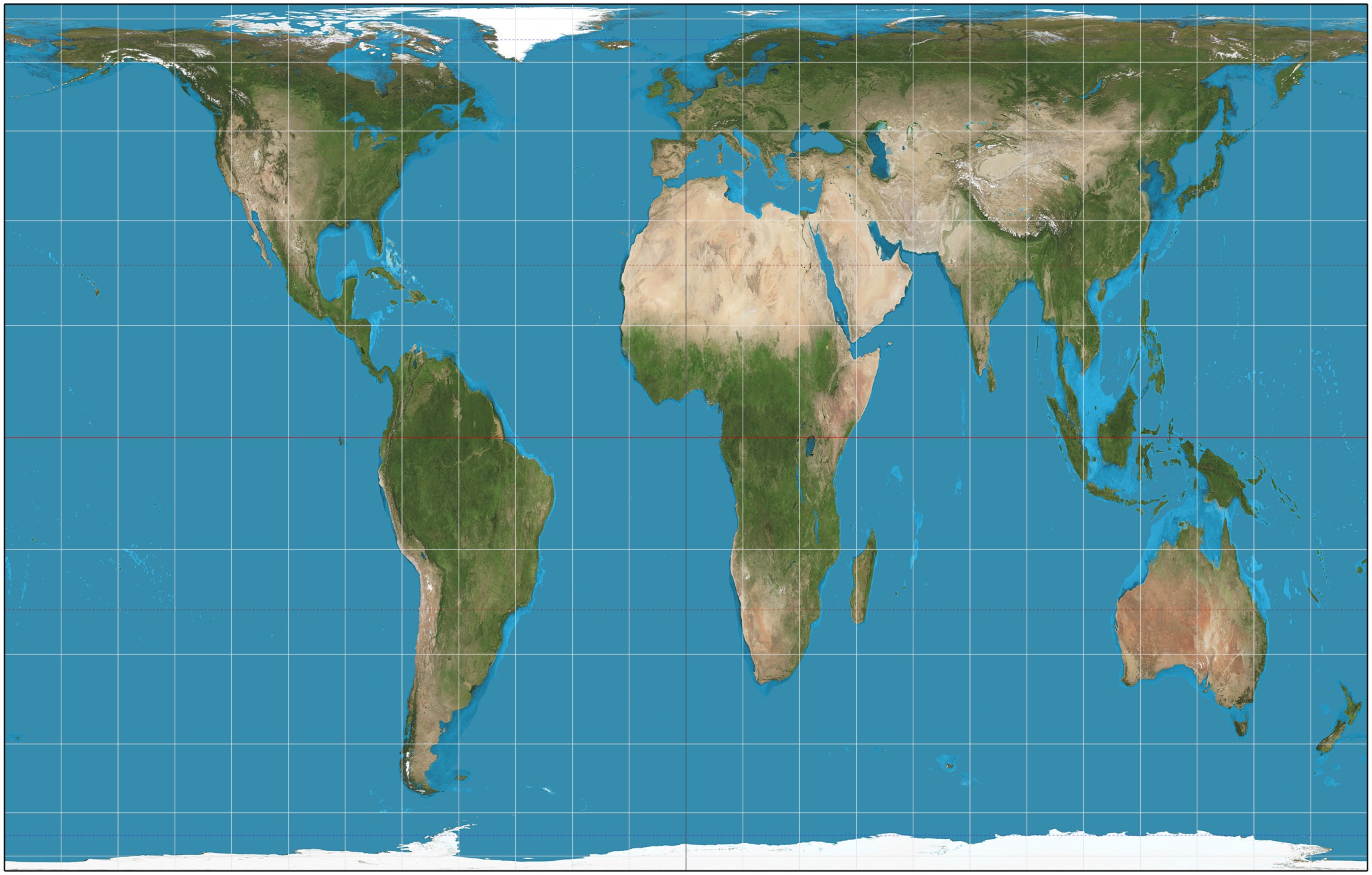
The map shown here, called the Peter's Projection, does which of the following?
It shows the accurate distance between the continents.
It is used for marine navigation.
It shows accurate sizes of the continents.
Why do we use maps more often than we use globes?
Globes are bulky and not as easy to store.
Globes distort shape and size too much.
Globes are not around anymore.
In recent years, a GPS has taken place of these maps...
road maps
thematic maps
elevation maps
physical maps

What are this map's distortions?
land masses near poles are too large
continents shapes are inaccurate
continent size is inaccurate

