
 Worksheets
SOL Review V: Geography
Total questions: 135
Worksheet time: 1hrs 15mins
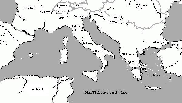

The type of trade conducted in the map can best be described as--
Camel caravans-based
Digital asynchronous-based
Maritime transportation-based
Hellenistic Diffusion-based

"F" represents which country?
Britain
Gaul
Spain
Carthage
"G" represents which country?
Britain
Gaul
Spain
Carthage
Which number represents the Atlantic Ocean?
1
2
3
4
Which of the following is the empire of Alexander the Great?


Which number on the map marks the location of this building?
1
2
3
4

Which number on this map represents the region where archaeologists believe the first humans appeared?
1
2
3
4

The ancient Hebrews established a civilization near which location?
1
2
3
4
The ancient Mespotamians established a civilization near which location?
1
2
3
4

Which number represents the location of ancient Athens?
1
2
3
4

This map illustrates the relationship between:
religion and government
humans and the environment
ironworking and tran Saharan trade
monsoons and flooding

What is an appropriate title for this map?
Egyptian Dynasties
The Fertile Crescent
Current Archaeology Sites
Spread of Islam

The Aegean Sea is labeled with the number
A 1
B 2
C 3
D 4
The Black Sea is labeled with the number –
A 1
B 2
C 3
D 4
Asia Minor is labeled closest to number –
A 1
B 2
C 3
D 4

The Mediterranean Sea is labeled with number –
A 1
B 2
C 3
D 4

Athens is labeled closest to number –
A 1
B 2
C 3
D 4

Sparta is labeled closest to number –
A 1
B 2
C 3
D 4
Troy is labeled closest to the number –
A 1
B 2
C 3
D 4
The kingdom of Macedonia is labeled closest to number –
A 1
B 2
C 3
D 4
All are true regarding how geography impacted the development of ancient Greece except -
F They created independent, small city-states that were cut off from
one another by mountains or water
G They built vast empires due to the large and flat land spaces
H Some cities became important trading centers while others were
isolated
J The location of the seas created skilled sailors and provided
harbors for ships

What is the empire located within the blue circle?
Israel
Phoenicia
Akkadia
Sumer

What is the empire located in the red circle?
Israel
Sumer
Babylon
Akkadia

According to the map Islam spread, across Asia and Africa into--
Scandinavia
Spain
England
Germany

Which number marks the location where the Battle of Tours took place
1
2
3
4
The Hindu Kush mountain passes were significant because they -
created harsh living conditions for those living nearby
offered access to an abundance of natural resources
provided migration routes into the Indian subcontinent
exposed India to easy invasion from intruders

Which numbered peninsula was the location of the capital of the Roman Empire
1
2
3
4

Which language was used in Christian liturgy in the areas labeled 2 and 4?
Greek
Arabic
Latin
French

Which number shows where the cities of Mecca and Medina are located?
1
2
3
4

Which of the following trade items were the most important to the people living in the shaded region on the map?
spices and platinum
salt and gold
amber and silver
silk and jade

Which empire is associated with this river system?
Gupta Empire
Chinese Empire
Phoenician Empire
Babylonian Empire
The empires of Ghana, Mali, and Songhai benefited from being near the--
largest European cities
Mediterranean Sea
Red Sea coast
Trans-Saharan trade routes
The lack of arable land in Greece contributed to an economic system based on--
manufactured goods
shipping and trade
agricultural production
lumber and minerals

Which number shows where Roman civilization first developed?
1
2
3
4
Which primary factor encouraged Greek city-states to develop different identities?
Language
Religion
Economy
Geography
Many Incan cities were easily defended because they were built--
in canyons
in rainforests
on islands
on mountaintops
Which phrase best describes the geographic location of the Mayan civilization?
Rainforests in Central America
Deserts in Mexico
Woodlands of North America
Mountains of Brazil

Which type of government was used in the Persian Empire?
F Religious oligarchy
G Republic
H Imperial bureaucracy
J Democracy

Which number marks a province of the Roman Empire?
A 1
B 2
C 3
D 4
Identify the migration patterns of early hunter-gatherer societies.
Africa --> Eurasia --> Americas
Americas --> Eurasia --> Africa
Eurasia --> Americas --> Africa
Africa --> Americas --> Eurasia
Homo sapiens emerged between
A 10,000 and 40,000 years ago
B 100,000 and 400,000 years ago
C 50,000 and 100,000 years ago
D 100, 000 and 150,000 years ago

Why did Homo sapiens migrate to other parts of the world?
F To meet other humans to form larger civilizations
G Exploration was for adventure and to gain wealth
H To create permanent villages throughout the world
J Early humans were nomadic mainly in search of food and shelter


The Indian Civilization developed along the...
Nile River
Indus River
Rio Grande River
Tigris River
Civilization along the Tigris and Euphrates Rivers
Mesopotamian
Egyptian
Indus River
Chinese
Civilization along the Nile River
Indus River
Mesopotamian
Egyptian
Chinese
The Huang-He River gave rise to the ancient
Chinese
Phoenicians
Hebrews
Persians
These people settled by the Jordan River; originators of the Jewish religion
Hebrews
Phoenicians
Egyptians
Persians
All were major reasons why early permanent settlements
developed in river valleys except –
A rich, fertile soil
B consumer trade opportunities
C irrigation water for agriculture
D offered protection from invaders

The river that replaces the question mark is the –
A Indus
B Huang He
C Nile
D Jordan

Sumer
Using the map, what river valley is shaded in pink?
Sumer
Using the map, what river valley is shaded in orange?
Sumer
Using the map, what river valley is shaded in purple?
Sumer


Constantinople is located on...
an island
a peninsula
a mountain
an ocean
One advantage of Constantinople's location was...
many natural harbors for boats to dock
protection from the Alps mountains
close to the Germanic tribes
close to China for trade
What are the two main holy cities of Islam?
Mecca and Medina
Mecca and Damascus
Damascus and Jerusalem
Petra and Medina
What battle stopped the spread of Islam into Europe?
Jerusalem
Damascus
Tours
Carthage


One of the main accomplishments of Justinian was...
Making Christianity the official religion of the Roman Empire
Reconquering territory that had once belonged to the Roman Empire
Stopping the Islamic conquest of Western European territories
Defeating an invading army of Ottoman Turks

Which ONE of the following was NOT an advantage of the location of Constantinople?
Location on the Royal Road provided key location for trade.
Location at the crossroads of trade between Asia, Africa, and Europe
Location provided protection from the eastern frontier and Germanic invasions
Location on peninsula provided easy fortification
The capital of the Byzantine Empire:
Axum
Constantinople
Rome
Moscow
One reason Constantinople was easy to protect and defend was because it is on this type of geographic feature and had natural harbors.
Peninsula
Island
Mountain
Archipelago
The ORIGINAL name of Constantinpople.
Byzantium
Istanbul
Moscow
Rome

What group is associated with the area in green?
Hebrews
Carthaginians
Mongols
Moors

Civilization in Mesopotamia developed between which two rivers?
the Persian Gulf and the Mediterranean
the Tigris and the Persian Gulf
the Persian Gulf and the Euphrates
the Euphrates and the Tigris

What continent is #1?
Australia
Africa
South America
Antarctica
What continent is #2?
North America
Asia
South America
Australia
What continent is #3?
North America
Asia
Antarctica
Australia
What continent is #4?
South America
Europe
Africa
Australia
What continent is #5?
South America
Europe
Africa
Australia
What continent is #6?
Antarctica
North America
Asia
Australia
What continent is #7?
Antarctica
Europe
Asia
South America

Which trade pattern shown connected Asia to the Mediterranean basin?
A Silk routes
B Maritime routes
C Western Europe river trade
D Trans-Saharan routes

Which trade pattern shown existed around 1000 to 1500 A.D.
(C.E.)?
F Maritime routes
G Trans-Saharan routes
H Silk routes
J Black Sea route

WHI.10b
The shaded area shown was known for trading which good?
A Textiles
B Amber
C Gold
D Porcelain
Muslim expansion helped diffuse which technological
advancements used for grinding, irrigation and energy use?
F Metal molds and wooden blocks
G Wedges and iron picks
H Compasses and lateen sails
J Waterwheels and windmills

Which idea replaces the question mark in the graphic?
A Islam
B Christianity
C Judaism
D Buddhism
India was the origin of –
F new crops such as sugarcane
G paper money
H the compass
J porcelain products

The “X” on the map identifies the location of –
A mainland China
B the East Sea
C Pacific Ocean
D East China Sea
What was the name of the city that was located in Zimbabwe that served as the capital of the empire?
Great Zimbabwe
Great Zambezi
Great Zanai
Great Zarkineal
Where did the Magyars settle?
Norway
Hungary
Italy
Denmark
Germanic group located in present-day France/Germany
Franks
Vikings
Angles/Saxons
Magyars
Germanic group located in present-day Scandinavia
Franks
Vikings
Angles/Saxons
Magyars
Germanic group who migrated to present day England in the 5th century.
Franks
Vikings
Angles/Saxons
Magyars
Group of people who migrated to central Europe (present-day Hungary) in the 10th century.
Franks
Vikings
Angles/Saxons
Magyars
What pair does not belong together?
Scandainavia - Viking
England- Angles & Saxons
Present Day France & Germany - Franks
Russia - Magyars
What was the main issue with Invasions?
Disease
Disrupting trade - towns decline
Death
Slavery
Which is not an effect from the invasions of the Angles, Saxons, and Magyars?
Trade was disrupted
Feudalism weakened
Towns declined
Conversion to Christianity

The Angles and Saxons migrated in the fifth century influencing which present-day nation?
One
Two
Three
Four

The Vikings originated closest to which number on the map?
One
Two
Three
Four
The name for the trade route(s) connecting th Mediterranean Sea to the Pacific Ocean:
Royal Road
Great Wall
Silk Road
Which TWO items were traded across the Sahara Desert of North Africa?
Silk
Porcelain
Gold
Salt
What TWO seas were important in the trade for northern Europe?
Mediterranean
Black
Aegean
Baltic
From where did the goods originate:
Silk, Paper, Porcelain, Compass
India
North Africa
Southeast Asia
China
From where did the goods originate?
Waterwheel, Windmill, Lateen Sail, Astrolabe
North Europe
North Africa
China
Middle East
With which should the Golden Horde be associated?
Mongol
Japan
India
China
Which city was a center of trade and learning in West Africa?
Axum
Alexandria
Great Zimbabwe
Timbuktu
The Limpopo and the Zambezi River were boundaries for the empire of:
Zimbabwe
Kush
Nubia
Ghana
The empires of Ghana, Mali, and Songhai benefited from being near the:
Largest European cities
Mediterranean Sea
Trans-Saharan trade routes
Red Sea coast
Trade between Europe and West Africa was carried on routes across the:
Nile River
Indian Ocean
Sahara Desert
Gobi Desert
What two trade items made Ghana, Mali, and Songhai increase in wealth and importance?
Gold and salt
Spices and silk
Rum and tobacco
Textiles and spices
Which of the following religions was introduced into West Africa?
Islam
Judaism
Buddhism
Shintoism
Who was the greatest ruler of Mali?
Mansa Musa
Justinian
King Tut
Cleopatra
The Incas are most closely associated with which of the following?
Machu Picchu
Chichen Itza
Tenochtitlan
Mexico City
Which civilization used high-altitude agriculture?
Maya
Aztec
Inca
Native Americans
Which American civilization was located in a rain forest?
Aztec
Mayan
Inca
Native Americans
Which American civilization had a road system?
Aztec
Inca
Mayan
Cherokee

Which civilization is shown by the letter "A"?
Inca
Aztec
Mayan
Pueblo
Which mountains influenced the lifestyle of the Incas?
Andes Mountains
Rocky Mountains
Himalaya Mountains
Pyrenees Mountains
Tenochtitlan was part of the
Aztec civilization
Mayan civilization
Incan civilization
Sioux civilization
The economies of the Aztec, Mayan, and Incan empires were based on
farming
trading
fishing
metalworking

Which empire is best described by this list?
Mayan
Incan
Toltec
Aztec
What similarity did the Mayan, Aztec, and Incan empires share?
They had economies based on agriculture
They were located in South America
They developed road systems
They practiced monotheistic religions
Which of the following was an achievement of the Maya, Aztec, and Inca civilizations?
Calendar
Iron weapons
Christian religion
Terraced farming
The growth of both the Aztec and Incan empires was primarily due to
a strong trade network
conquering of other natives and claiming their territory
the geography of Tenochtitlan
sacrifice of conquered peoples to the gods

