
 Worksheets
Types of Maps and Projections
Total questions: 25
Worksheet time: 13mins

This is an example of ________ location
absolute
specific
general
relative
Most maps, unlike globes, have __________ which is inaccuracies due to flattening a globe onto a piece of paper.
contours
modification
distortion
manipulation

Mercator Maps are frequently used by __________
ships
airplanes
geography teachers
historians
Which lines shows distance north of south of the equator?
latitude
longitude
equatorial
perpendiculars
Which one of the following is more useful to a sailor?
Mercator's Projection
Gnomonic Projection
Sinusoidal Projection
Mollweide's Projection

Choropleth Map
Isoline Map
Dot Density Map
Proportional Symbol Map
Flow Line Map

This map shows an election map in the United States based on population. Which type of map is this?
Choropleth Map
Isoline Map
Dot Density Map
Proportional Symbol Map
Cartogram Map

What is the name of this type of map, which distorts items the further they are from the equator?
Mercator Projection
Robinson Projection
Lambert Conformal Conic
Oleani Projection
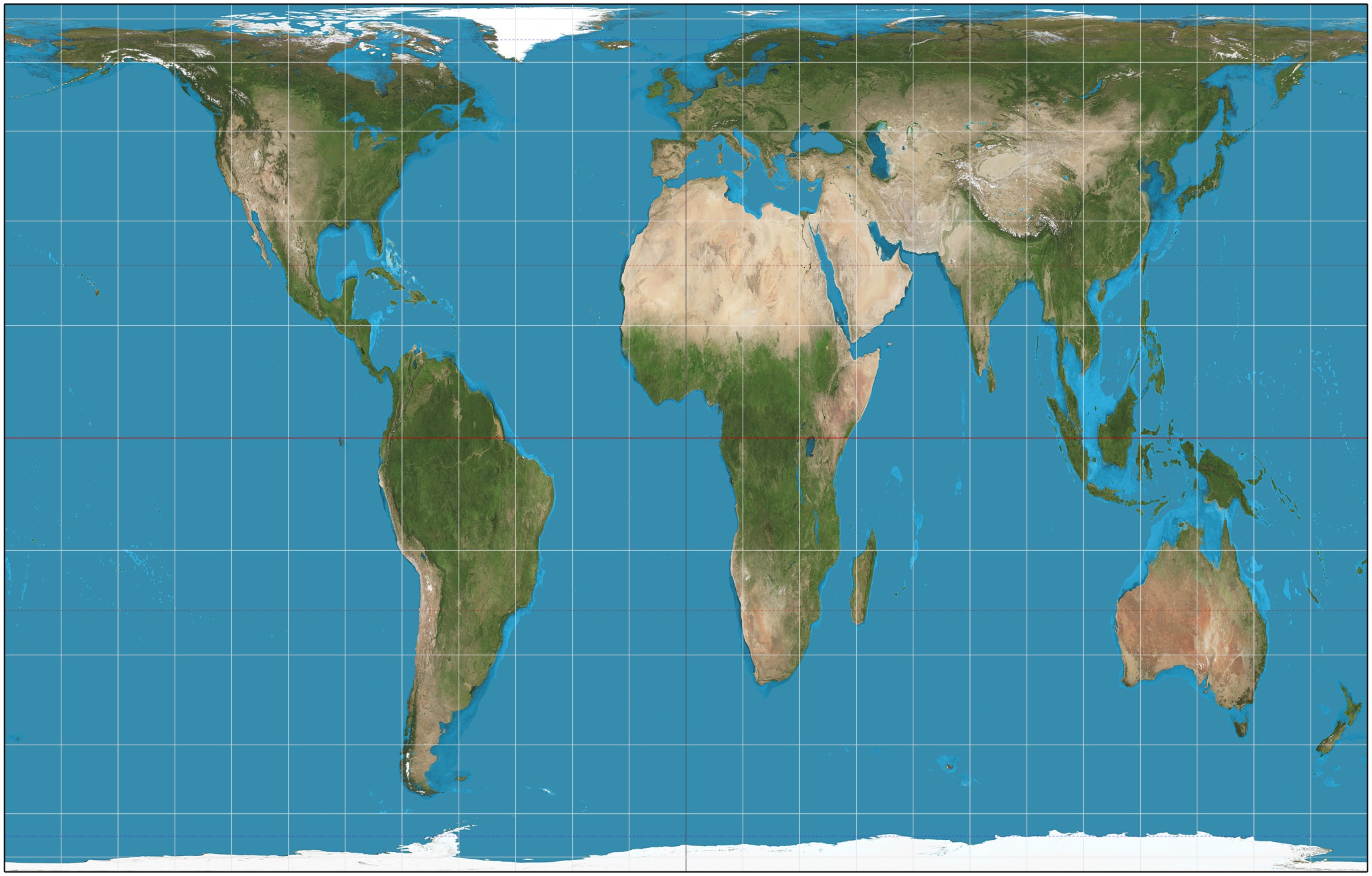
Which projection is this?
Gall Peter's
Robinson
Mercator
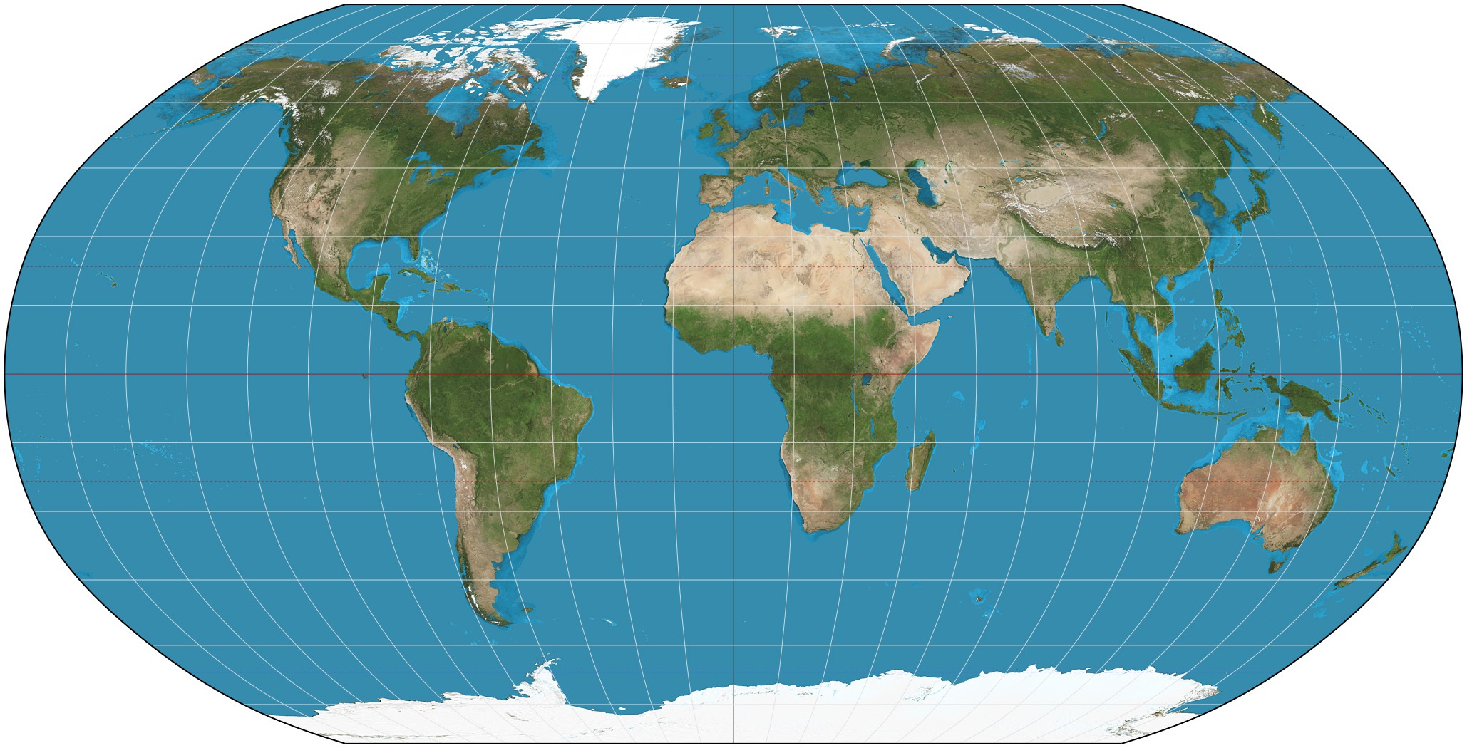
Which projection is this?
Gall Peter's
Robinson
Mercator
Which map projection's shape and direction are accurate but size is very distorted?
Robinson
Gall Peter's
Mercator
Which map projection was created in the 1800’s in order to try and fix size distortion?
Gall Peter's
Mercator
Robinson
Which map projection's size and shape are both fairly accurate even though they are slightly distorted near the poles?
Robinson
Gall Peter's
Mercator
Which map projection was created in the 1500’s in order to help ships navigate the oceans?
Mercator
Gall Peter's
Robinson
Why are there so many types of map projections and why do they all look so different?
They are all made for different purposes
Cartographers get bored and make new maps
To confuse students
A way of representing the spherical Earth on a flat surface:
Projection
Distortion
Cartographer
A geographer who makes maps:
Cartographer
Distortion
Projection
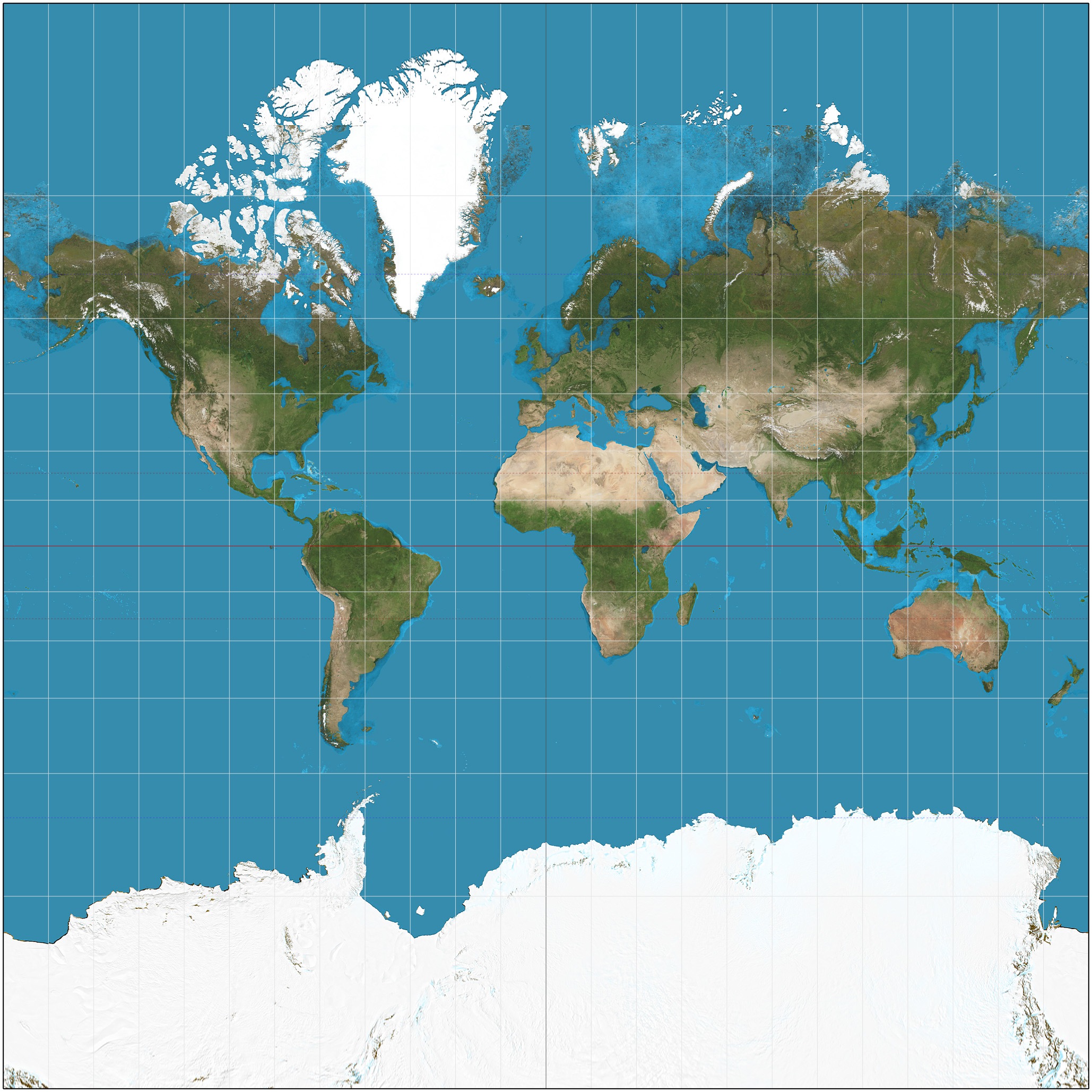
Which projection is this?
Gall Peter's
Robinson
Mercator
Which projection is this?
Gall Peter's
Robinson
Mercator
A ____ is a three-dimensional representation of the Earth.
globe
topographic map
thematic map
nautical map
Convenience is an advantage of what?
globes
2D maps
Accuracy is an advantage of what?
globes
2D maps
Why can a 2D map never be as accurate as a globe?
There is always some distortion because the earth is 3D.
The projections are done incorrectly.
People don't know how to read maps properly.
2D maps can't be specific.

