
 Worksheets
Geography Basics
Total questions: 13
Worksheet time: 7mins
Name
Class
Date
1.

Distance north or south of the equator (these lines go sideways [East-West], across the globe).
a)
Latitude
b)
Prime Meridian
c)
Equator
d)
Longitude
2.

Distance east or west of the prime meridian (these lines go up and down [North-South] on a globe).
a)
Longitude
b)
Archipelago
c)
Political Map
d)
Equator
3.

An imaginary circle around the middle of the earth, halfway between the North Pole and the South Pole. 0° latitude.
a)
Equator
b)
Map Legend/Map Key
c)
Longitude
d)
Prime Meridian
4.
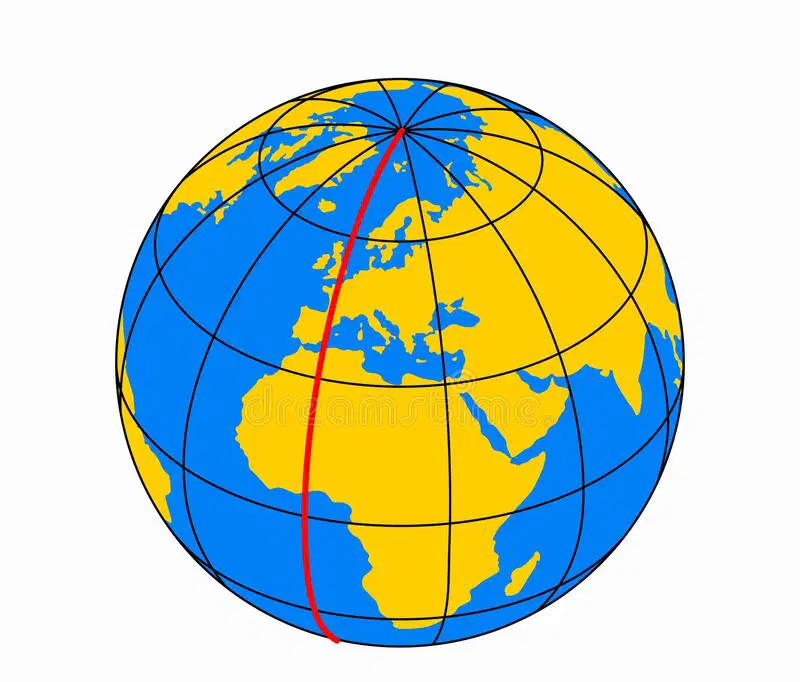
An imaginary circle that runs from the North Pole to the South Pole and passes through the Royal Observatory in Greenwich, England. 0° longitude.
a)
Prime Meridian
b)
Physical Map
c)
Latitude
d)
Equator
5.

The exact location of a place or thing on earth. Measured by latitude and longitude.
a)
Absolute Location
b)
Prime Meridian
c)
Physical Map
d)
Peninsula
6.
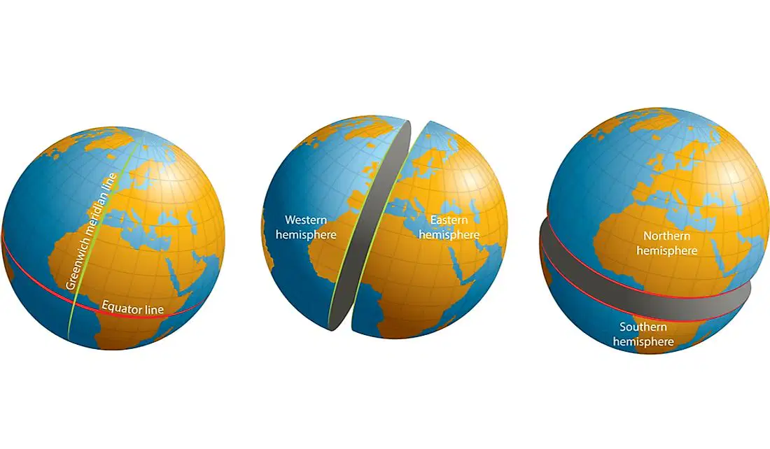
Half of the earth; either the northern hemisphere, southern hemisphere, eastern hemisphere, or western hemisphere.
a)
Hemisphere
b)
Longitude
c)
Absolute Location
d)
Archipelago
7.

A tool on a map showing cardinal (N,E,S,W) and intermediate (NE,SE,NW,SW) directions.
a)
Compass Rose
b)
Prime Meridian
c)
Latitude
d)
Absolute Location
8.

A box or other display on a map that explains the meaning of the symbols used on the map.
a)
Map Legend/Map Key
b)
Latitude
c)
Political Map
d)
Peninsula
9.

Compares a distance on a map with a distance in the real world.
a)
Map Scale
b)
Map Legend/Map Key
c)
Archipelago
d)
Longitude
10.

A type of map that shows the boundaries between countries, states, and cities, as well as the names of those places.
a)
Political Map
b)
Equator
c)
Prime Meridian
d)
Map Scale
11.

A type of map that shows the natural features of an area, including landforms, bodies of water, and vegetation (plants).
a)
Physical Map
b)
Compass Rose
c)
Map Scale
d)
Map Legend/Map Key
12.

A piece of land that is surrounded by water on three sides.
a)
Peninsula
b)
Equator
c)
Archipelago
d)
Political Map
13.

A group or chain of islands clustered together in a sea or ocean (e.g., Hawaii, Japan, Indonesia)
a)
Archipelago
b)
Peninsula
c)
Hemisphere
d)
Compass Rose
100 %

