wayground logo

Free Printable Worksheets

Font size

S
M
L
XL
Worksheets

Climate/Climatograms

Total questions: 27

Worksheet time: 23mins

Name
Class
Date
1.

On a climatogram, the bar graph represents _____________.

a)

precipitation

b)

temperature

2.

A climatogram shows a biome's ___________ and ___________.

a)

temperature and precipitation

b)

temperature and plant life

c)

precipitation and rainfall

d)

precipitation and cloud cover

3.
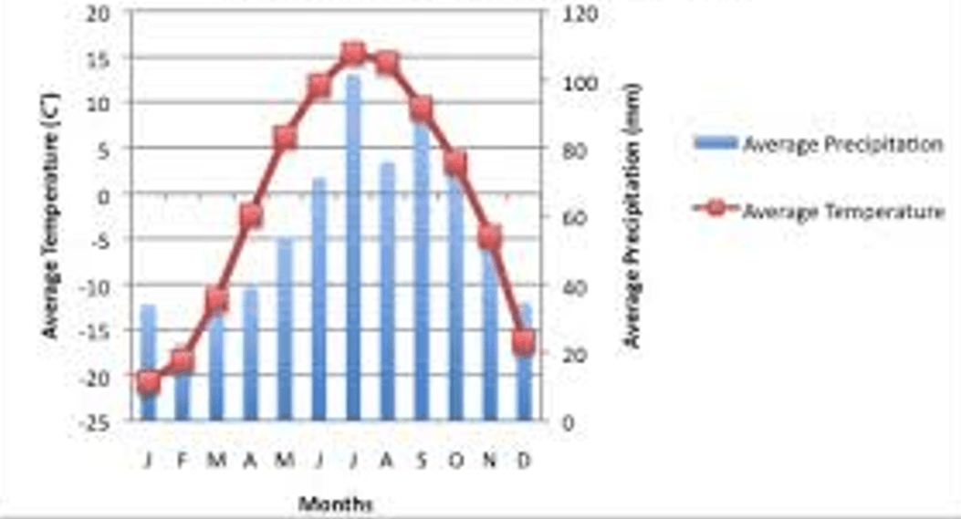
The line graph represents?
a)
Temperature
b)
Precipitation
c)
Wind Direction
4.
The bar graph represents?
a)
Temperature
b)
Precipitation
c)
Wind Direction
5.

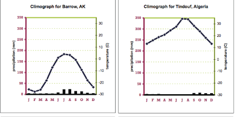
Which biome is best represented by this climatograph?

a)

Tundra

b)

Desert

c)

Tropical rainforest

d)

Boreal Forest

6.

Which biome is best represented by this climatograph?

a)

Tundra

b)

Desert

c)

Tropical rainforest

d)

Grasslands

7.

Which of the following is a similarity between the tundra and the desert?

a)

low temperatures

b)

high temperatures

c)

low precipitation levels

d)

permanently frozen ground

8.

Which of the following aspects of a rainforest allow for such a high biodiversity?

a)

stable high temperatures year round

b)

high levels of precipitation year round

c)

both high,stable temps and precipitation year round

d)

neither high temperature and precipitation

9.

How can you tell this is a temperate deciduous forest?

a)

There is lots of rain all year

b)

The temperature is warm all year

c)

There are 4 seasons

d)

There is a wet and dry season

10.

How can you tell this is a grassland?

a)

There are 4 Seasons

b)

There is rain all year

c)

It is dry all year

d)

There is a wet and dry season

11.

The place represented by the climatogram can be found in the _____.

a)

Northern Hemisphere

b)

Southern Hemisphere

c)

Western Hemisphere

d)

Eastern Hemisphere

12.

Using the graph to the right, what biome would have annual precipitation of 45cm and an annual temperature of 25 degrees celsius.

a)

Temperate grassland

b)

Subtropical desert

c)

Woodland / shrubland

d)

Savanna

13.
Which city has the highest rainfall in July? 
a)
Iquitos ( Graph on Left)
b)
Monrovia (Middle Graph)
c)
Normanton (Graph on Right)
d)
None of the above
14.
How much rainfall does Anqing recieve in September?
a)
10 inches
b)
80 inches
c)
4 inches
d)
1 inches
15.

Which month has the lowest average temperature?

a)

December

b)

November

c)

January

d)

February

16.
This climate zone is located on the equator and is the hottest climate zone.
a)
Tropic
b)
Temperate
c)
Frigid
17.
The climate zone has mild temperatures and a half year long growing season.
a)
Tropic
b)
Temperate
c)
Frigid
18.
What month has the lowest average precipitation in Dublin?
a)
March
b)
May
c)
April
d)
February
19.

A climate graph measures:

a)

Temperature (A)

b)

Precipitation (B)

c)

Landforms

d)

A and B

20.
In a climate graph, what does the line graph represent?
a)
high temperatures
b)
amount of precipitation all year
c)
average temperatures
d)
average amount of precipitation
21.
Which city has the highest rainfall in July? 
a)
Iquitos ( Graph on Left)
b)
Monrovia (Middle Graph)
c)
Normanton (Graph on Right)
d)
None of the above
22.
Which city has the lowest rainfall in July? 
a)
Iquitos ( Graph on Left)
b)
Monrovia ( Middle Graph)
c)
Normanton (Graph on Right)
d)
None of the above
23.
This city is in what climate zone?
a)
Tropical
b)
Temperate
c)
Frigid
d)
Lousiana 
24.
How much rainfall does Anqing recieve in September?
a)
10 inches
b)
80 inches
c)
4 inches
d)
1 inches
25.
Which month has the lowest average temperature?
a)
December
b)
November
c)
January
d)
February 
26.
This climate zone is located on the equator and is the hottest climate zone.
a)
Tropic
b)
Temperate
c)
Frigid
27.
What is the average amount of precipitation in the month of June?
a)
less than 50 mm
b)
about 125 mm
c)
about 100 mm
d)
about 200 mm