
 Worksheets
Intro to Geography
Total questions: 36
Worksheet time: 20mins

According to this map, letter D is
Africa
Antarctica
Australia
Europe

According to this map, letter H is the
Atlantic Ocean
Arctic Ocean
Pacific Ocean
Indian Ocean

According to this map, letter G is
North America
South America
Europe
Africa

According to this map, letter B is
Africa
Atlantic Ocean
Antarctica
Europe

According to this map, letter L is the
Atlantic Ocean
Arctic Ocean
Indian Ocean
Pacific Ocean

According to this map, letter E is
Asia
Europe
Australia
Antarctica

According to this map, letter A is
Asia
Africa
Antarctica
North America

According to this map, letter F is
Pacific Ocean
Asia
North America
South America

According to this map, letter I is the
Arctic Ocean
Atlantic Ocean
Pacific Ocean
Indian Ocean

According to this map, letter J is the
Arctic Ocean
Atlantic Ocean
Pacific Ocean
Indian Ocean

According to this map, letter C is
Australia
Europe
Asia
Africa

According to this map, letter K is the
Atlantic Ocean
Pacific Ocean
Arctic Ocean
Indian Ocean
What is used to determine distance on a map?
compass
scale
key/legend
elevation
What is the purpose of a compass rose?
to provide elevation information
to determine directions
to provide how far the distance is
to provide information on climate/weather
On a map, what provides the information on what symbols or images represent?
key/legend
compass rose
elevation
scale
exact location using a coordinate system
absolute location
relative location
equator
latitude line
location in relation to another place
absolute location
relative location
equator
latitude line
What is the imaginary line located at the 0° latitude line?
prime meridian
equator
tropic of capricorn
tropic of cancer
What is the imaginary line located at the 0° longitude line?
prime meridian
equator
tropic of capricorn
tropic of cancer

According to the compass, number 3 is pointing in the ______ direction
north
south
east
west

According to the compass, number 2 is pointing in the ______ direction
north
south
east
west

According to the compass, number 4 is pointing in the ______ direction
north
south
east
west

According to the compass, number 1 is pointing in the ______ direction
north
south
east
west
latitude lines runs
north to south
west to east
longitude lines runs
north to south
west to east
What type of map is used to show landforms and other natural features?
climate map
political map
physical map
topographic map
What type of map is used to show borders of each country/continent?
climate map
political map
physical map
topographic map

Name the hemispheres North America is in.

Name the hemispheres South America is in.
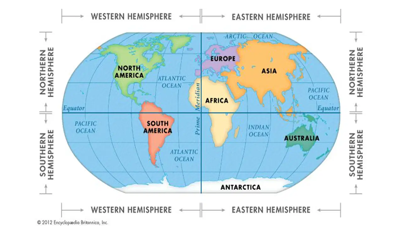
Name the hemispheres Europe is in.
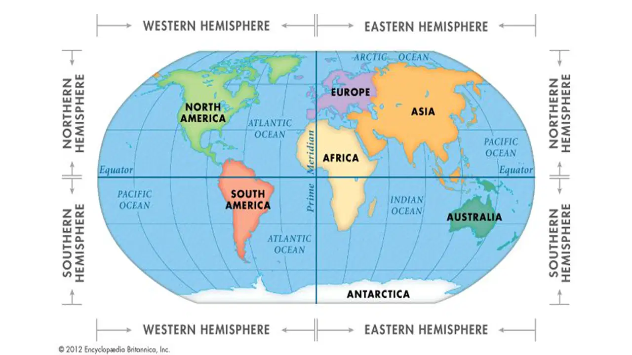
Name the hemispheres Asia is in.

Name the hemispheres Australia is in.
This continent is found in all four hemispheres.
This is the largest ocean in the world.
The largest ocean in the world is the -
This type of map gives a lot of detailed information about one particular topic.
political map
physical map
thematic map
world map

