
Font size
 Worksheets
Human Geography Unit 1
Total questions: 141
Worksheet time: 2hrs 14mins
is the acquisition of data about earth's surface from a satellite orbiting earth or from other long- distance methods
(a)
What is the technique that collects information from the earth from a distance?
Geographic Information Systems
Global Positioning Systems
Remote Sensing
Ethnography
Demography
Which map would have the smallest scale?
Orlando
Orange County
Florida
United States
World
What does a Mercator projection map show?
standard map for navigation
straight segment of course
cylindrical
Greenland & Antarctica appear much larger
All of the above
A hiker would use
an isoline map
a choropleth map
a graduated symbol map
a small scale map
a political map
The precise point where a place is located on Earth
Relative location
Coordiantes
Absolute location
Place
The science of making maps
Cartography
Geography
Biology
Historiography
Distance east or west of the prime meridian, measured in degrees
Longitude
Latitude
Distance north or south of the equator
Latitude
Longitude
What is GIS?
Geographic Intelligence System
Geological Information System
Global Positioning System
Geographic Information System
A computer system that stores, organizes, analyzes, and displays geographic data
GPS
GIS
Specific human and physical characteristics of a location
Location
Position
Place
Number of something in a specifically defined area
Scale
Density
Diffusion
The ratio between the size of things in the real world and the size of those same things on a map
Disorient
Distortion
Scale
Projection
An area in which everyone shares in one or more distinctive characteristics
Formal region
Vernacular region
Location
Functional region
A system that determines accurately the precise position of something on Earth through satellites, tracking stations, and receivers
GIS
GPS
A map that shows a particular theme, or topic
Thematic
Reference
Dot distribution
Maps designed for people to refer to for general information about places
Thematic
Reference
Dot distribution
A projection of a map of the world onto a cylinder in such a way that all the parallels of latitude have the same length as the equator
Mercator projection
Robinson projection
Peters projection
Projection that attempts to balance several possible projection errors. It does not maintain completely accurate area, shape, distance, or direction, but it minimizes errors in each.
Mercator projection
Robinson projection
Peters projection
Maps that people create in their minds based on their experience and knowledge
Imaginary map
Mental map
Thematic map
Topographic map
The use of Earth's renewable and nonrenewable natural resources in ways that do not constrain resource use in the future.
Sustainability
Preservation
Reservation
Which is primarily concerned with spatial analysis of the Earth’s natural phenomena.
Physical Geography
Human Geography
What are the two main questions in Human Geography
What and How
Who and When
Where and Why
What are the 5 themes? Write at least 2 sentences about each theme
Absolute Distance
describing how far a distance is quantitative units of distance
describing the distance between locations using qualitative terms
Describing where something is using the exact site or an objective coordinate system
Describing the position of a place as compared to another landmark
Relative Location
describing the distance between locations using qualitative terms or non-traditional measurements of distance (one hour north of Walmart)
describing how far a distance is quantitative units of distance (miles, kilometers, etc.)
describing where something is using the exact site on an objective coordinate system (Long. & Lat.)
describing the position of a place as compared to (or relative to!) another landmark (near the beach)
Absolute Location
describing how far a distance is quantitative units of distance (miles, kilometers, etc.)
describing the distance between locations using qualitative terms or non-traditional measurements of distance (one hour north of Walmart)
describing where something is using the exact site on an objective coordinate system (Long. & Lat.)
describing the position of a place as compared to (or relative to!) another landmark (near the beach)
Topography
the flow of goods, people, or information among places, in response to localized supply and demand
the belief that a physical environment is THE reason that some societies are strong while others are weaker
a map that displays not only locations but maps a topic or theme of information with the location
The arrangement of the natural and artificial physical features of an area.
Functional Region
process by which a characteristic spreads across space from one place to another over time. Can mean people in different regions can modify ideas at the same time in different ways.
a region based around a node or focal point - terrestrial radio broadcasts are an example of this
a region that is based quantitative data data (that can be documented or measured) - all government areas are this because they share a government
Is a combination of cultural, economic and physical features of a place (ex. Language, industry, climate)
Thematic Map
maps that emphasizes the location of places (without data attached)
a map that displays not only locations but maps a topic or theme of information with the location
The arrangement of the natural and artificial physical features of an area.
the belief that a physical environment is THE reason that some societies are strong while others are weaker
Space
process by which a characteristic spreads across space from one place to another over time. Can mean people in different regions can modify ideas at the same time in different ways.
Characteristics that make a location unique... human and physical.
Interaction of goods, people, or information among places, in response to localized supply and demand
implies the extent of a area and can be in a relative and absolute sense
Environmental Determinism
the flow of goods, people, or information among places, in response to localized supply and demand
a region based around a node or focal point - terrestrial radio broadcasts are an example of this
useful for gathering SOME types of information. It can show you things like physical features, locations of urban areas, refugee camps, traffic, military targets, agriculture, etc.
the belief that a physical environment is THE reason that some societies are strong while others are weaker
Sustainability
the flow of goods, people, or information among places, in response to localized supply and demand
the belief that a physical environment is THE reason that some societies are strong while others are weaker
useful for gathering SOME types of information. It can show you things like physical features, locations of urban areas, refugee camps, traffic, military targets, agriculture, etc.
a region based around a node or focal point - terrestrial radio broadcasts are an example of this
Reference Map
the belief that a physical environment is THE reason that some societies are strong while others are weaker
a map that displays not only locations but maps a topic or theme of information with the location
The arrangement of the natural and artificial physical features of an area.
maps that emphasizes the location of places (without data attached)
Map Projections
detailed observations that provide insight into a group of people in a specific area
arrangement of a phenomenon across the Earth's surface (clustering/dispersal)
a method of taking a 3D object and putting in on a 2D plane
objective data that is fact based, usually measurable and usually expressed in numbers
Qualitative Data
objective data that is fact based, usually measurable and usually expressed in numbers
the belief that a physical environment plays a role in the development of a society, but is NOT the ONLY factor at work
subjective information that is opinion based, is usually descriptive, and often expressed as text
arrangement of a phenomenon across the Earth's surface (clustering/dispersal)
Quantitative Data
subjective information that is opinion based, is usually descriptive, and often expressed as text
software that captures, manages, analyzes, and displays data that is collected geographically
an official count of individuals in a population (in the USA, it happens every 10 years)
objective data that is fact based, usually measurable and usually expressed in numbers
Relative Location
describing where something is using the exact site on an objective coordinate system (Long. & Lat.)
describing the position of a place as compared to (or relative to!) another landmark (near the beach)
describing how far a distance is quantitative units of distance (miles, kilometers, etc.)
describing the distance between locations using qualitative terms or non-traditional measurements of distance (one hour north of Walmart)
Pattern
What you see in a specific location- can be physical features or human created features of a place
Is a combination of cultural, economic and physical features of a place (ex. Language, industry, climate)
The geometric or regular arrangement of something in an area. Linear Pattern- Straight pattern such as houses on a street. Centralized Pattern- Clustered or concentrated at a certain place. Or a random pattern
the Location of one place relative to other significant places/resources/activities
GIS
relating to data that is specific to one location
software that captures, manages, analyzes, and displays data that is collected geographically
a system that measures distance from a series of satellites to determine location on the planet
the science of making measurements of the earth using sensors on airplanes or satellites
Flow
process by which a characteristic spreads across space from one place to another over time. Can mean people in different regions can modify ideas at the same time in different ways.
Characteristics that make a location unique... human and physical.
Interaction of goods, people, or information among places, in response to localized supply and demand
implies the extent of a area and can be in a relative and absolute sense
Cultural Landscape
What you see in a specific location- can be physical features or human created features of a place
Is a combination of cultural, economic and physical features of a place (ex. Language, industry, climate)
The geometric or regular arrangement of something in an area. Linear Pattern- Straight pattern such as houses on a street. Centralized Pattern- Clustered or concentrated at a certain place. Or a random pattern
the Location of one place relative to other significant places/resources/activities
GPS
a system that measures distance from a series of satellites to determines exact location on the planet
the science of making measurements of the earth using sensors on airplanes or satellites
software that captures, manages, analyzes, and displays data that is collected geographically
relating to data that is specific to one location
Remote Sensing
a system that measures distance from a series of satellites to determine location on the planet
the science of making measurements of the earth using sensors on airplanes or satellites
software that captures, manages, analyzes, and displays data that is collected geographically
relating to data that is specific to one location
Distance Decay
a metaphor that explains that effort must be used to overcome distance
a physical material constituting part of Earth that people need and value
the idea that the world feels smaller than it used to because of increased technology in transportation and communication
the idea that the interaction between two places declines as the distance between them increases
Friction of distance
a metaphor that explains that effort must be used to overcome distance
a physical material constituting part of Earth that people need and value
the idea that the world feels smaller than it used to because of increased technology in transportation and communication
the idea that the interaction between two places declines as the distance between them increases
Natural Resources
a metaphor that explains that effort must be used to overcome distance
a physical material constituting part of Earth that people need and value
the idea that the world feels smaller than it used to because of increased technology in transportation and communication
the idea that the interaction between two places declines as the distance between them increases
Time-space Compression
a metaphor that explains that effort must be used to overcome distance
a physical material constituting part of Earth that people need and value
the idea that the world feels smaller than it used to because of increased technology in transportation and communication
the idea that the interaction between two places declines as the distance between them increases
Diffusion
process by which a characteristic spreads across space from one place to another over time. Can mean people in different regions can modify ideas at the same time in different ways.
Characteristics that make a location unique... human and physical.
Interaction of goods, people, or information among places, in response to localized supply and demand
implies the extent of a area and can be in a relative and absolute sense
Geospatial
a system that measures distance from a series of satellites to determine location on the planet
the science of making measurements of the earth using sensors on airplanes or satellites
software that captures, manages, analyzes, and displays data that is collected geographically
relating to data that is specific to one location
Formal Region
a region that is based on quantitative data (that can be documented or measured) - all government areas are this because they share a government
a region based around a node or focal point - terrestrial radio broadcasts are an example of this
(or perceptual region)
an area that shares a common qualitative characteristic, it's only a region because people believe it's a region
the flow of goods, people, or information among places, in response to localized supply and demand
Place
process by which a characteristic spreads across space from one place to another over time. Can mean people in different regions can modify ideas at the same time in different ways.
Characteristics that make a location unique... human and physical.
Interaction of goods, people, or information among places, in response to localized supply and demand
implies the extent of a area and can be in a relative and absolute sense
Situation
What you see in a specific location- can be physical features or human created features of a place
Is a combination of cultural, economic and physical features of a place (ex. Language, industry, climate)
The geometric or regular arrangement of something in an area. Linear Pattern- Straight pattern such as houses on a street. Centralized Pattern- Clustered or concentrated at a certain place. Or a random pattern
the Location of one place relative to other significant places/resources/activities
Site
What you see in a specific location- can be physical features or human created features of a place
Is a combination of cultural, economic and physical features of a place (ex. Language, industry, climate)
The geometric or regular arrangement of something in an area. Linear Pattern- Straight pattern such as houses on a street. Centralized Pattern- Clustered or concentrated at a certain place. Or a random pattern
the Location of one place relative to other significant places/resources/activities
(Unit 1) Diffusion which moves from large cities to smaller cities to towns, skipping over rural areas between is
Expansion Diffusion
Stimulus Diffusion
Relocation Diffusion
Hierarchical Diffusion
(Unit 1) The spread of specialty coffee shops across the United States in the 1990's is an example of
Hierarchical diffusion
Contagious diffusion
Stimulus diffusion
Relocation diffusion
Which map scale shows the most detail?
1:10,000
1:62,500
1:100,000
1:250,000
1:2,500,000

Success in AP Human Geo takes time, effort, and determination. What is NOT a good strategy for growth and achievement?
Build a study group and work together as a team.
Do "a little, a lot" so that information builds and deadlines do not sneak up on you.
Ask for help as you go through the chapter.
Say the course is too hard, and pull the covers over your head.
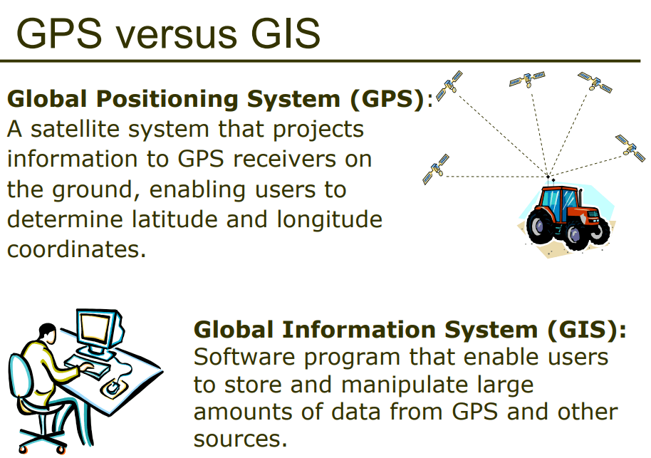
GPS and GIS are examples of contemporary mapping tools that rely on ______ technology.
remote sensing/satellite
computer
smart phone/satellite
International Space Station
Why is the mercator map projection useful.
The distortion is minimized
Directions is constent across the map
Distances are correctly protrayed
Area of the land masses is shown accurately.
Cartography is the science of
Map making
Spatial Topography
demographics
Cognitive Imaginary
Which geographical theme would involve the study of the impact drainage of part of the Florida, Everglades?
Movement
Location
Place
Human Environment Interaction
The greater the distance from the hearth, the less likely the interaction would be referred to as,
Distance Decay
Acculturation
Time-Space Compression
Sequent occupance
Which form of diffusion cannot be transmitted by media (television, internet, radio)?
Relocation Diffusion
Stimulus Diffusion
Contagious Diffusion
Hierarchical diffusion
The location of a place in relationship to other places or features around it is called:
Situation
Relative Location
Absolute Location
Site
Every map projection has some degree of distortion because
a curved surface cannot be represented on a flat surface without distortion
parallels and meridians never cross at right angles on a globe
the grid system is two-dimensional, while the real world is three-dimensional
Earth is not a perfect sphere
latitude lines are shorter than meridian lines

Which of the following scales is represented in the map shown?
Local, showing the towns and township areas in a county
Regional, showing the states or provinces in one part of a country
State or province, showing the counties or parishes
Neighborhood, showing the block along street boundaries
Block, showing the property lines and names of owners
(Unit 1) Diffusion which moves from large cities to smaller cities to towns, skipping over rural areas between is
Expansion Diffusion
Stimulus Diffusion
Relocation Diffusion
Hierarchical Diffusion
(Unit 1) The spread of specialty coffee shops across the United States in the 1990's is an example of
Hierarchical diffusion
Contagious diffusion
Stimulus diffusion
Relocation diffusion
Which map scale shows the most detail?
1:10,000
1:62,500
1:100,000
1:250,000
1:2,500,000
Success in AP Human Geo takes time, effort, and determination. What is NOT a good strategy for growth and achievement?
Build a study group and work together as a team.
Do "a little, a lot" so that information builds and deadlines do not sneak up on you.
Ask for help as you go through the chapter.
Say the course is too hard, and pull the covers over your head.
GPS and GIS are examples of contemporary mapping tools that rely on ______ technology.
remote sensing/satellite
computer
smart phone/satellite
International Space Station
Why is the mercator map projection useful.
The distortion is minimized
Directions is constent across the map
Distances are correctly protrayed
Area of the land masses is shown accurately.
Cartography is the science of
Map making
Spatial Topography
demographics
Cognitive Imaginary
Which geographical theme would involve the study of the impact drainage of part of the Florida, Everglades?
Movement
Location
Place
Human Environment Interaction
The greater the distance from the hearth, the less likely the interaction would be referred to as,
Distance Decay
Acculturation
Time-Space Compression
Sequent occupance
Which form of diffusion cannot be transmitted by media (television, internet, radio)?
Relocation Diffusion
Stimulus Diffusion
Contagious Diffusion
Hierarchical diffusion
The location of a place in relationship to other places or features around it is called:
Situation
Relative Location
Absolute Location
Site

