
 Worksheets
Unit 1 Review (Physical Geography and Regions)
Total questions: 21
Worksheet time: 11mins
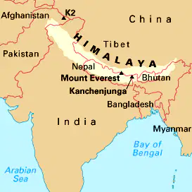
What physical processes could create the landform in the picture?
The deposition of sediment
The collision of tectonic plates
Weathering and Erosion
A volcanic hot spot
Which of the following is not a landform?
Mountain
Forest
Tornado
Desert
People often think of the American South as a place of churches, sweet tea, and country music. This would make the American South an example of a...
Linguistic Region
Formal Region
Functional Region
Perceptual Region

Which type of region usually consists of a hub and nodes?
Functional Region
Vernacular Region
Perceptual Region
Formal Region
Which one would be the most useful for finding your exact location on Earth?
Map and Compass
GPS
GIS
Yodeling
Tropical Climates close to the equator are _______ than regions further away.
dryer
colder
warmer
more temperate

Which of the following is closest to the Prime Meridian?
51.4769° N, 0.0005° W
38.8899° N, 77.0091° W
0.0263° S, 109.3425° E
32°52′36″N 96°45′07″W
Which region will get the least snow?
Desert
Tundra
Tropical Rainforest
Taiga

Mountains are often shaped by...
deposition of sediment
earthquakes
divergent plate boundaries
weathering and erosion
Which type of tectonic plate boundary creates earthquakes?
Convergent
Divergent
Transform
Optimal or Primal
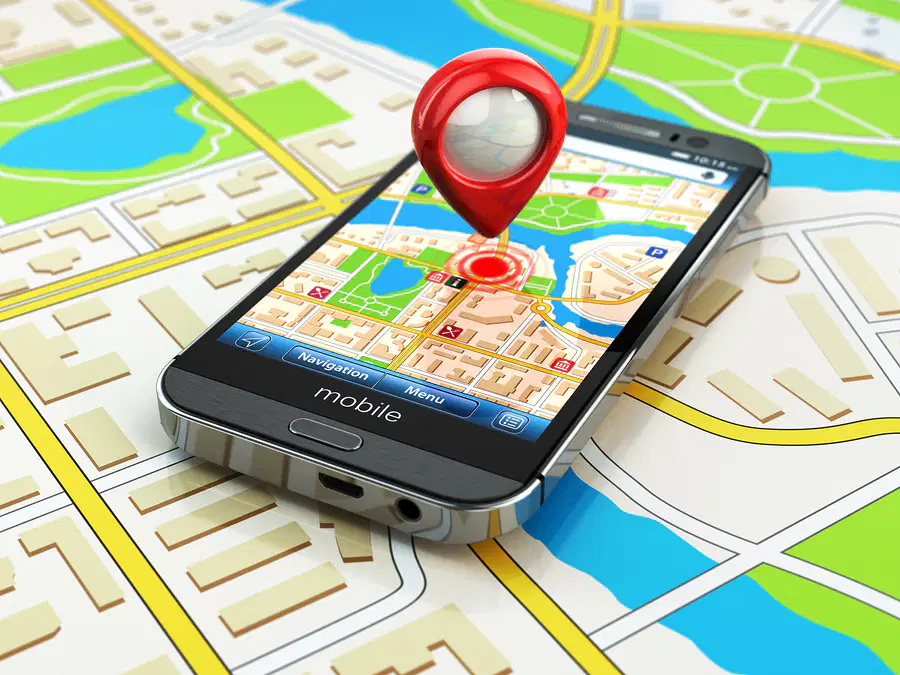
When you are tracking/following something, which one would be the best to use?
SGA
GIS
GPS
GPA
What does GPS provide?
Absolute Location
Relative Location
Place
Known Location
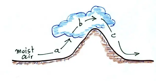
The arrows show the prevailing wind. Which of the following is true?
B is warmer and drier than C
B is cooler and wetter than C
C is warmer and wetter than B
C is cooler and drier than B
What would Geographic Information Systems (GIS) be good for?
Finding objects
Analyzing data
Finding directions
Taking pictures of the land
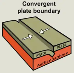
Convergent plates move towards each other. What do they create?
Mountains
Valleys
Earthquakes
Tsunamis
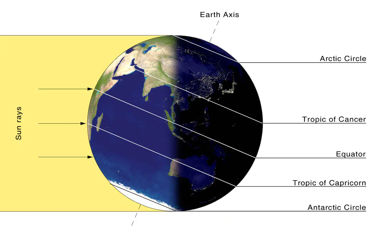
In this picture, it is winter in Texas. Which hemisphere is facing the sun?
Northern
Southern
Eastern
Western
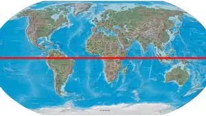
Where is the equator?
0 degrees E/W
0 degrees N/S
23.5 degrees N/S
23.5 degrees E/W
What is a biome?
The condition of the atmosphere over a long period of time
The condition of the atmosphere at a given time and place
A small ecosystem with different climates and types of plants and animals
A large ecosystem with distinct climates and types of plants and animals
Which description of the hydrologic cycle (Water Cycle) is best?
Ice melts and increases the ocean volume causing flooding
Ice seeps into the ground doubling the size of aquifers
Water dries out in certain regions but floods in others
Water evaporates into the atmosphere and returns as precipitation
People think of the Sahara Desert as one place, but it has many different peoples and landscapes. What type of region would this make the Sahara Desert?
Nonexistent
Formal
Perceptual
Functional
What affects temperature, climate, and weather?
Latitude and Longitude
Earth-Sun Relationship
Tectonic Plates
Latitude, Longitude, and the Earth-Sun Relationship

