
 Worksheets
Year 9 Biomes Geography Skills
Total questions: 20
Worksheet time: 10mins

This map is an example of a:
Thematic map
Topographic map
Climate map
Weather map

A map that shows a particular topic (usually colour-coded) is called a:
Thematic map
Topographic map
Climate map
Weather map

The lines on this map are called _____ and it shows _____.
Contour lines;
Height above sea level
Topographic lines;
Elevation
Isobars;
Air Pressure
Elevation lines;
Mountains
What do geographers use to indicate the absolute location of any place on Earth?
Map legend
Map key
Longitude and latitude
Compass bearing
What is the name of the imaginary line that divides the Earth into the Northern and Southern Hemispheres?
Prime Meridian
Equator
International Date Line
Tropics lines
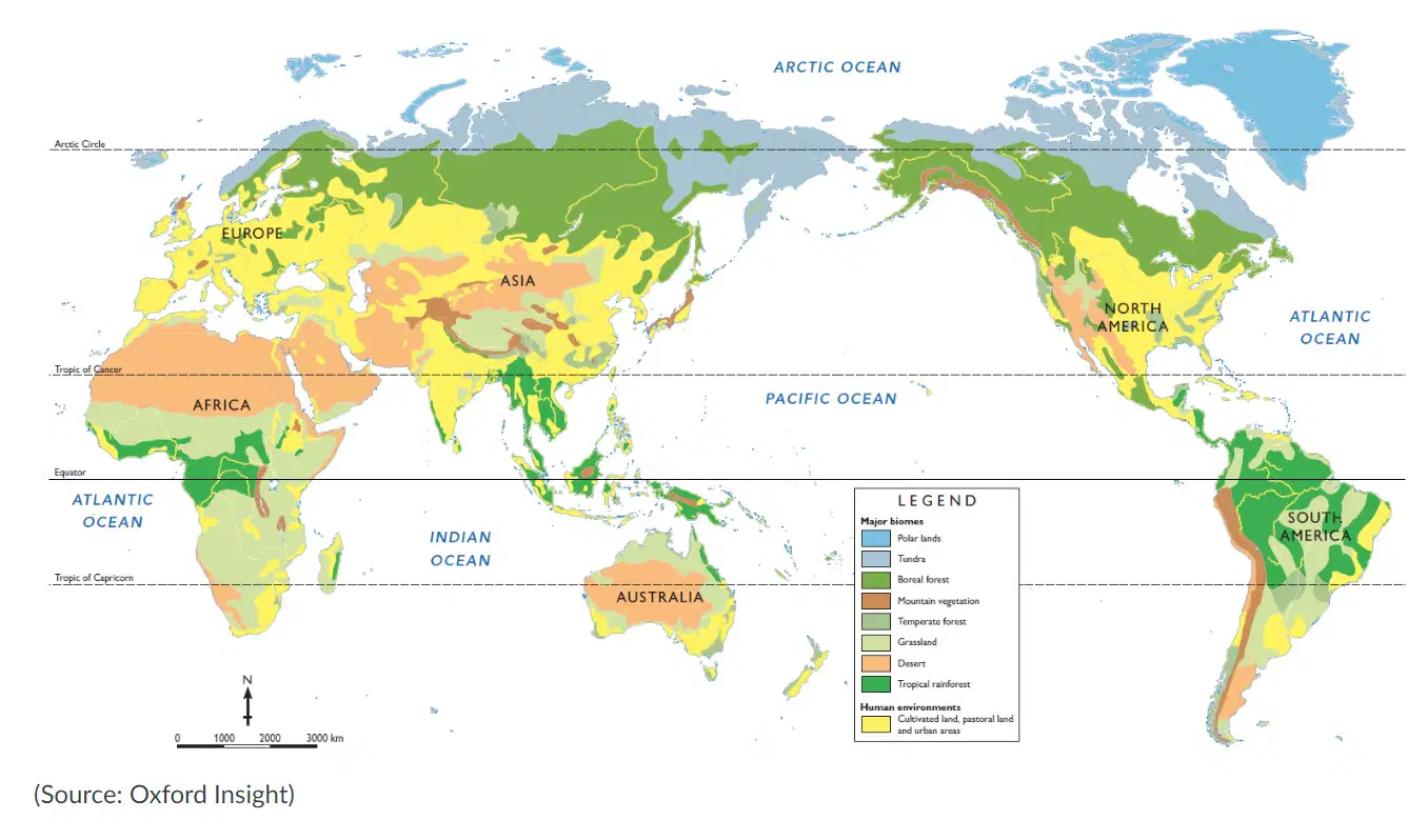
What aspect of BOLTSS is missing in this map?
L. T
O, S
B. T
T, S

What type of map is shown here?
Climatic map
Political map
Topographic map
Thematic map

What is the name of the line that is shown on this map?
Equator
Tropic of Cancer
Tropic of Capricorn
Prime Meridian
What kind of graph is used to indicate rainfall on a climate graph?
Column graph
Line graph
Data graph
Scatter plot

Which season had the highest amount of rainfall in London?
Spring
Summer
Autumn
Winter
What is the difference between climate and weather?
Climate is determined by temperature and precipitation. Weather is determined by humidity, air pressure, and wind conditions.
Weather is determined by temperature and precipitation. Climate is determined by humidity, air pressure, and wind conditions.
Climate is the condition of Earth's atmosphere at a particular time and place. Weather is the characteristic climate in an area over a long period of time.
Weather is the condition of Earth's atmosphere at a particular time and place. Climate is the characteristic weather in an area over a long period of time.
Which graph shows higher temperatures throughout the year?


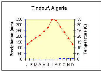
Which biome is best represented by this graph?
Tundra
Desert
Boreal forest
Tropical rainforest
The winter months in Queensland are:
December, January, February
June, July, August
May, June, July
November, December, January
Why does Australia and China have opposite seasons?
They are both in the northern hemisphere
They are both in the southern hemisphere
They are in opposite hemispheres
They have different levels of rainfall
Why is Antarctica considered a desert?
It has no vegetation with no land used for agriculture
It is the driest continent on Earth with little precipitation
It is the most arid and wet continent
The continent receives no rainfall throughout the year
What type of climate would you find at the low latitudes?
hot and wet tropical climates
cold all year long
hot all year long
warm summer and cool winter temperate climate
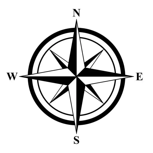
What is this a picture of, using the BOLTSS acronym?
B
O
L
T
S
Which biome is characterized by low temperatures and low amounts of rainfall?
Temperate grassland
Tundra
Temperature forest
Boreal forest
How does latitude affect climate?
the higher you move up an area the cooler it becomes
the closer you move to the equator the warmer the climate becomes
brings in cooler air, resulting in more rainfall
brings in warmer air, resulting in hotter weather

