
 Worksheets
1st Quarter Final Exam: Part 5 - The Americas Geography
Total questions: 28
Worksheet time: 15mins

The account of what happened in the lives of different peoples.
longitude
history
latitude
geography
Before 1500, __________ used information from sailors, travelers and legends to create maps of the world.
tributary
cartographers
hemispheres
elevation
Area between the Rocky Mountains and the Appalachian Mountains.
Great Plains
Great Lakes
Western Hemisphere
Sierra Nevada
Mountain range that lies inland from the Pacific Coast in the United States.
Great Plains
Great Lakes
Western Hemisphere
Sierra Nevada
Geographers help historians understand the past by
showing how people and the land are related.
reporting current events.
studying different systems of government.
comparing people and animals.
What is the name of the mountains chain that runs along the eastern part of North America? They were once very high rugged mountains but have been worn down throughout the years.
The Appalachian Mountains.
The Alps.
The Rocky Mountains.
The Himalayas.
Which kind of map is correctly paired with what it shows?
physical map – natural features
population map – natural resources
economic map – battle sites
political map – climates

An isthmus is:
wide section of land
an island
narrow strip of land between two larger land areas surrounded by water
a Mayan holiday

The continent we live on is _______.
North America
South America
Europe
Asia

Which river located in South America is the arrow pointing to on this map?
Nile River
Amazon River
Bering Strait
Andes River

The world's longest mountain range is in South America. It is labeled on this map. What is it called?
Pampas Mountains
Rocky Mountains
Mount St. Helen
Andes Mountains
The ____________ are the largest mountain system in North American.
Rocky Mountains
The Alps
Nova Scotia Mountains
Lawerence Mountains

Rivers are also a physical feature. What is the largest river in the United States?
The St. Lawrence River
The Mississippi River
The Raisin River
The Ohio River
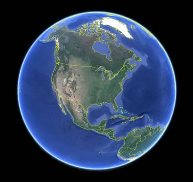
How many continents are there in the world?
6
7
10
1 Giant Continent
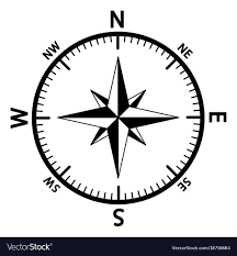
What is this direction finder called?
Briar Rose
Yellow Rose
Compass Rose
Rose Bowl
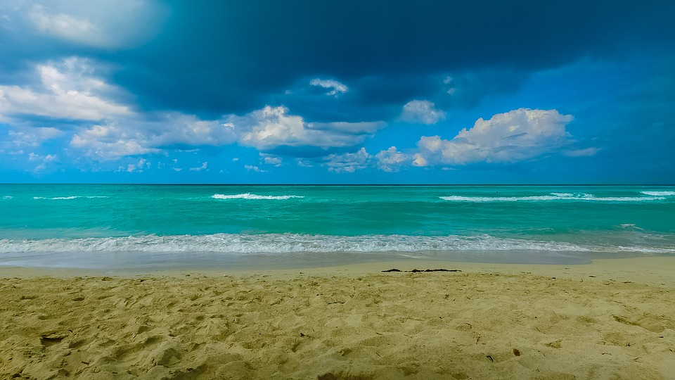
What 2 oceans border the USA?
Atlantic and Arctic
Arctic and Pacific
Atlantic and Pacific
Atlantic and Southern

What continent is circled?
Brazil
Africa
South America
Iceland
What is the name of the plateau of ancient, hard rock surrounding the Hudson Bay?
Canadian Shield
Hudson Shield
Hudson Bay Plateau
Canadian Plains
What two extensions of the Atlantic Ocean border Mexico and Central America on the east?
Rio Bravo del Norte
Caribbean Sea
Gulf of Mexico
Lake Nicaragua
Rio Grande

Which physical feature is circled in GREEN on the map?
Aleutian Islands
Sonoran Desert
Yucatan Peninsula
Alaskan Peninsula

Which body of water lies SOUTH of the US and EAST of Mexico? Shown in orange on the map.
Gulf of Mexico
Pacific Ocean
Caribbean Sea
West Indie Sea

What desert in South America is the world's driest hot desert?
The Atacama Desert
The Sonoran Desert
The Gobi Desert
The Sahara Desert

What cool, dry, temperate plain in Southern Argentina is good for grazing sheep?
Patagonia
Pampas
Altiplano
Llanos

What warm, rainy, subtropical temperate plain in eastern Argentina, Uruguay, and southern Brazil is good for ranching cattle and farming crops?
Patagonia
Pampas
Llanos
Guyana

