
 Worksheets
Remote Sensing
Total questions: 20
Worksheet time: 13mins
What is the primary purpose of remote sensing?
To study astronomical objects
To collect information about the earth from a distance
To amplify sound waves
To monitor personal health
What is one-way remote sensing is beneficial for agriculture?
It reduces labor costs
It improves soil quality
It helps in predicting the stock market
It assists in monitoring crop health
Which of the following is a benefit of using remote sensing in disaster management?
It provides real-time monitoring and assessment
It can prevent all-natural disasters
It eliminates the need for emergency services
It increases the frequency of disasters
Which of the following is an application of remote sensing in environmental monitoring?
Monitoring local traffic
Recording sound pollution
Measuring indoor air quality
Tracking deforestation
How does remote sensing contribute to urban planning?
By creating fictional city layouts
By reducing population density
By mapping infrastructure and land use changes
By providing virtual reality experiences
Why is remote sensing important for climate studies?
It is used solely for entertainment
It provides data on weather patterns and climate conditions
It can completely eliminate climate change
It increases carbon emissions
What is a common tool used in remote sensing technology?
Microscope
Telescope
Satellite
Thermometer
Remote sensing technology is often used in the following fields, except?
Nuclear energy
Agriculture
Natural resource management
Urban planning
How does remote sensing help in disaster mitigation?
By predicting earthquakes
By providing weather and natural disaster data
By detecting criminal activity
By measuring sea level
In the field of marine science, remote sensing is used for?
Catching fish faster
Knowing the depth of the ocean
Monitoring sea surface temperature and currents
Measuring salinity
In an image interpretation process, the elements of the image are always identified. If a geographer observes a palm tree based on its star-like crown, the interpretation element used is...
Texture
Color
Association
Shape
Pattern
Rectangular uniform shape, uniform length, regular pattern with close spacing between each building, located on the edge of a major road and associated closely with vehicle consequences is the identification of an object in the image in the form of....
Market
Factory
School building
Rice field
Road

Observe the following image! The image shows an object that can be identified related to the field of transportation, which is...
Railway track
Bus terminal
Airport
Station
Bus stop
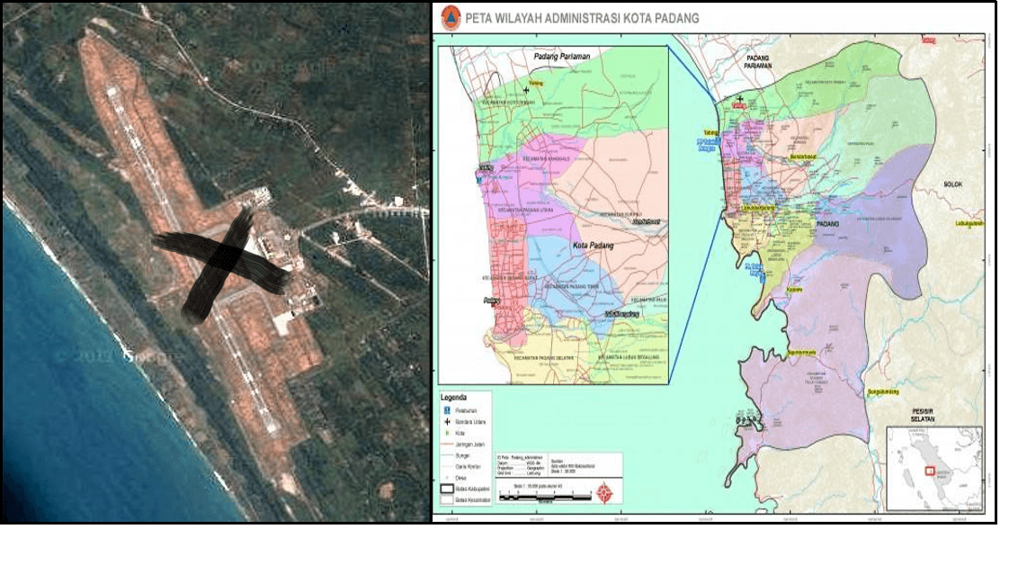
Mark X Indicates Location
Settlement
Airport
Main Road
Forest
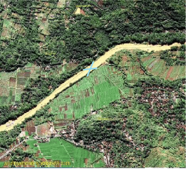
Region X is
rice field
highway
river
embankment

The largest object in the photo above is
Sports arena
Stadium
Running track
Office buildings
Residential houses

Characteristics of objects in the image
1. Dark tone, contrasting with the surrounding area
2. Intersections form sharp angles
3. Elongated shape
4. Uneven width (wider at one end)
The object depicted in the image is recognized as …
River
Bridge
Highway
Coastline
Tunnel
11. Characteristics of the object visible in the image:
(1) tone : bright
(2) shape : in the form of parallel lines
(3) site : in the plain area
(4) color : black
(5) size : length and width ±80 cm
Based on the identification characteristics, the object depicted can be concluded as...
boundary
highway
dirt road
irrigation channel
railway
Examples of the use of remote sensing images in the field of demography are for mapping ….
mangrove land
population density
waste disposal sites
motor vehicle ownership
•Rona: dark in the dry season and bright in the rainy season
•Texture: smooth and uniform
•Shape: elongated with irregular direction
•Size: width is not uniform
•Association: sometimes appears as a sharp river that narrows towards the upstream and widens towards the mouth.
river
highway
railway
bridge
market

