
 Worksheets
INITIAL TEST ECDIS
Total questions: 35
Worksheet time: 18mins

How many layers of digital information can a Raster chart display?
It depends on how much memory the ECDIS has
One
Up to nine
It depends on which maritime authority has issued the electronic chart

How do you know your vessel is fully complied with ECDIS requirements or not?
By checking Safety Equipment Certificate (SEC) Form E
It will be mentioned in SMS
It will be mentioned in Masters Standing orders

What is the recommended maximum size for ENC cells?
5 MB
1 MB
50 MB
5 GB

Which of the given options is the typical scale of a Harbour chart?
1 : 24,000
1 : 5,000
1 : 1,500,000
1 : 30,000,000

Each ENC is identified by an 8-character identifier.
In the following exampling AU412130, Please identified third (3rd) character purpose?
Indicates the producer
Indicates the navigational purpose band
Provides a unique identifier of cell

Vertical lines are displayed, as shown on the picture in red box, on the ECDIS screen.
what dose it means?
No Go Area and we can not pass through it
Electronic Navigational Chart is not installed properly
Electronic charts are not displayed at the appropriate scale
System failure of ECDIS

What electronic Navigational chart (ENC) do you use for coastal Navigation?

1 : 1,000,000

1 : 100,000
Either is fine
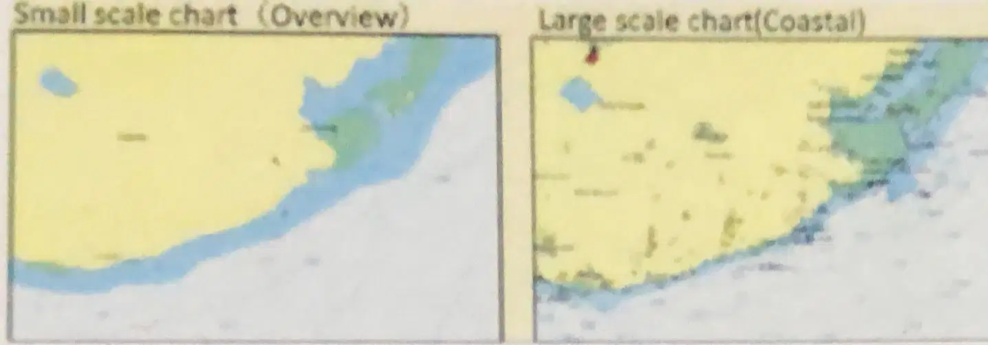
There is a difference in the roughness of the display of shore line between small scale charts and large scale ones. What do you think is the maximum difference of the distance in the shore line display?
No difference
0.5 - 1.0 Nautical mile
More than 1.0 nautical mile
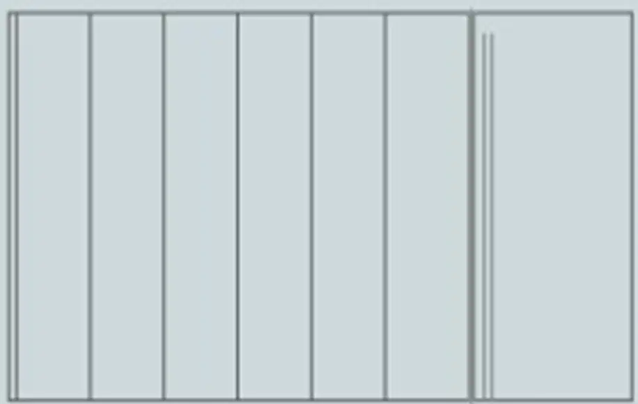
The 'Over scale' status is generally indicated by a thin black VERTICAL LINES pattern all over the relevant chart areas.
True
False
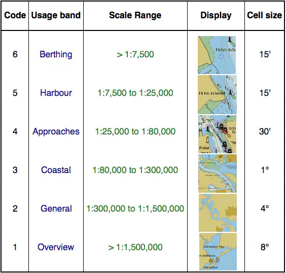
You are sailing on ENC scale 1 : 90,000 and you received following ALERTS on ECDIS "larger scale data is available"
Choose scale from below options your going to use in order to clear above Alert.
1 : 50,000
1 : 120,000
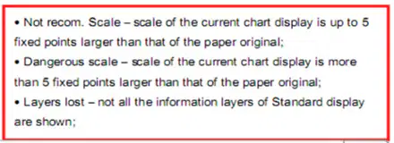
You are sailing on chart scale 1: 5,000. In one moment you received following ALERT on ECDIS "NOT RECOMMENDED SCALE".
Choose scale from options below, your going to set in order to clear above Alert.
1 : 10,000
1 : 2,000

Best scale (compilation scale, compilation, original scale...) is the original scale in which an ENC is created. (1:1)
True
False
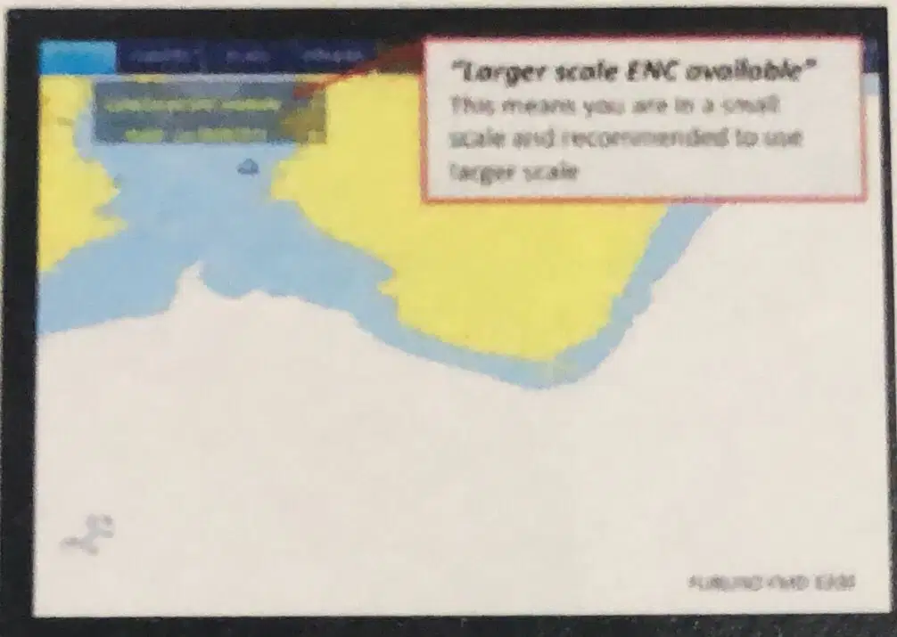
Is it okay to execute and monitor the voyage with the ECDIS displaying "LARGER SCALE ENC AVAILABLE"?
True
False

Select the option which correctly completes the following statement.
"The SCAMIN attribute will influence the chart display because....
...the chart cannot be used in the official mode with SCAMIN
...the SCAMIN affects the saved files in order to recall same files later
...the colour of the display will be wrong when the SCAMIN is set wrongly
...objects will be removed as the operator zooms in or out of original compilation scale
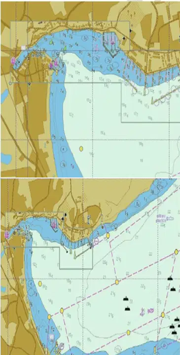
SCAMIN is the term for the scale below which an object will NOT be displayed on an ENC. The main purpose of this feature is to reduce ECDIS screen clutter as seen by a user who could have zoomed out the compilation scale.
True
False

What are the impplications of the SCAMIN filter when APPLIED?
It has the potential to hide potential dangerous object/information/layers
That it clutter the chart
It stops the use the correct scale being used
It Causes symbols and objects to be misplaced on the chart display

To use the CATZOC information, all we need to do is apply the MAXIMUM possible errors wherever required.
considering the position accuracy - if we are planning a passage that involves passing close to a danger, we need to keep safe distance considering the CATZOC category in that area.
True
False

Which is the ZOC symbol that means "the quality of the bathymetry data has yet to be assesed" (i.e Un Assessed)

C

D

U

How many CATZOC Zones are there in ECDIS system available ?
6
5
4
3
Depending of the source of realibility

Which datum is the level to which all soundings, bathymetry countours and drying heights are generally referenced?
Lowest Astronomical Tide (LAT)
Mean High Water Springs (MHWS)
Mean Sea Level
Highest Astronomical Tide (HAT)
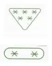
Which of the two CATZOC icons shown on the picture represent BETTER survey accuracy and what does is stand for ?
5 stars stand for CAT ZOC A2
5 stars stand for CAT ZOC A3
2 stars stand for CAT ZOC U
2 stars stand for CAT ZOC D
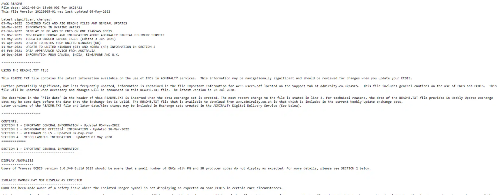
README.TXT file contains the latest information vailable on the use of ENCs in ADMIRALTY services.
This information may be navigationally significant and should be reviewed for changes when you update your ECDIS.
True. The README file contains important safety information
False. The README file does not contains important safety information
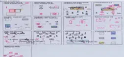
What is the name of the chart which contains all the symbols used in ECDIS, and it is provided with the IHO Presentation Library.
Chart 1
ENC Chart
Chart 11

What does a Question mark symbol in black in the ENC indicate?
Data missing from the feature object
Feature object of low accuracy
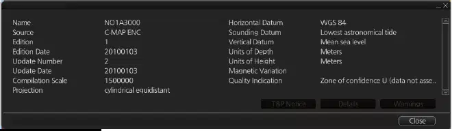
Where do you find information on Magnetic Variation in the ENC's on the ECDIS ?
In chart display
In chart catalogue
In chart alert
In chart legend
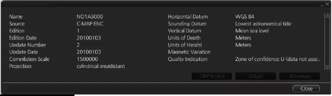
Which information can you find in the Vector Chart legend ?
Notice To Mariner
Presentation Library edition number
Chart edition & update date
Safety Countour setting

Which two (2) types of chart symbols (Symbology) listed below are existing in ENC ?
Traditional symbols (very much like used for paper chart)
Simplified symbols
Altenative symbols
Day/Night symbols
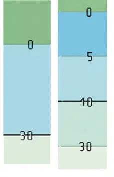
The use of four (4) depth shades reduces the contrast difference between adjacent depth areas.
This may make is more difficult to distinguish between safe and unsafe waters under certain lighting conditions, particularly at night where its use is not recommended.
True
False
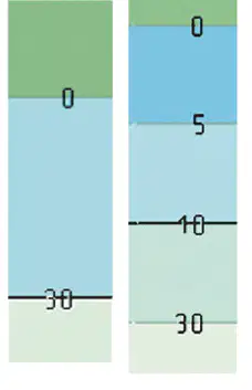
You are viewing the chart in Two shades mode at Day 1 colours. What color is used to display shallow waters (unsafe waters)?
Blue
Grey
White
Black
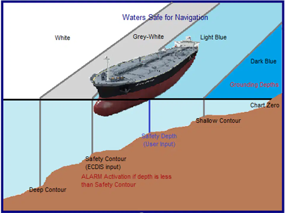
In the FOUR colour scheme, what colour is the navigable water in daylight presentation (depth above ECDIS safety Contour displayed) ?
Deep Blue
Light Blue
Green
Light Grey
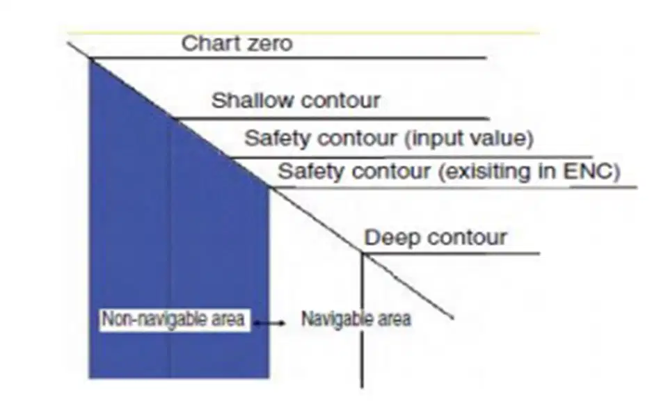
In the TWO colour scheme in the daylight presentation showing depth, what colour is the shallow unsafe area?
Deep Blue
Light Blue
White
Light Grey
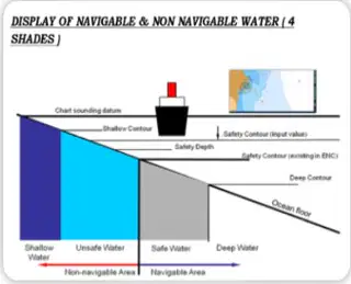
Calculated safety countour by OPERATOR is 15 meters and same value inputted in ECDIS.
Please select what contour ECDIS is designed to display according to below available depths contour in particular ENC ?
10 meters
20 meters
30 meters

Look at the picture and select the correct answer from the choices below
The dotted line is display if the isolated danger is within navigable waters when it is safe to pass over
Isolated danger which is a danger for your vessel on the entered safety values but within the navigable waters
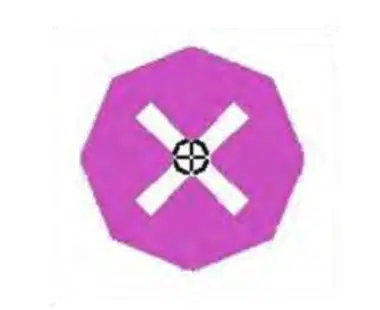
The magenta coloured ISOLATED UNDERWATER DANGER (as shown on the picture) of depth less than or equal to the "MARINER'S SELECTED SAFETY CONTOUR" in safe water, and, therefore....
....is a danger to own ship
...is not a danger to own ship
...may or may not be a danger to own ship

How many routes should usually be planned on ECDIS for a voyage ?
One preferred route
One preferred route and an alternative route
Two preferred route and two alternative routes

