
 Worksheets
LD Arch 221 Lecture 1 quiz
Total questions: 16
Worksheet time: 16mins
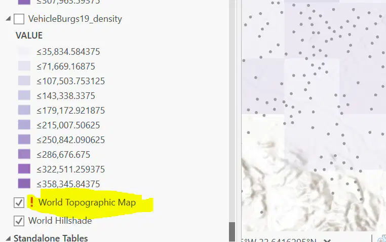
When you open ArcGIS, and encounter a red exclamation point next to the name of a layer in the table of contents, what should you do?
ArcGIS is not working. I need to restart the program.
The symbology of the layer is not right. I need to change the color.
ArcGIS can't find the data source for this layer, I need to link it to the correct data source.
The layer name doesn't match with the file name. I need to rename it.
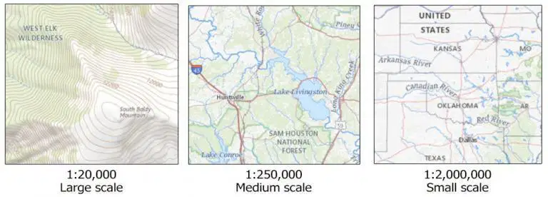
A map displayed at a scale of 1:2,000 shows more details than one displayed at a scale of 1:24,000.
True
False
The shapefile format is a digital vector format for storing geometric locations and associated attribute information. While it can consist of several files with different file name extensions, three file names are needed to be properly identified as a shapefile. These are:
shp
shx
prj
dbf
sbn
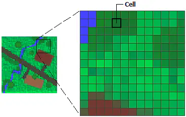
You have an image that covers a rectangular area 4 kilometers wide by 3 kilometers high. The image has 300 rows and 400 columns. What is the resolution of the image?
10 meter
26.67 meter
200 meter
100 meter
The following elements are important even in a simple map
Title
Legend
Scale
North Arrow
Table Join is equivalent to Spatial Join
True
False

Which of the following field is not Text?
Parcel ID
Zip Code
Tax Region
Zoning
One column in the attribute table can only store a specific type of data.
True
False
One row in the attribute table can only store a specific type of data.
True
False
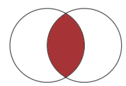
Which logical operator does this visual expression show?
AND
OR
NOT
Which of the following queries will select all housing parcels classified as “residential” (from a layer called PARCELS) that are also considered to be “seasonal” homes (from a layer called STATUS)?
PARCELS = “residential” OR STATUS = “seasonal”
PARCELS = “residential” AND STATUS = “seasonal”
PARCELS = “residential” XOR STATUS = “seasonal”
PARCEL <> “residential” AND STATUS <> “seasonal”
Which of the following queries will select all counties that have a population with more than 100,000 persons (from a layer called POP) as well as all counties that have more than 100,000 housing units (from a layer called HOUSES)?
POP > 100000 AND HOUSES > 100000
(POP AND HOUSES) > 100000
POP > 100000 OR HOUSES > 100000
Map projections will always result in some distortion - either area, shape, distance, or a combination of these properties
True
False
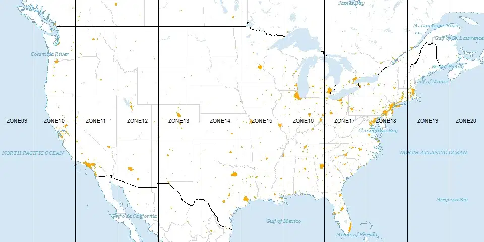
Which coordinate system does this graph explain?
Universal Transverse Mercator (UTM)
North American Datum of 1983 (NAD 83)
Tansverse mercator
World Geodetic System 84 (WGS84)
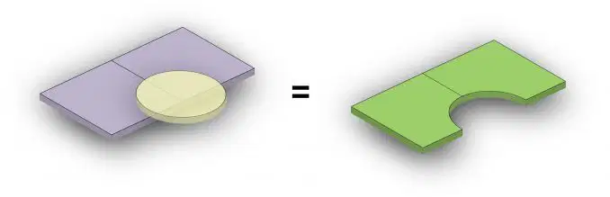
Which geoprocessing tool does this graph show?
union
erase
intersect
buffer
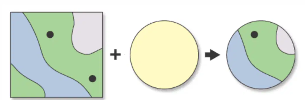
Which analysis tool does this graph illustrate?
Clip
Erase
Union
Select by attribute

