
 Worksheets
Map Skills Unit Test
Total questions: 99
Worksheet time: 2hrs 5mins
Click on the map key.
Click on the compass rose.
Click on the map scale.
Click on the map title.
Click on the map title.
Click on the map scale.
Click on the map key / map legend.
(a) is the study of the earth and the (b) on the Earth.

Look at the map. What map element explains the map symbols?


Look at the map. What map element measures the distance between locations?
Look at the map. What symbol represents a town or village?


Look at the map. What is the distance from Odesa to Kherson?
100 miles
500 miles
1200 miles
750 miles
Look at the map. What is the distance from Kherson to Ternopil?
450 miles
50 miles
900 miles
750 miles
Look at the map. What symbol represents an international boundary?

a tool to measure distance
a tool to tell direction
a tool to start a fire
a tool to build a house


Longitude
Latitude

Equator
International Date Line
Prime Meridian
Tropic of Cancer

International Date Line
Prime Meridian
Equator
Arctic Circle

Eastern and Southern
Northern and Southern
Western and Eastern
Northern and Western

Northern and Southern
Western and Eastern
Northern and Eastern
Southern and Western




Information box on a map that explains what symbols on a map represent
compass rose
map key
map scale


What does number 1 represent?
Legend/Key
Compass Rose
Title
Inset Map
What does number 5 represent?
Legend/Key
Compass Rose
Title
Inset Map


Political Map
Lines that run east and west around the world. They are labeled as
°N or °S and are sometimes called "parallels"Latitude
Longitude
Equator
Prime Meridian

Location D is located at which coordinates?
(a) (b) , (c) (d)
Location H is located at which coordinates?
(a) (b) , (c) (d)
Location L is located at which coordinates?
(a) (b) , (c) (d)
Location C is located at which coordinates?
(a) , (b) (c)
Location B is located at which coordinates?
(a) (b) , (c)
Which point is located at 0°, 0°?
Which point is located at 30° S, 150° E?
Which point is located at 45° N, 105° W?
Which point is located at 45° N, 30° E?
Which point is located at 60° N, 180° E?
Which point is located at 15° N, 15° W?

You measure Longitude from the East or West of the Prime Meridian (0 degrees). True or False?
True
False

Latitude is always measured (1)_________ or (2)__________ of the Equator (0 degrees).
(1) North (2) South
(1) East (2) West
When writing coordinates, we write ____ first
Latitude
Longitude
I don't know why you're asking us this, you never told us.

Which continent is green?
North America
South America
Asia
Antarctica

Which continent is pink?
North America
South America
Asia
Europe

Which continent is purple?
Europe
Asia
Austrailia
North America

What continent is light yellow?
Africa
Australia
Antarctica
Alaska

What continents is dark yellow?
United States
South America
North America
Europe

What continent is dark red?
Africa
South America
Antarctica
Europe

What continent is blue?
Australia
Antarctica
North America
Asia

What ocean is number 4?
Atlantic
Pacific
Arctic
Indian

What ocean is number 1?
Pacific
Atlantic
Southern (Antarctic)
Indian

What ocean is number 5?
Indian
Southern (Antarctic)
Pacific
Atlantic

What ocean is number 2?
Pacific
Indian
Arctic
Atlantic

What ocean is number 3?
Arctic
Pacific
Indian
Atlantic


Which continent is this?
Asia
Africa
Antacrtica
North America

Which Continent is this?
North America
South America
Asia
Africa

Which continent is this?
Africa
Asia
Europe
North America

Which continent is this?
Africa
South America
Europe
Asia

Which continent is this?
Africa
South America
Africa
North America

What continent?
Africa
Pandora
Australia
Asia

Using the map key, which European country is represented by the color green?
Britain
Italy
France
Germany
Language
Roads
Buildings
Traditions
Schools
Mountains
Rivers
Canyons
Volcanoes
Islands

What direction is this?
west
east
south
north

City

What direction is this?
west
east
south
north

Scale is 1in = 8mi. Hatboro and Smithville are 24 miles apart on the map, how far apart are they?
87 mi
30 in
6 in
3 in





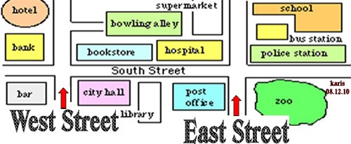

True or false: Globes provide a three-dimensional view of the Earth. They provide the most accurate view of the world, but have limitations in their use.
True
False

What is this map's distortions?
size is inaccurate
shape of land masses are inaccurate
bodies of water a too small

Globes show more detail and are easier to transport than maps.
True
False

All world map projections create distorted images of Earth to some degree. These distortions relate to size, shape, direction, and distance.
True
False
Why does distortion occur on every map?
Cartographers are politically biased.
GIS technology encourages errors.
The 3D world cannot be accurately converted to 2D

