
 Worksheets
Unit 4 social
Total questions: 76
Worksheet time: 2hrs 3mins

ready?
yes
no
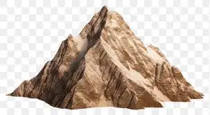
They take millions of years to form.
valley
hill
mountain
plateau
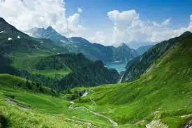
They are long areas of land between mountains an hills. They can have a U shape, a V shape , or be flat.
valley
hill
plain
plateau
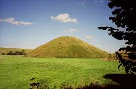
They are shorter than mountains. They have a rounder shape.
valley
hill
plain
plateau
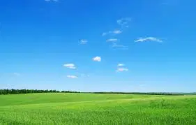
They are wide flat areas of land.
valle
hill
plain
plateau
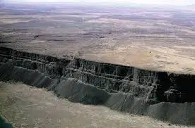
They are high plains.
valley
hill
plain
plateau
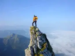
valley
slope
summit
foot
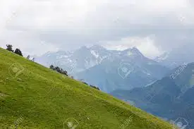
valley
slope
summit
foot
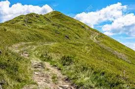
valley
slope
summit
foot
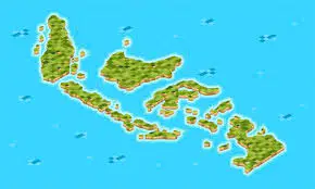
They are group of islands.
islets
islands
archipelagos
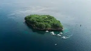
They are small islands.
islets
islands
archipelagos
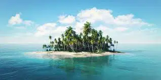
They are flat areas of lands surrounded by water.
archipelagos
islands
islets
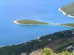
They have water on three sides. A narrow piede of land connects them to mainland.
peninsulas
capes
cliffs
gulfs
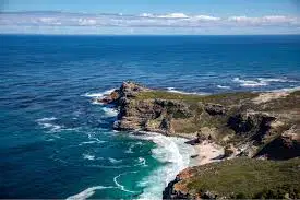
They are areas of land that extend into the sea.
peninsulas
capes
cliffs
gulfs
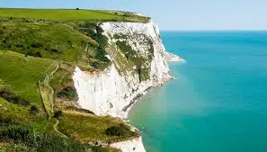
They are vertical walls of rock.
peninsulas
capes
cliffs
gulfs
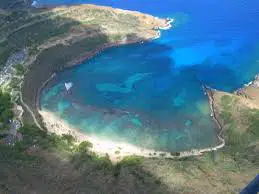
They are areas of water that extend into the land.
peninsulas
capes
cliffs
bays
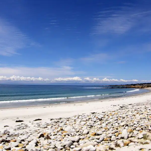
They are flat area of rock or sand next ti the sea
beaches
capes
cliffs
gulfs
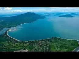
Large bays are called........
peninsulas
capes
cliffs
gulfs
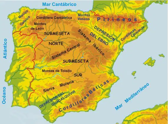
IN THE MESETA CENTRAL:
Sistema central
It divides the Meseta Central into Submeseta Norte y Submeseta Sur.
They are located between the Tajo and Guadiana basin.
IN THE MESETA CENTRAL:
Montes de Toledo
It divides the Meseta Central into Submeseta Norte y Submeseta Sur.
They are located between the Tajo and Guadiana basin.
AROUND THE MESETA CENTRAL:
Montes de León.
They are home to the largest Iberican wolf population of Spain.
It is one of the habitants of the Cantabrian brown bear.
Rivers, such as the Tajo,Júcar and Duero, begin in this landform.
It contains numerous protected natural areas.
AROUND THE MESETA CENTRAL:
Cordillera Cantábrica.
They are home to the largest Iberican wolf population of Spain.
It is one of the habitants of the Cantabrian brown bear.
Rivers, such as the Tajo,Júcar and Duero, begin in this landform.
It contains numerous protected natural areas.
AROUND THE MESETA CENTRAL:
Sistema Ibérico.
They are home to the largest Iberican wolf population of Spain.
It is one of the habitants of the Cantabrian brown bear.
Rivers, such as the Tajo,Júcar and Duero, begin in this landform.
It contains numerous protected natural areas.
AROUND THE MESETA CENTRAL:
Sierra Morena
They are home to the largest Iberican wolf population of Spain.
It is one of the habitants of the Cantabrian brown bear.
Rivers, such as the Tajo,Júcar and Duero, begin in this landform.
It contains numerous protected natural areas.
On the edge to Iberica Peninsula
Macizo Galaico
The average altitude of its formations is 500 m.
Its peaks do not reach great heights.
It is a natural border between Spain and France.
It is made up of two mountain ranges running parallel to the Mediterranean coast.
The highest peak to the Iberican Peninsula , Mulhacén ( 3479m), is located here.
On the edge to Iberica Peninsula
Montes Vascos.
The average altitude of its formations is 500 m.
Its peaks do not reach great heights.
It is a natural border between Spain and France.
It is made up of two mountain ranges running parallel to the Mediterranean coast.
The highest peak to the Iberican Peninsula , Mulhacén ( 3479m), is located here.
On the edge to Iberica Peninsula
Pyrenees
The average altitude of its formations is 500 m.
Its peaks do not reach great heights.
It is a natural border between Spain and France.
It is made up of two mountain ranges running parallel to the Mediterranean coast.
The highest peak to the Iberican Peninsula , Mulhacén ( 3479m), is located here.
On the edge to Iberica Peninsula
Cordillera Costero-Catalana
The average altitude of its formations is 500 m.
Its peaks do not reach great heights.
It is a natural border between Spain and France.
It is made up of two mountain ranges running parallel to the Mediterranean coast.
The highest peak to the Iberican Peninsula , Mulhacén ( 3479m), is located here.
On the edge to Iberica Peninsula
Sistema Bético
The average altitude of its formations is 500 m.
Its peaks do not reach great heights.
It is a natural border between Spain and France.
It is made up of two mountain ranges running parallel to the Mediterranean coast.
The highest peak to the Iberican Peninsula , Mulhacén ( 3479m), is located here.

Marca la respuesta correcta
Macizo Asturiano
Montes de León
Macizo Galaico
Sistema Central

¿?
Montes de leon
Montes de toledo
Pirineos
Sierra morena

Which mountain range is number 1?
Cordillera Cantábrica
Sistema Central
Sistema Bético
Sierra Morena
Pyrenees

¿?
Montes Vascos
Cordillera cantabrica
Montes de toledo
Cordillera penibetica
Which mountain range is number 2?
Cordillera Cantábrica
Sistema Central
Sistema Bético
Sierra Morena
Pyrenees

¿Qué señala?
Sistema central
Cordillera costera catalana
Tajo
Mulhacén
Which mountain range is number 3?
Sistema Iberico
Sistema Central
Sistema Bético
Sierra Morena
Pyrenees
Which mountain range is number 6?
Sistema Iberico
Sistema Central
Sistema Bético
Montes de Toledo
Pyrenees
Which mountain range is number 4?
Sistema Iberico
Sistema Central
Sistema Bético
Sierra Morena
Pyrenees
Which mountain range is number 5?
Sistema Iberico
Sistema Central
Sistema Bético
Montes de Toledo
Pyrenees

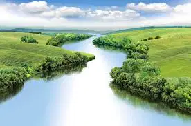
river
beach
mountain
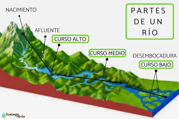
Rainwater and melted snow collect in the mountains. They form rivers that travel to a lake, the sea or the ocean.
True
false
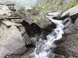
It is where a river begins
mouth
source
tributary
river basin
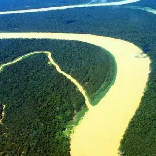
It is a small river that flows into a larger river
mouth
source
tributary
river basin
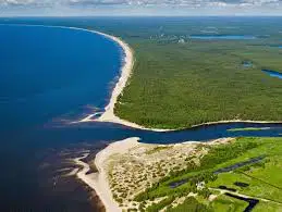
It is where a river meets an ocean, sea or lake.
source
mouth
tributary
river basin

It is the area of land that a particular river and its tributaries occupy
source
river basin
mouth
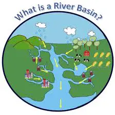
It is the area of land that a particular river and its tributaries occupy.
false
true
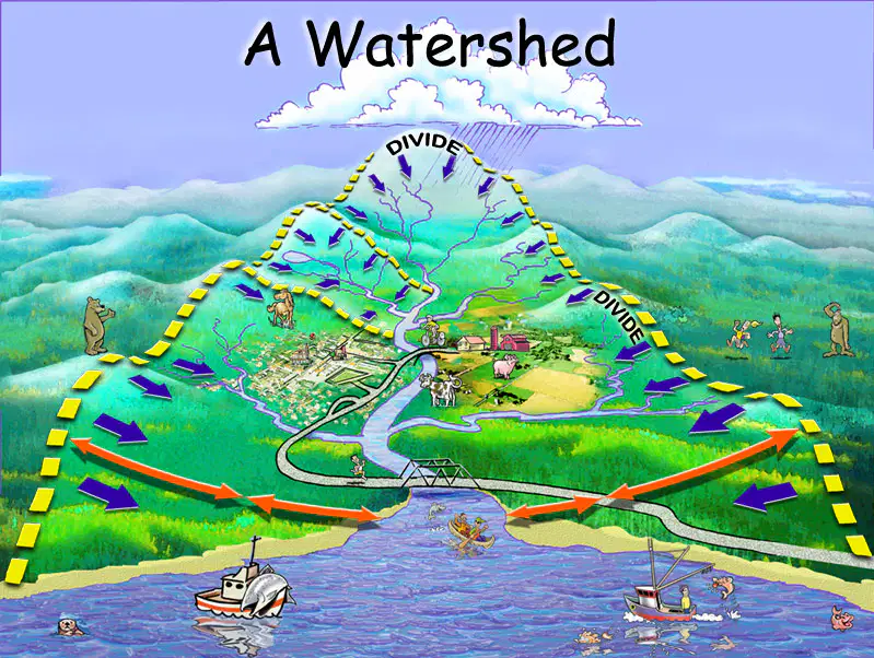
All rivers that flow into the same sea or ocean form part of the same watershed.
false
true
A river basin is an area of land where rainwater collects and flow into a particular river.
true
false

The three watersheds of Spain are: ...( MARCAR LAS TRES)
Atlantic watershed
European watershed
Cantabrian watershed
Mediterranean watershed
East watershed
The watersheds of Spain (blue) is_______
Atlantic watershed
Cantabrian watershed
Mediterranean watershed
West watershed
The watersheds of Spain (green) is_______
Atlantic watershed
Cantabrian watershed
Mediterranean watershed
West watershed
The watersheds of Spain (yellow) is_______
Atlantic watershed
Cantabrian watershed
Mediterranean watershed
West watershed
The flow of the rivers is abundant and regular.
Atlantic watershed
Cantabrian watershed
Mediterranean watershed
The rivers are short , except the Ebro.
Atlantic watershed
Cantabrian watershed
Mediterranean watershed
The rivers are short and fast-flowing.
Atlantic watershed
Cantabrian watershed
Mediterranean watershed

Cantabrian Sea
Atlantic Ocean
Mediterranean Sea
Pacific Ocean

Cantabrian Sea
Atlantic Ocean
Mediterranean Sea
Pacific Ocean

Cantabrian Sea
Atlantic Ocean
Mediterranean Sea
Pacific Ocean

¿?
Canary Islands
Balearic Islands

¿?
Canary Islands
Baleriac Islands

RIVERS OF THE CANTABRIAN WATERSHED
Bidasoa, Nervión y Nalón
Miño, Duero, Tajo, Guadiana y Guadalquivir
Ebro, Júcar y Segura
RIVERS OF THE ATLANTIC WATERSHED
Bidasoa, Nervión y Nalón
Miño, Duero, Tajo, Guadiana y Guadalquivir
Ebro, Júcar y Segura
RIVERS OF THE MEDITERRANEAN WATERSHED
Bidasoa, Nervión y Nalón
Miño, Duero, Tajo, Guadiana y Guadalquivir
Ebro, Júcar y Segura

¿?

¿?

¿?

¿?

¿?

¿?

¿?

¿?
¿?
¿?

¿?

yes
other

