
 Worksheets
Geography Talent Test AY 2024-2025 Senior
Total questions: 60
Worksheet time: 31mins
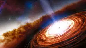
Quasars stand for
Quasi Stellar Radio Source
Quick astronomical source
Quarter star remaining
Quasi Solar System
Which planet given below does not have a ring round it?
Jupiter
Mars
Uranus
Neptune
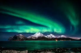
Aurora Borealis is the curtain of brilliant light in the

South Polar Region

North Polar Region

Arctic Circle

Equatorial region
What causes the winds to get deflected to its right in the northern hemisphere and to the left in the southern hemisphere
The force of the wind
The rotation of the earth
Gravitational force
Sun’s rays
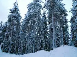
'Taiga' are forests found between the latitudes
0 degree to 10 degree N&S
20 degree to 30 degree N&S
Below 66½ degree N
Below 45 degree S
When the sun, earth and moon are on the same plane, an eclipse occurs.
When does a lunar eclipse occur?
When the earth comes in between the sun and the moon
When the moon is in between the sun and the earth
When the sun and earth are in opposition
When the sun and the moon are in perpendicular
Which gas is primarily responsible for global warming?
Ozone
Carbon dioxide Co2
Methane
Nitrous - Oxide
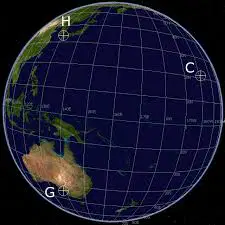
The imaginary lines drawn on the globe are helpful _________
To find places on the globe
To know the direction between two places
To know the correct shape of continents
All the above
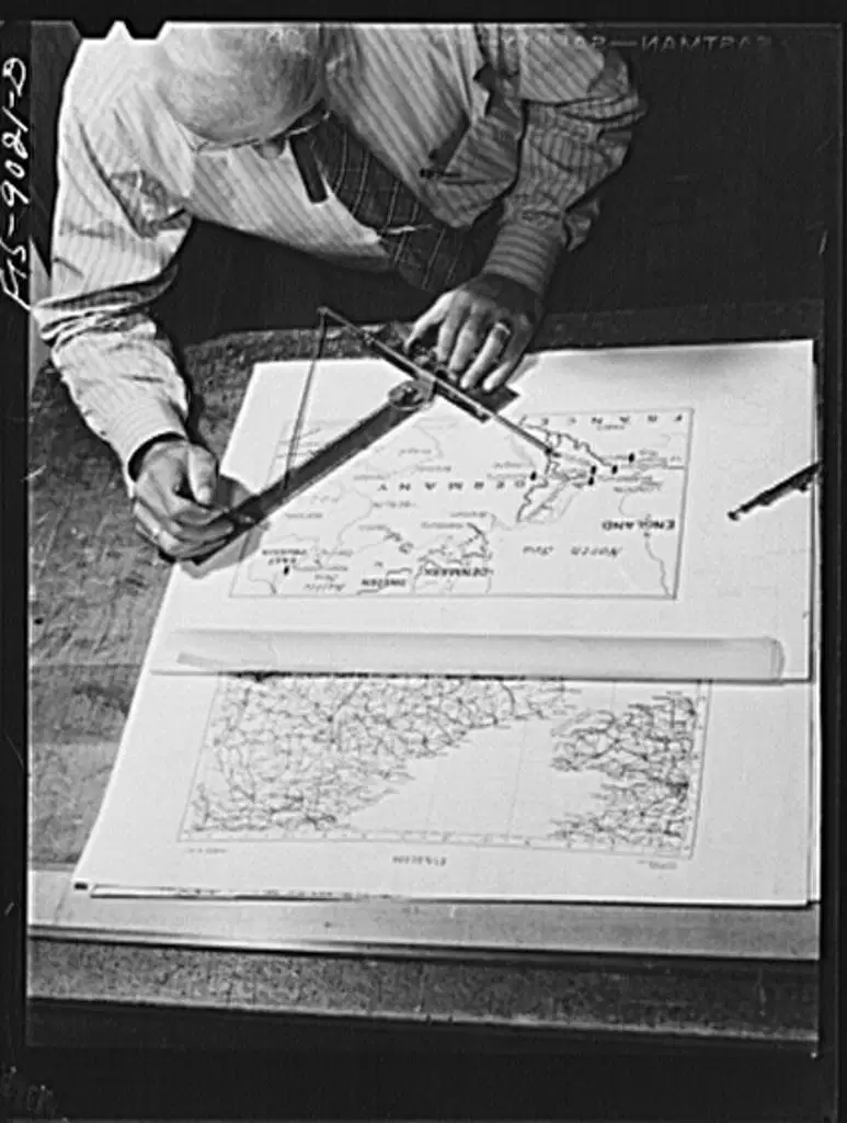
The person who makes maps is called

Astronomer

Astrologer

Meteorologist

Cartographer
The name of cyclone in tropical region of Australia

Depression
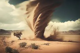
Willy-willy

Tornado

Storm

What geographical term is used for the difference between the maximum and minimum temperature for a day?
Average temperature
Relative temperature
Diurnal range of temperature
Mean temperature
Read the four given statements and choose the correct pair of statements
A) The fuel for a tropical cyclone is provided by a transfer of water vapor and heat from the warm ocean to the overlying air.
B) The warm, saturated air rising in the Centre of the circulation tends to keep growing as long as the surrounding air is cooler and heavier.
C) The low-pressure Centre must be at least 500 km (300 miles) from the Equator.
D) The temperature of the surface layer of ocean water must be 26.5 °C (80 °F) or warmer, and this warm layer must be at least 50 meters (150 feet) deep.
A B C are correct
B C D are correct
A C D are correct
All statements are correct.
Match the Terms with the Statements
1. An intense circular storm that originates over warm tropical oceans and is characterized by low atmospheric pressure, high winds, and heavy rain is a Tropical cyclone
2. The direction of rotation of the tropical cyclone in the northern hemisphere is Clockwise
3. A central region of clear skies, warm temperatures, and low atmospheric pressure is the Eye of the cyclone
All are true
1.and 2 are true.
1,3, are true
2,3, are true.
The following graph shows the temperature distribution for a year, Which one of the cities will have this type of temperature graph?
Srinagar
Karachi
Kolkata
Trivandrum
Choose the statements pertaining to November 2024 rainfall in Tamil Nadu
A) Kayalpattinam in Thoothukudi district, recorded the highest rainfall ever witnessed in 24 hours in Tamil Nadu.
B) Uthangarai in Krishnagiri of rainfall, recorded the highest rainfall in 24 hours during fengal cyclone.
C) Coimbatore, Krishnagiri, Dharmapuri, Nammakkal, Tirupattur received above normal rainfall in the northeast monsoon season.
D) Interior districts received less rainfall during north east monsoon.
a,b
b,d
b,c
a,d
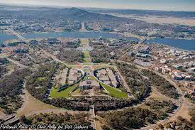
Washington DC is to United States of America as --------------------- is to Australia
(a)
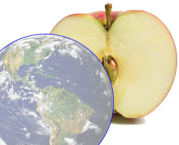
The skin is to apple, as the -------------------, is to the earth
(a)
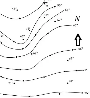
Isotherms is to temperature, as ------------------, is to rainfall
(a)
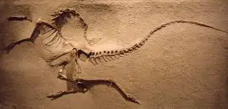
Demography is to population, as ---------------,is to fossils.
(a)
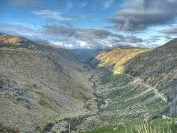
V shaped valley is to rivers, as ---------------- valley, is to the glaciers
(a)
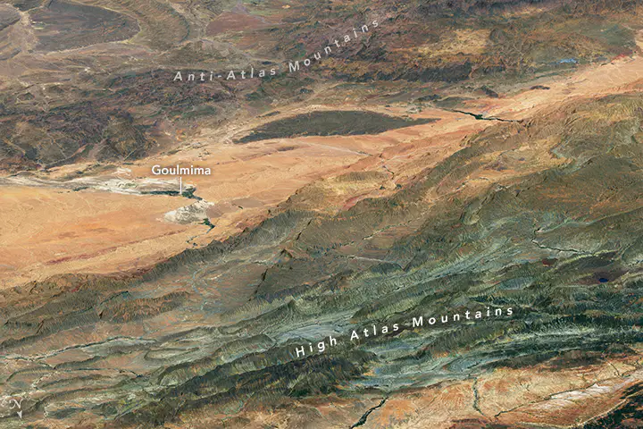
Atlas are fold mountains found in ----------------------------
(a)

Hydrocarbon and lead that pollute the atmosphere are emitted by-------------------
(a)

The process of water vapor turning to water droplets is-----------------
(a)
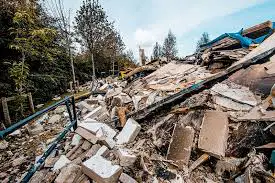
Earthquakes are common in ------------------- type of mountains
(a)
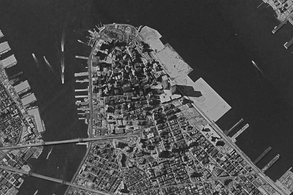
--------------------------are used in the preparation of maps on computers
(a)
Compare the RF scale 1/100 and 1/100000 and say which is a
1 large scale map
2 small scale map
(a)
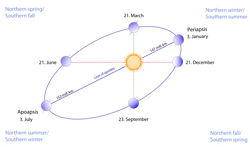
March 21st and September 23rd are called
(a)

The Continent that is spread over the North, South, East, and West hemispheres?
(a)
What type of map shows the boundaries of a state or country?
(a)
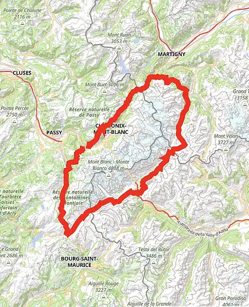
Mount. Blonc is the bone of contention between _______ & ________
(a)
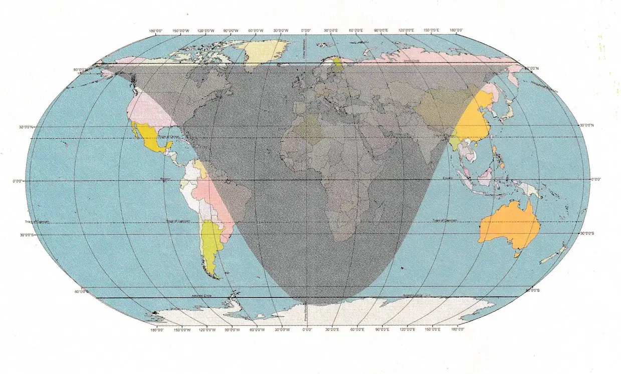
The map shows the daylight and darkness.
Choose the correct answer
What is the season in northen hemisphere and southern hemisphere?
Australia has winter
There is no difference between the equatorial region & polar region
Winter in the northern hemisphere and summer in the southern hemisphere
Autumn in the Northern hemispshere

The map shows irrigation in Chennai and its surrounding areas.
Which reservior is the farthest from the chennai city?
Poondi reservior
Redhills reservior
Chembarampakkam reservior
The map shows irrigation in Chennai and its surrounding areas.
Are the rivers shown in the map, source of drinking water supply to Chennai?
Yes
No
The map shows irrigation in Chennai and its surrounding areas.
Where do the rivers drain into?
Indian Ocean
Arabian Sea
Bay of Bengal
Gulf of Mannar

This is a weather map of India.
The lines on the map are called -------------------------
(a)

This is a weather map of India.
Locate the high-pressure area by Seeing the value of the lines marked.
Western
Eastern
Northern
Southern

This is a weather map of India.
What will be the direction of the wind in West Bengal?
SW to NE
NE to SW
NW to SE
SE to NW

This is a weather map of India.
What is the season represented by the map here?
South West Monsoon
North East Monsoon

Identify the shaded red area
Name 1 the Country and 2 their capital
(a)
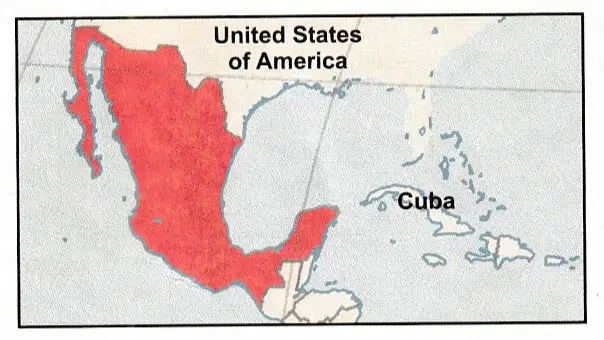
Identify the shaded red area
Name 1 the Country and 2 their capital
(a)
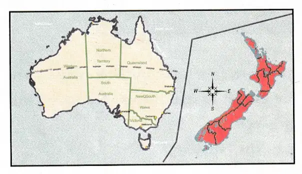
Identify the shaded red area
Name 1 the Country and 2 their capital
(a)
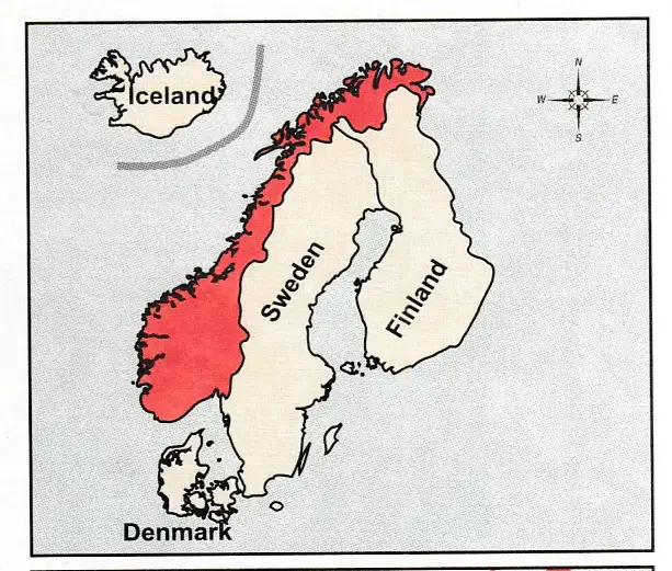
Identify the shaded red area
Name 1 the Country and 2 their capital
(a)
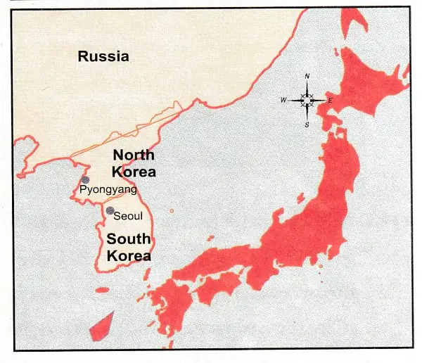
Identify the shaded red area
Name 1 the Country and 2 their capital
(a)
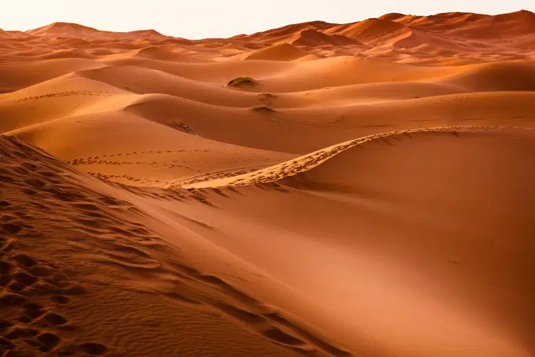
Read the following verse and answer the questions below:-
Invisible you are, but most powerful in the desert
To cut the rocks and carry the dunes
your mission is to create wonderful lands ‘
A) What type of work is carried out by this agent?
Erosion
Deposition
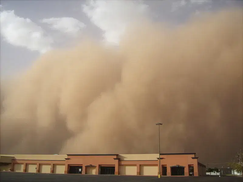
Transportation
All the Above
Read the following verse and answer the questions below:-
Invisible you are, but most powerful in the desert
To cut the rocks and carry the dunes
your mission is to create wonderful lands ‘
B) What is addressed here?
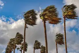
Wind
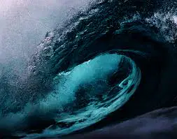
Wave

Rainfall
None of the Above
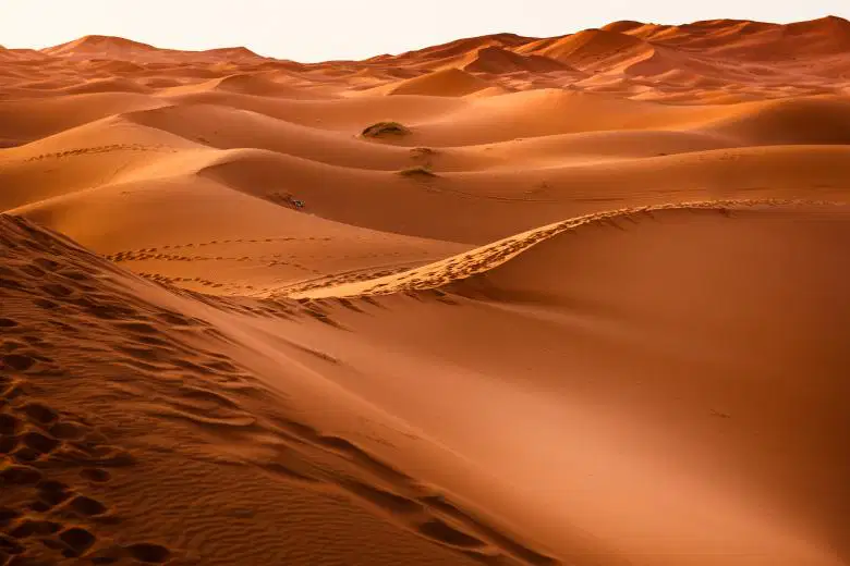
Read the following verse and answer the questions below:-
Invisible you are, but most powerful in the desert
To cut the rocks and carry the dunes
your mission is to create wonderful lands ‘
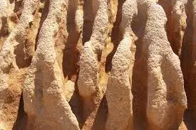
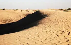
C) What is the name of the landform feature shown here?
(a)
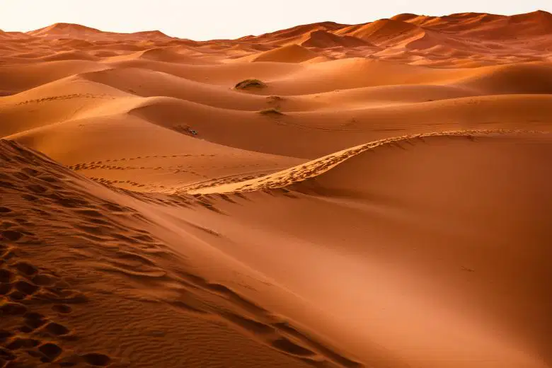
Read the following verse and answer the questions below:-
Invisible you are, but most powerful in the desert
To cut the rocks and carry the dunes
your mission is to create wonderful lands ‘
D) Where is it very active to create landform features?
(a)
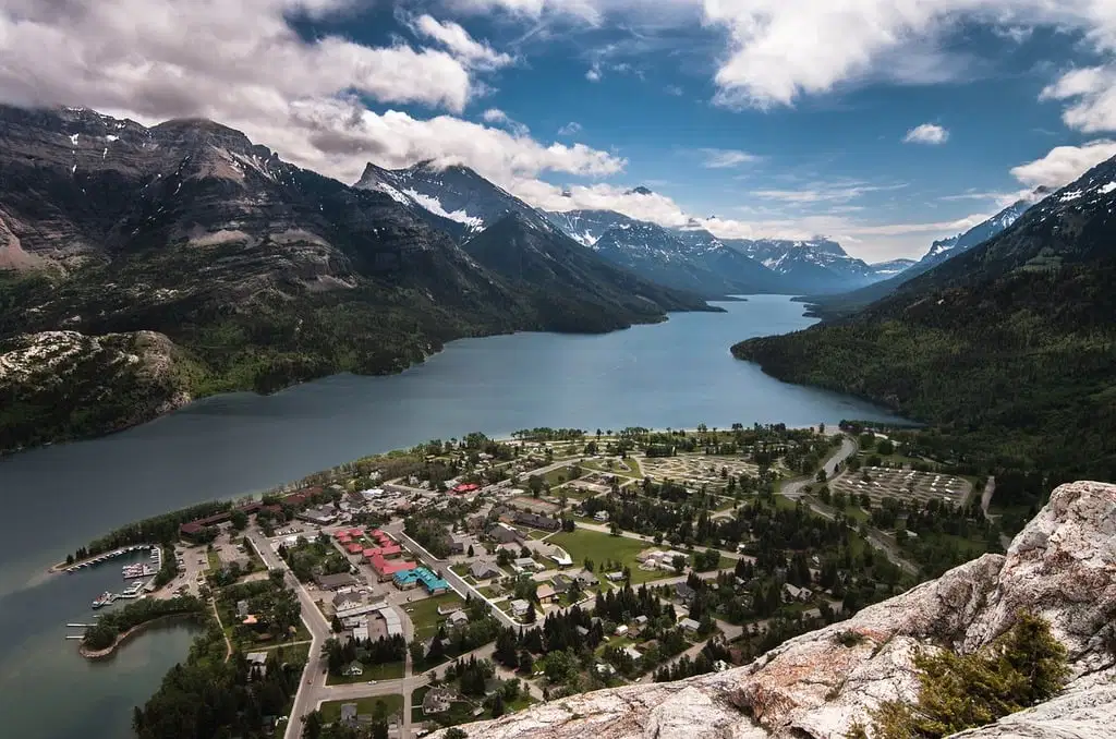
Which agent of erosion forms this?
(a)
Where is this found in Europe?
(a)

This is called Kangaroo rat
A) What is the use of the long tail for this rat?
Escape From Heat
To Search of Water
To Collect Food
None of the above
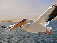
Identify the name of the bird
(a)

Identify the name of the bird
(a)
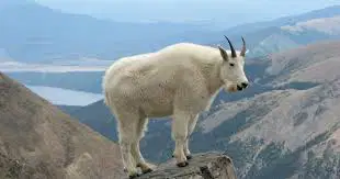
Identify the name of the animal
(a)
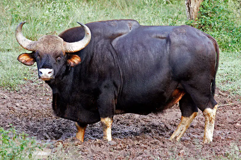
Identify the name of the animal
(a)

Identify the name of the animal
(a)
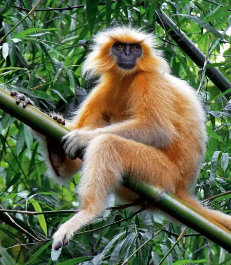
Identify the name of the animal
(a)
Where is the polar nights?
Northen polar region
Southern polar region
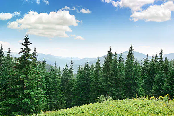
Identify the name of the trees
(a)
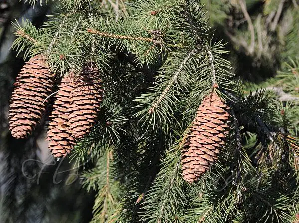
Identify the name of the tree
(a)

Identify the name of the tree
(a)

