
 Worksheets
Unit 1 Test Review
Total questions: 27
Worksheet time: 18mins
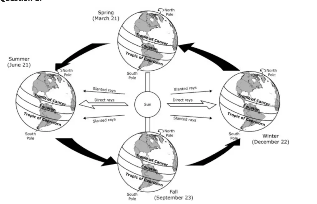
Based on the diagram, how does the Earth-Sun relationship affect the climate of different regions of the world?
It creates a pattern where different areas of the globe receive differing amounts of sunlight.
It creates a pattern in which the warm ocean currents bring monsoon rains to some regions.
It creates a pattern in which the summers and winters are longer than fall and spring seasons.
It creates a pattern where the eastern and western hemispheres have seasonal differences.
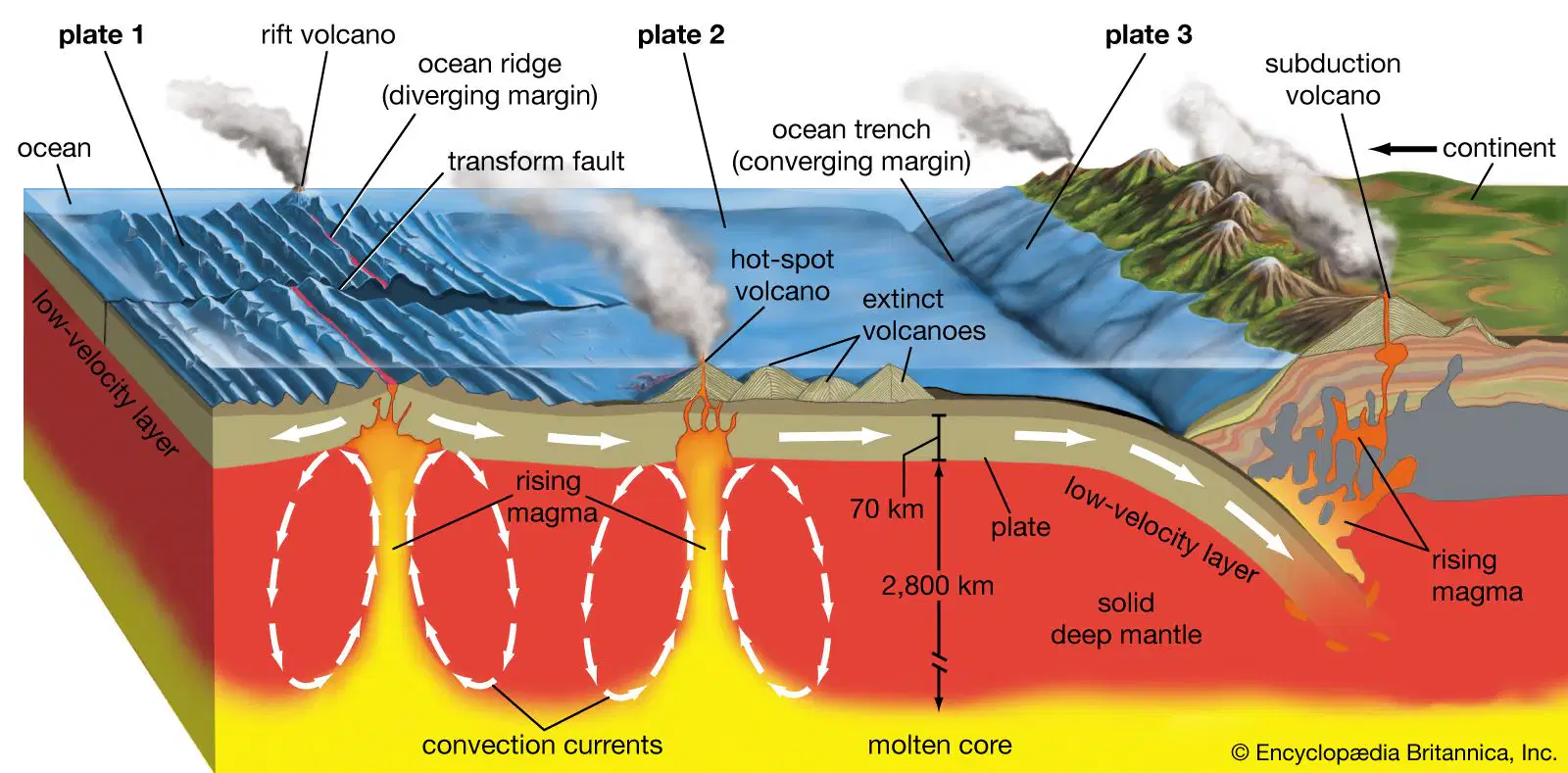
Which physical process is responsible for the formation of islands in the Pacific Ocean?
Erosion
Landslides
Flood deposits
Tectonic activity

The Namib Desert was formed due to —
climatic forces
tectonic forces
human habitation
overgrazing by animals
Which of the following best describes the physical process of erosion?
The wearing down of rocks by wind and water.
The breaking of the Earth’s crust that causes a fault.
The movement of weathered materials by wind, ice or water.
The mixing of weathered rock with decayed plant and animal material.

An earthquake is a physical process that most affects which subsystem of the earth?
biosphere
lithosphere
atmosphere
hydrosphere

Which of the following best explains how elevation influences temperature?
Higher elevations experience cooler temperatures compared to lower elevations.
Higher elevations experience warmer temperatures compared to lower elevations.
Higher elevations experience very little temperature variation from lower elevations.
Higher elevations experience varied temperatures depending on proximity to oceans.
The climate of an area is determined by the combination of precipitation and temperature. Which of the following most affects these two factors?
Proximity to water and latitude
Latitude and longitude
Weathering and erosion
Convection and subduction
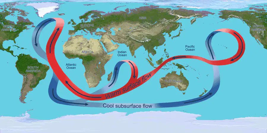
Which physical process is most responsible for creating the climate pattern shown on the map?
Ocean currents
Volcanic activity
Earthquakes
Deforestation

Which of the following is most likely to influence weather patterns?
Erosion
Deforestation
Wind currents
Mountain barriers
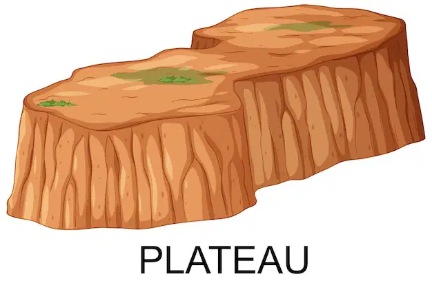
What is the term for a large, flat area of land that is higher than the surrounding land?
Valley
Plateau
Canyon
Glacier
Which physical feature is characterized by a flowing body of water?
Glacier
Island
River
Cliff

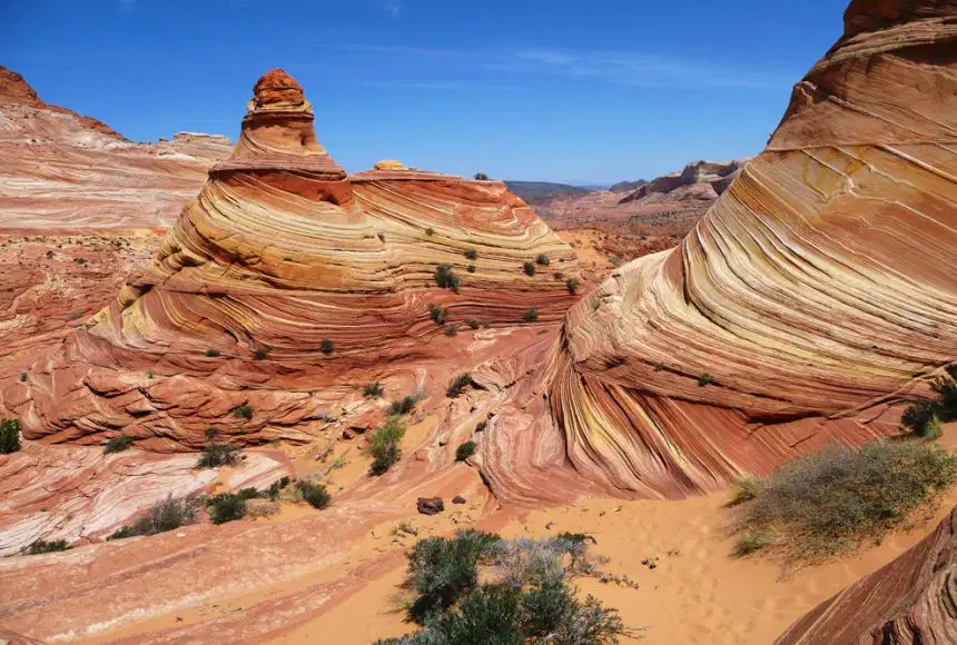
What landform is in the picture?
Glacier
Mountain Range
Island
Plateau

As a river reaches its mouth, it is often affected by incoming tides, resulting in a formation called a —
fjord
delta
plateau
canyon

Which of the following is most directly responsible for the variation in seasonal weather patterns?
Phases of the Moon
Tilt of the Earth’s axis
Distance from the Sun
Rotation of the Earth on its axis
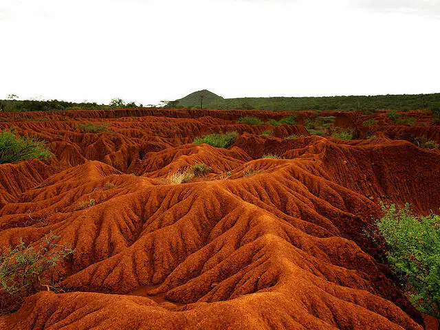
Which physical process is most likely responsible for this landform?
Volcanic activity
Erosion
Glaciation
Deposition
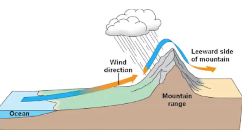
Select which side of the mountain range in which the temperatures would be warm and the amount of precipitation low.
Windward side
Leeward side
Both sides
Neither side

Which of the following processes is usually responsible for the creation of soil from solid rock?
Seepage
Volcanism
Weathering
Fossilization
The ecological differences between these ecoregions can be explained by —
heavy commercial farming in the Chihuahuan Desert.
differing climates caused by differing altitudes.
natural gas reserves underneath the Chihuahuan Desert.
their respective presence and absence of rivers.
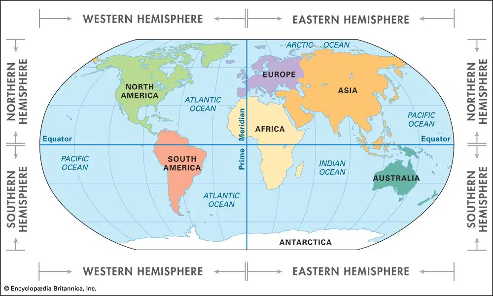
In the Southern Hemisphere, the winter solstice, the shortest day of the year, occurs in which month?
March
June
September
December

The June solstice in the Southern Hemisphere marks the beginning of which season?
Spring
Summer
Fall
Winter
The Ring of Fire in the Pacific Ocean closely follows the boundary of —
the Pacific Plate.
a large impact crater.
the Pacific Proving Grounds.
the United States' territorial claims.
What effect will desertification have on the people living in a region that is experiencing it?
A) Agriculture would decline.
B) Soil quality would improve.
C) Rural housing would expand.
D) Animal populations would increase.
Surface ocean currents in the Northern Hemisphere curve to the right due to —
A) the moon's orbit around Earth.
B) the moon's rotation around its own axis.
C) the Earth's orbit around the sun.
D) the Earth's rotation around its own axis.

Which biome is characterized by extreme cold temperatures and low levels of precipitation?
Temperate Deciduous Forest
Tropical Rainforest
Tundra
Desert
Which biome is primarily found near the equator and has warm year-round temperatures with high levels of precipitation?
Desert
Temperate Deciduous Forest
Tundra
Tropical Rainforest
Which biome is known for having hot days and cold nights with low levels of precipitation?
Desert
Tundra
Tropical Rainforest
Temperate Deciduous Forest

Which biome is primarily located around the midlatitudes and experiences moderate temperatures and cool winters?
Tropical Rainforest
Tundra
Temperate Deciduous Forest
Desert

