
Font size
 Worksheets
Week 7 - Topic 4, Lesson 1 - Climate
Total questions: 11
Worksheet time: 18mins
The climate of an area is usually described as (average temperature / daily changes in weather).
average temperature
daily changes in weather
The climate of an area is usually described as average temperature and (precipitation / cloud cover).
precipitation
cloud cover

Based on the data in the table, which city has a tropical climate?
City W
City X
City Y
City Z

Which best describes the climate in City W?
City W is warm in the summer and cold in the winter. It is dry all year.
City W is cold in the summer and in the winter. It is wet in the summer and dry in the winter.
City W is cold in the summer and in the winter. It is dry all year.
City W is warm in the summer and in the winter. It is dry all year.

What is the best prediction for the average temperature in July for City Z?
4°C
10°C
20°C
32°C
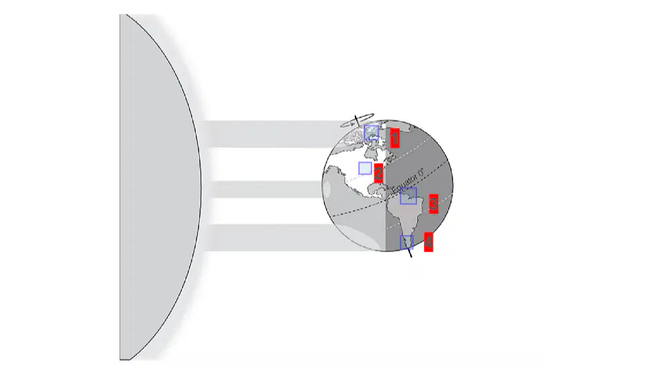
Based on the picture, circle the area of Earth most likely to have the warmest climate.
1
2
3
4

Look at the location of the area marked with a star. What is the most likely climate in this area?
cool, breezy, and wet summers
hot and dry summers
very cold, breezy, and dry winters
very cold and wet winters
What are the three (3) main climate regions?
Choose three options
polar
tornados and earthquakes
temperate
tropical
What has a large impact on a location's climate?
longitude
equator
the Arctic and Antartica
latitude
What are the factors that affect climate?
Choose all that apply.
latitude
atmosphere
oceans
land features
What is climate?

