Wayground logo

Free Printable Worksheets

Font size

S
M
L
XL
Worksheets

Geography Test Unit 1 Review

Total questions: 80

Worksheet time: 49mins

Name
Class
Date
1.

What is Physical Geography?

a)

Studying natural resources

b)

A large body of water

c)

A flat picture of the world

d)

A line that divides the world into north and south

2.

What is an Ocean?

a)

A sphere that is a true representation of the Earth

b)

A large body of water

c)

A line that divides the world into north and south

d)

A large piece of land

3.

What is a Map?

a)

A flat picture of the world

b)

A line that divides the world into north and south

c)

A large piece of land

d)

A sphere that is a true representation of the Earth

4.

What is Human Geography?

a)

A large body of water

b)

Learning about different cultures

c)

A line that divides the world into north and south

d)

A sphere that is a true representation of the Earth

5.

What are Continents?

a)

A large piece of land

b)

A line that divides the world into north and south

c)

A flat picture of the world

d)

A large body of water

6.

What is the Prime Meridian?

a)

A line that divides the world into north and south

b)

A line that divides the world into west and east

c)

A large piece of land

d)

A sphere that is a true representation of the Earth

7.

What is a Globe?

a)

A flat picture of the world

b)

A sphere that is a true representation of the Earth

c)

A large piece of land

d)

A large body of water

8.

Which line divides the world into north and south?

a)

Prime Meridian

b)

Equator

c)

Map

d)

Globe

9.

Which line divides the world into west and east?

a)

Equator

b)

Prime Meridian

c)

Map

d)

Globe

10.

What percentage of the Earth is covered by oceans?

a)

50%

b)

60%

c)

70%

d)

80%

11.

What is a flat picture of the world called?

a)

Globe

b)

Map

c)

Equator

d)

Prime Meridian

12.

What is a true representation of the Earth?

a)

Map

b)

Globe

c)

Equator

d)

Prime Meridian

13.

Which of the following is a large piece of land?

a)

Ocean

b)

Continent

c)

Map

d)

Globe

14.

What is the term for a large body of water?

a)

Continent

b)

Ocean

c)

Map

d)

Globe

15.

What is the term for a line that divides the world into west and east?

a)

Equator

b)

Prime Meridian

c)

Map

d)

Globe

16.

What is the term for a line that divides the world into north and south?

a)

Prime Meridian

b)

Equator

c)

Map

d)

Globe

17.

If it is 1pm in Toronto, what time is it in St. John's?

a)

1:30pm

b)

2:30pm

c)

3:00pm

d)

12:30pm

18.

If it is 3am in Victoria, what time is it in Winnipeg?

a)

5am

b)

4am

c)

6am

d)

2am

19.

If it is 12pm in Fredericton, what time is it in Edmonton?

a)

10am

b)

11am

c)

9am

d)

1pm

20.
How many continents are on the Earth?
a)
7
b)
4
c)
5
d)
2
21.
How many oceans are on the Earth?
a)
7
b)
4
c)
5
d)
2
22.
What is the name of the object by number 1?
a)
North America
b)
South America
c)
United States
d)
Europe 
23.
What is the name of the object by number 2?
a)
North America
b)
South America
c)
United States
d)
Europe 
24.
What is the name of the object by number 3?
a)
North America
b)
Antarctica 
c)
South Pole 
d)
Europe 
25.
What is the name of the object by number 4?
a)
North America
b)
Europe
c)
South Pole 
d)
Africa
26.
What is the name of the object by number 5?
a)
Australia  
b)
Africa
c)
Asia
d)
Europe 
27.
What is the name of the object by number 6?
a)
Australia  
b)
Africa
c)
Asia
d)
Europe 
28.
What is the name of the object by number 7?
a)
Australia  
b)
Africa
c)
Asia
d)
Europe 
29.
What is the name of the object by number 8?
a)
Atlantic Ocean 
b)
Indian Ocean
c)
Pacific Ocean
d)
Arctic Ocean 
30.
What is the name of the object by number 9?
a)
Atlantic Ocean 
b)
Indian Ocean
c)
Pacific Ocean 
d)
Arctic  Ocean
31.
What is the name of the object by number 10?
a)
Atlantic Ocean 
b)
Indian Ocean
c)
Pacific Ocean 
d)
Arctic  Ocean
32.
What is the name of the object by number 11?
a)
Atlantic Ocean 
b)
Northern Ocean
c)
Pacific Ocean 
d)
Arctic  Ocean
33.
What is the name of the object by number 12?
a)
Atlantic Ocean 
b)
Indian Ocean
c)
Pacific Ocean 
d)
Southern  Ocean
34.
What is the name of the smallest continent? 
a)
Africa
b)
China
c)
Australia  
d)
The Bahamas
35.
What is the name of the largest continent? 
a)
Africa
b)
China
c)
Asia 
d)
The Bahamas
36.
What is the southern most continent?
a)
Antarctica
b)
Asia
c)
None 
d)
Afica
37.
What is the type of continent is Australia  continent? 
a)
Island continent
b)
Baby continent
c)
Mini continent
d)
Archipelago 
38.
What continent is The Bahamas apart of?
a)
North America
b)
South America
c)
None 
d)
Africa
39.

Did you know all of the information on this quiz?

a)

No

b)

Kinda

c)

Yes

40.
Antarctica, Australia, and most of South America are in what hemisphere? 
a)
Northern 
b)
Southern 
c)
Western 
d)
Eastern
41.
Asia and Australia are in what hemisphere?
a)
Northern
b)
Southern
c)
Western
d)
Eastern
42.
North and South America are in what hemisphere?
a)
Northern
b)
Southern
c)
Western
d)
Eastern
43.
Europe, Asia and North America are in what hemisphere?
a)
Northern
b)
Southern
c)
Western
d)
Eastern
44.
Latitude and Longitude lines are measured in __________.
a)
inches
b)
miles
c)
degrees
d)
ounces
45.
Lines of Longitude measure how far from the _______ a place is located.
a)
Equator
b)
International Date Line
c)
Prime Meridian
d)
Tropic of Cancer
46.
Lines of Longitude run from the _____ to the ______.
a)
East, West
b)
North, South
c)
South, East
d)
North, West
47.
The Tropic of Cancer and Tropic of Capricorn are what type of lines?
a)
Latitude lines
b)
International Date lines
c)
Longitude lines
d)
Meridian lines
48.
Lines of ______ measure how far from the equator a place is located?
a)
Longitude
b)
Latitude
49.
The invisible line at 0 degrees latitude is called the ________. 
a)
International Date Line
b)
Prime Meridian
c)
Equator
d)
Arctic Circle
50.
The invisible line at 0 degrees longitude is called the _________.
a)
International Date Line
b)
Prime Meridian
c)
Equator
d)
Antarctic Circle
51.
Latitude lines run from the _____ to the  _______.
a)
West, East
b)
North, South
c)
North, East
d)
South, West
52.
What shape is the planet Earth?
a)
Circle
b)
hemisphere
c)
sphere
d)
cone
53.
The equator breaks the Earth into what two hemispheres?
a)
Eastern and Southern
b)
Northern and Southern
c)
Western and Eastern
d)
Northern and Western
54.
The Prime Meridian separates the Earth into what two hemispheres?
a)
Northern and Southern
b)
Western and Eastern
c)
Northern and Eastern
d)
Southern and Western
55.

The line of latitude at 90 Degrees North is called the...

a)

Equator

b)

Prime Meridian

c)

South Pole

d)

North Pole

56.

The 66.5 degrees South line of latitude is called...

a)

Tropic of Cancer.

b)

Tropic of Capricorn.

c)

Antarctic Circle.

d)

Arctic Circle.

57.

180 degree line of longitude is called the....

a)

Equator

b)

Prime Meridian

c)

International Date Line

d)

Tropic of Cancer.

58.
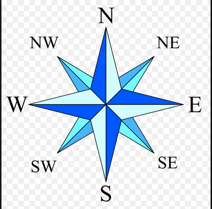
What is this object known as?
a)
map symbol
b)
map key
c)
map scale
d)
compass rose
59.
a)
The map show the lines of longitude.
b)
The map shows the lines of latitude.
60.
a)
The map shows lines of longitude.
b)
The map shows lines of latitude.
61.

Location D is located at which coordinates?

a)

30oN, 90oW

b)

90oN, 30oW

c)

10oN, 40oW

d)

30oN, 90oE

62.

Location H is located at which coordinates?

a)

60oN, 120oE

b)

90oN, 30oE

c)

10oS, 40oW

d)

30oN, 90oE

63.

Location E is located at which coordinates?

a)

30oS, 30oE

b)

30oS, 30oW

c)

10oS, 40oW

d)

30oN, 90oE

64.

Location L is located at which coordinates?

a)

15oS, 60oW

b)

45oS, 60oW

c)

15oS, 60oE

d)

45oS, 60oE

65.

Which point is located at 30oS, 30oE?

a)

K

b)

D

c)

E

d)

G

66.

Which point is located at 30oS, 150oE?

a)

K

b)

D

c)

E

d)

G

67.

Which point is located at 30oN, 90oW?

a)

K

b)

D

c)

E

d)

G

68.

Which point is located at 45oN, 30oE?

a)

K

b)

D

c)

E

d)

G

69.
Europe, Asia and North America are in what hemisphere?
a)
Northern
b)
Southern
c)
Western
d)
Eastern
70.
North and South America are in what hemisphere?
a)
Northern
b)
Southern
c)
Western
d)
Eastern
71.
Lines of ______ measure how far from the equator a place is located?
a)
Longitude
b)
Latitude
72.
The invisible line at 0 degrees latitude is called the ________. 
a)
International Date Line
b)
Prime Meridian
c)
Equator
d)
Arctic Circle
73.
The invisible line at 0 degrees longitude is called the _________.
a)
International Date Line
b)
Prime Meridian
c)
Equator
d)
Antarctic Circle
74.

*Use the map above. You can ZOOM IN by clicking on the map! TAKE YOUR TIME!*

On what continent would you find a location of latitude 30°N30\degree N  and longitude  0°0\degree  ?

a)

Europe

b)

Asia

c)

Africa

75.

*Use the map above. You can ZOOM IN by clicking on the map! TAKE YOUR TIME!*

On what continent would you find a location of latitude 30°S30\degree S  and longitude  60° W60\degree\ W  ?

a)

South America

b)

Africa

c)

North America

76.

*Use the map above. You can ZOOM IN by clicking on the map! TAKE YOUR TIME!*

On what continent would you find a location of latitude 30°S30\degree S  and longitude  130° E130\degree\ E  ?

a)

Europe

b)

Australia

c)

Africa

77.

*Use the map above. You can ZOOM IN by clicking on the map! TAKE YOUR TIME!*

Identify the city located closest to latitude 30°N30\degree N  and longitude  90° W90\degree\ W  ?

a)

New Orleans

b)

Quito

c)

London

78.

*Use the map above. You can ZOOM IN by clicking on the map! TAKE YOUR TIME!*

Identify the city located closest to latitude 30°N30\degree N  and longitude  30° E30\degree\ E  ?

a)

San Francisco

b)

London

c)

Cairo

79.

*Use the map above. You can ZOOM IN by clicking on the map! TAKE YOUR TIME!*

What are the approximate coordinates of Durban, Africa?

a)

30°S, 30°E30\degree S,\ 30\degree E  

b)

30°N, 30°E30\degree N,\ 30\degree E  

c)

0°, 30°E0\degree,\ 30\degree E  

80.

*Use the map above. You can ZOOM IN by clicking on the map! TAKE YOUR TIME!*

What are the approximate coordinates of Shanghai, China?

a)

30°N, 30°E30\degree N,\ 30\degree E  

b)

30°N, 120°E30\degree N,\ 120\degree E  

c)

30°S, 150°E30\degree S,\ 150\degree E