
 Worksheets
U.S. Trade of Enslaved People Quiz
Total questions: 20
Worksheet time: 10mins

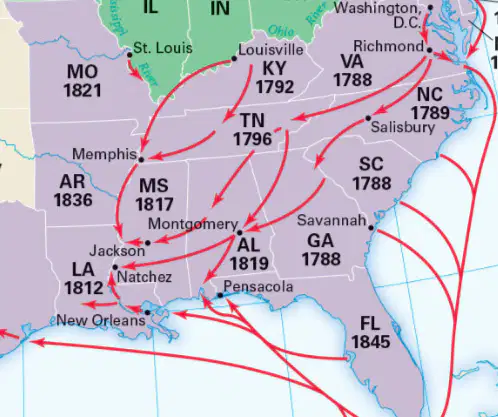
Which states are highlighted in the map related to the U.S. Trade of Enslaved People, 1808–1865?
Texas, Missouri, Virginia, Florida
California, Nevada, Oregon, Washington
New York, Pennsylvania, Ohio, Michigan
Illinois, Indiana, Wisconsin, Minnesota
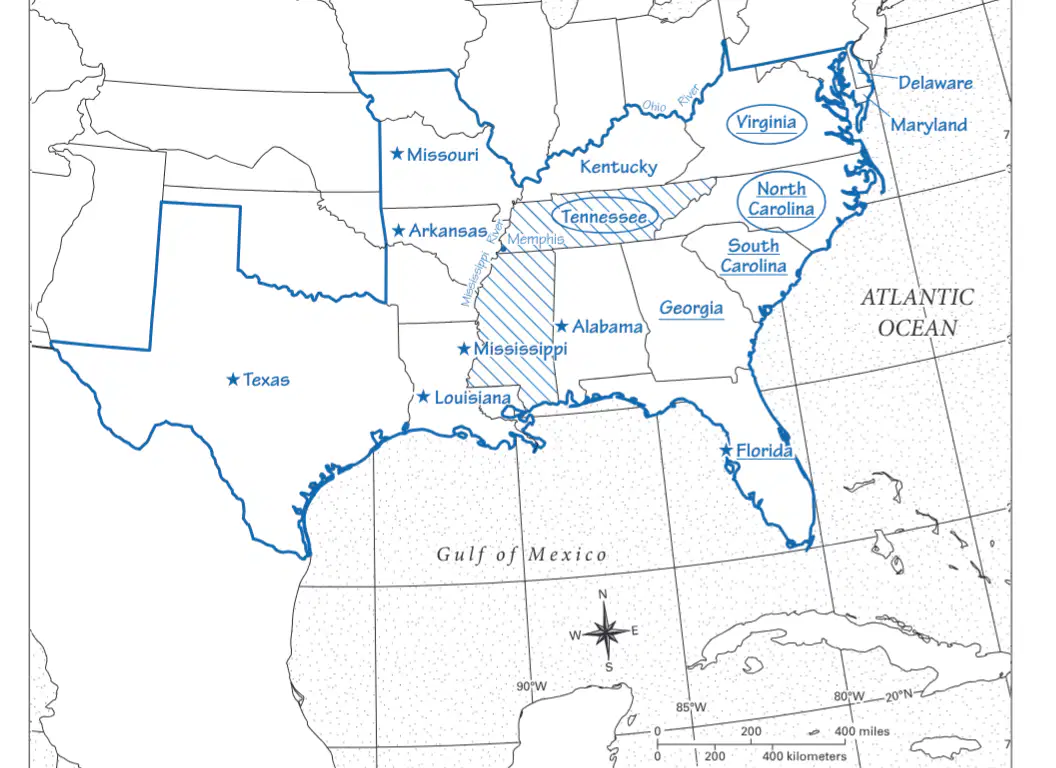
What body of water is shown at the bottom of the map?
Atlantic Ocean
Gulf of Mexico
Pacific Ocean
Great Lakes

Which state is located directly west of Mississippi on the map?
Texas
Arkansas
Alabama
Georgia
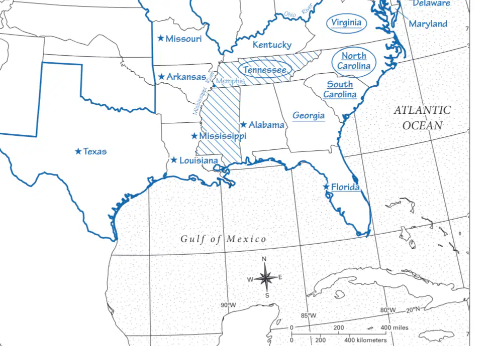
Which state is shown to the north of Alabama on the map?
Tennessee
Georgia
Florida
South Carolina
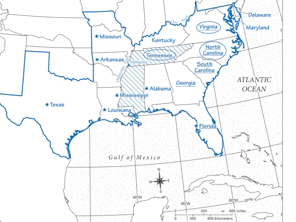
Which state is located to the east of Texas on the map?
Louisiana
Mississippi
Arkansas
Alabama
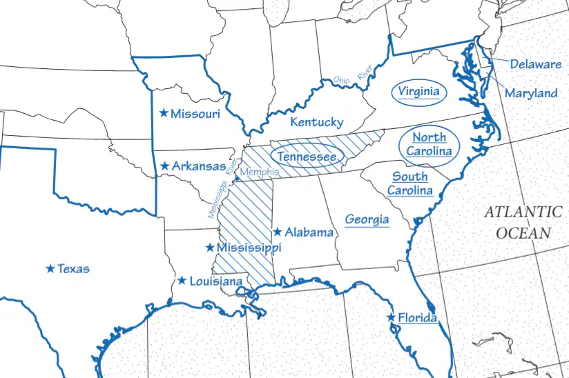
Which state is shown to the west of Georgia on the map?
Alabama
Florida
South Carolina
Tennessee
Outline the border of the states with slavery on your map. Which rivers were along the border between states with and without slavery? Locate and label them.
Mississippi and Ohio Rivers
Colorado and Rio Grande Rivers
Hudson and Delaware Rivers
Missouri and Columbia Rivers

Locate and label each of the states with slavery. Which of them had the largest enslaved population in 1860?
Georgia
South Carolina
Virginia
Alabama
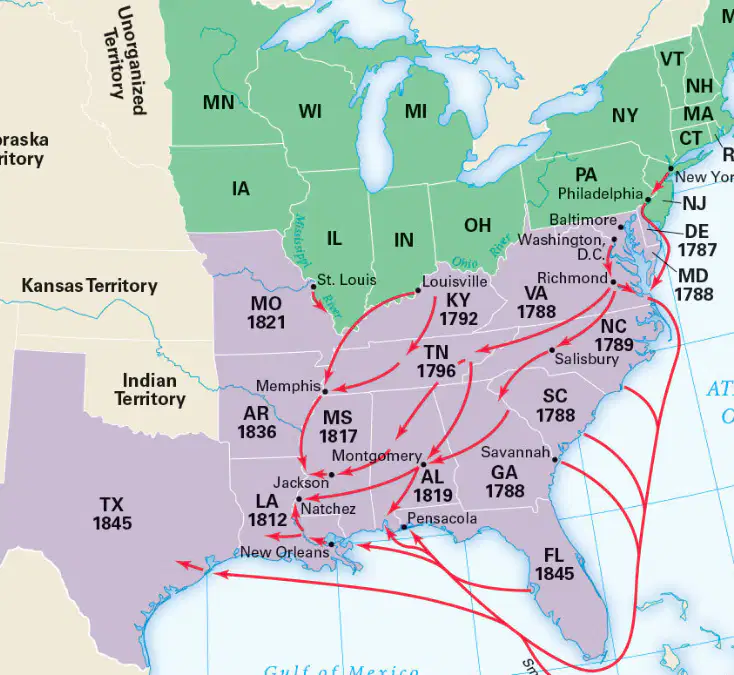
Find the major centers for the trade of enslaved people on the map in the Student Text. What role did these cities have in this trade?
They were agricultural hubs.
They were industrial centers.
They were cities where large numbers of people who were enslaved were bought and sold.
They were political capitals.
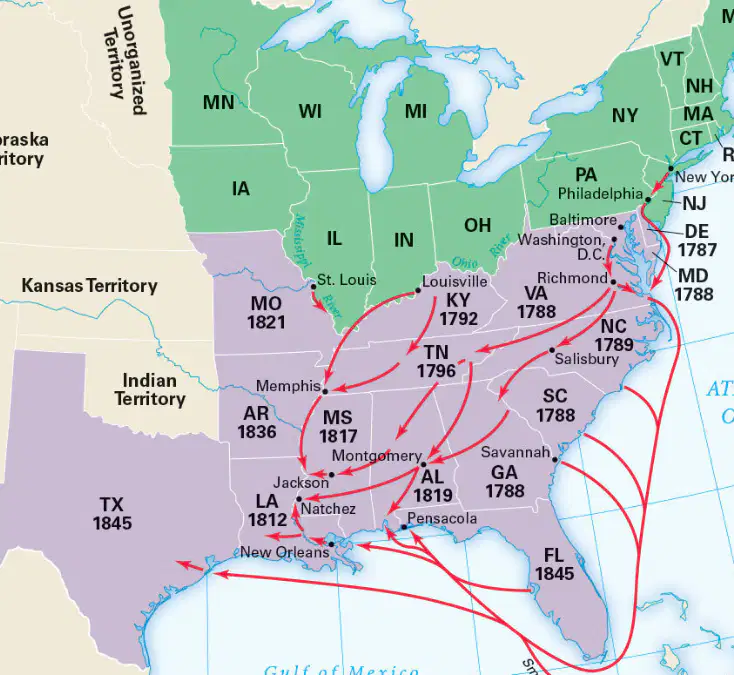
Which cities outside the states with slavery were involved in this trade?
Boston and Chicago
New York and Philadelphia
San Francisco and Seattle
Miami and Orlando
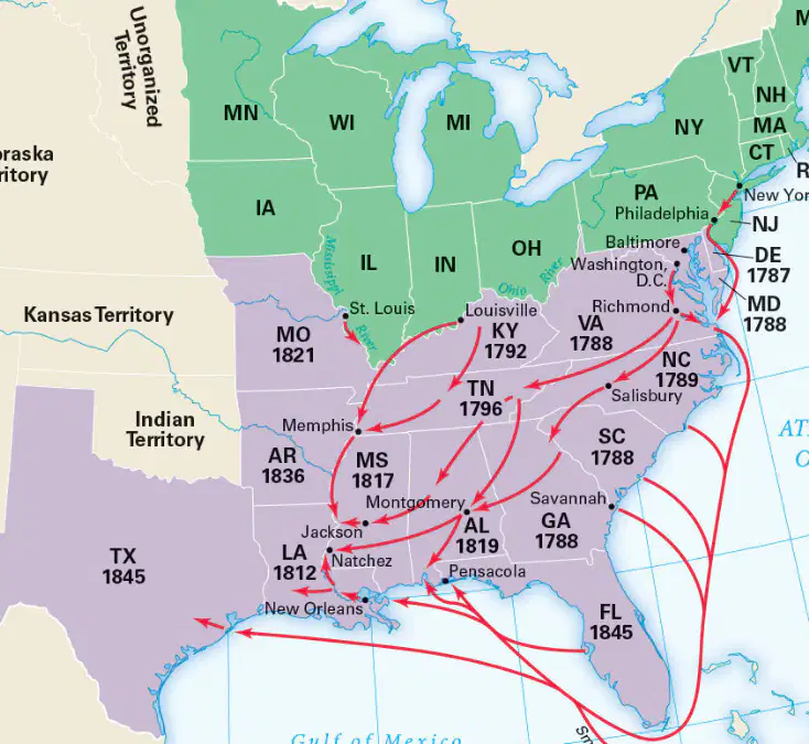
Which three of the new states with slavery were most important to the growth and expansion of slavery? How can you tell?
Mississippi, Louisiana, and Alabama
Texas, California, and Nevada
New York, Pennsylvania, and Ohio
Georgia, Florida, and South Carolina
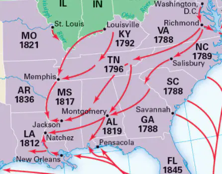
From which three states were enslaved people sold in the market at Montgomery, Alabama, likely to have come? Write the state names here, and circle them on your map.
Virginia, North Carolina, and Tennessee
New York, New Jersey, and Pennsylvania
California, Oregon, and Washington
Texas, Arizona, and New Mexico
In which two states were people sold in Kentucky likely to be enslaved?
Virginia and Georgia
Tennessee and Mississippi
Florida and South Carolina
Texas and Alabama
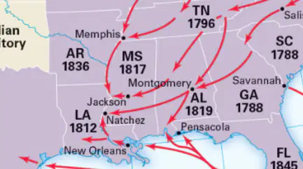
Which market was probably the main source from which enslavers in Arkansas purchased people to enslave?
New Orleans
Charleston
Memphis
Atlanta
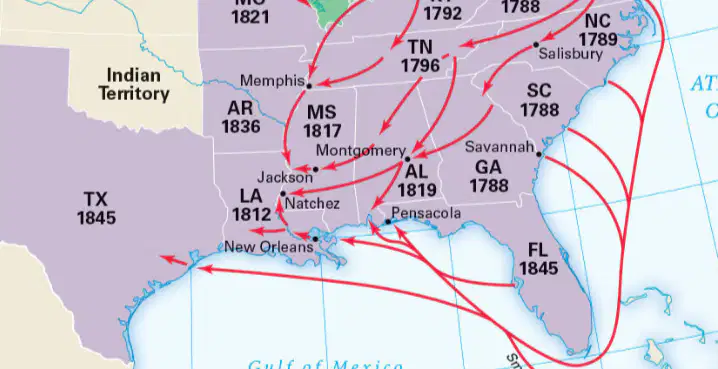
Why did most of the people sold to enslavers in Texas arrive by sea?
Because of the convenience of air travel
Due to the distances and challenges of land transport
Because of the proximity to the Pacific Ocean
Due to the abundance of railroads
Why would it have been easy for traders to illegally bring enslaved people into the United States from islands in the Caribbean?
Because of the lack of laws
Due to the use of airplanes
By mixing with ships carrying people enslaved in the U.S.
Because of the proximity to Europe
Where did the people that were sold as slaves come from?
Africa
Ireland
Mexico
Europe
The majority of enslaved people brought to the Americas
were captured from West African coastal tribes.
were mainly women captured through tribal wars.
were obtained through slave trade with Muslim merchants.
traders.were captured from the Cape of South Africa by Dutch traders.
were captured by British slave traders and brought to the East coast of North America.
The majority of enslaved people brought to the Americas
were mainly women captured through tribal wars.
were obtained through slave trade with Muslim merchants.
were bought by European slave traders, from West African rulers and brought to the Americas
Which city banned the slave trade?
Richmond
New Orleans
Washington D.C.
Charleston

