
 Worksheets
UNIT 1 EXAM REVIEW: Geography: Its Nature and Perspective
Total questions: 13
Worksheet time: 11mins
Match the following

MERCATOR (Conformal)

Goode-Homolosine (Equal-Area/Compromise)

Robinson (Compromise/ Uninterrupted)

Azimuthal (Polar)
Choose the one that does not belong:
site
situation
relative location
Choose the one that does not belong:
latitude and longitude
site
situation
absolute location
Choose the one that does not belong:
time zones
China
United States railroads
15 degrees
Match the following
exact point on earth's surface (uses latitude/longitude)
ABSLUTE LOCATION
based on what a place is near
RELATIVE LOCATION
exact miles/km between two locations
ABSOLUTE DISTANCE
how connected or separate 2 places feel, even if they're physically close or far apart
RELATIVE DISTANCE
Compass Rose (N, S, E, W, etc)
ABSOLUTE DIRECTION
Match the following
farther away two places are, the less interaction they will have with each other, due to the increased costs and time required to travel between them
DISTANCE DECAY
the obstacles and costs associated with traveling over a distance, including time, money, and effort, which ultimately limit how much interaction occurs between distant locations
FRICTION OF DISTANCE
technological advancements, like faster transportation and communication technologies, "shrink" the world by reducing the time and cost associated with traveling long distances
SPACE-TIME COMPRESSION
The “why of where” refers to
geography’s emphasis on landscape features.
spatial patterns on the landscape.
a definition of geography that is simply locational.
the idea that the explanation of a spatial pattern is crucial.
the depiction of a region’s physical features.
Match the following THEMATIC MAPS

choropleth

proportional symbol

dot density

cartogram

flow line

MAP SCALE
cover a smaller area
cover a larger area
show more detail, including individual buildings and streets
show less detail, often focusing on states and countries
1:10,000
1:1,000,000


Match the following GEOSPATIAL TECHNOLOGIES:
City planners use it to layer flood risk, elevation, and population data to plan drainage systems.
G.I.S. (geographic information system)
Scientists monitor changes in deforestation by comparing satellite images over time.
Remote Sensing
Aid workers use it to help deliver supplies to remote villages after a disaster.
GPS (Satellite Navigation)
Match the following SCALES OF ANALYSIS

LOCAL
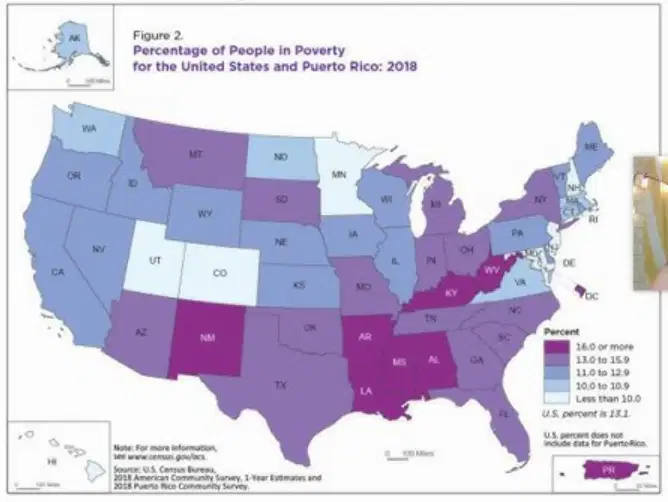
REGIONAL (SUBNATIONAL)

NATIONAL

GLOBAL
TYPES OF REGIONS:
AKA UNIFORM
AKA FUNCTIONAL
AKA PERCEPTUAL
area in which everyone shares one or more characteristics
area organized around a hub
area that people believe to exist as part of their cultural identity


States, countries, cities
cities with regard to how they connect with outlying areas
"Midwest" or "The South"
Distribution network (area that a service delivers/provides to)
HUMAN-ENVIRONMENT INTERACTION:
climate & geography dominate human behavior
environment influences, but humans can largely adapt and change surroundings



