
 Worksheets
U3M1 Review
Total questions: 82
Worksheet time: 2hrs 45mins
What are landforms?
Landforms are how the land changes.
Landforms shape the surface of the Earth.
Landforms are cool
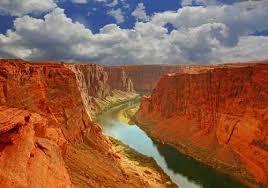

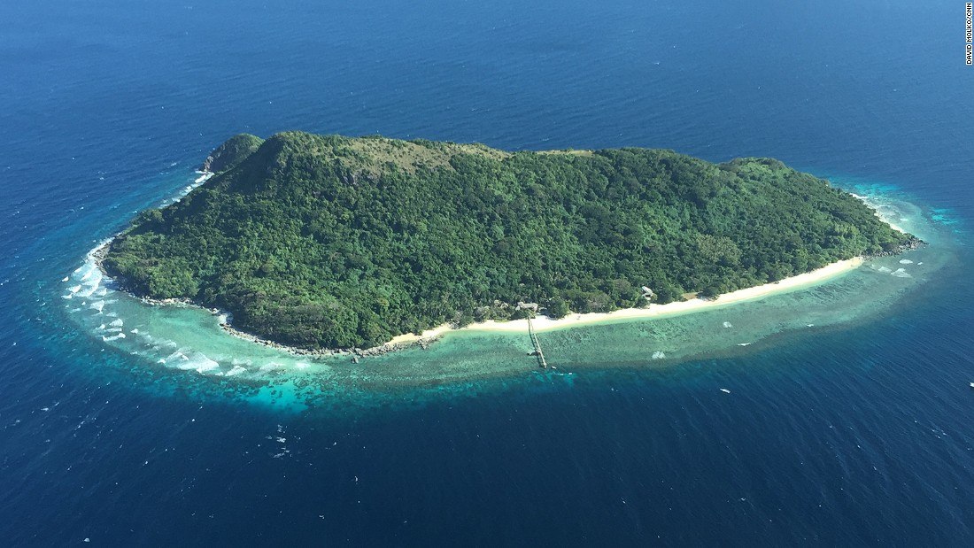


The flattest area of the ocean is known as the _________________________.
Rift Zone
Abyssal Plain
Mid-ocean Ridge
Subduction zone

Where are you walking when you are wading in the ocean?
Ocean Trench
Abyssal Plain
Continental Slope
Continental Shelf

What letter symbolizes an abyssal plain?
H
A
C
F


What is a landform?
a large landmass
shows elevation of an area using lines
a physical feature on the earth's surface
very large pieces of the earth's crust
What is a topographic map?
shows elevation of an are using lines
an opening in the earth's surface where gas and rock are forced out
a sudden movement of the earth's crust
a large landmass
What is a plate?
a large landmass
how far something is north or south of the equator
an opening in the earth's crust where melted rock and gas are forced out
a very large piece of the earth's crust
What is a continent?
a physical feature on the earth's surface
a large landmass
used to describe how far east and west a place is from the Prime Meridian
shows elevation of an area using lines
What is an earthquake?
a sudden movement of the earth's crust
a very large piece of the earth's crust
used to describe how far north or south a place is from the equator
a large landmass
What is latitude?
used to describe how far east or west a place is from the Prime Meridian
shows elevation of an area using lines
used to describe how far north or south a place is from the equator
a sudden movement of the earth's crust
What is longitude?
a large landmass
used to describe how far east or west a place is from the prime meridian
a physical feature of the earth's surface
used to describe how far north or south a place is from the equator
What is a volcano?
a very large piece of the earth's crust
a sudden movement of the earth's surface
a large landmass
an opening in the earth's surface where melted rock or gases are forced out

What is this a picture of?
Political Map
Latitude lines
Physical Map
Longitude Lines

What is this a picture of?
Latitude Lines
Political Map
Longitude Lines
Physical Map

What does this map show?
Mountains
Longitude Lines
Canyons
Latitude Lines
What imaginary line is the largest latitude line, and it circles the middle of the earth?
longitude
hemisphere
equator
Prime Meridian
This type of map shows boarders between countries, states, and cities?
physical maps
globes
political maps
alphanumeric maps
Physical Maps show mountains, rivers, and oceans?
True
False
Most Earthquakes and Volcanoes can be found....
around the Pacific Ring of Fire
along the coast of Asia
along plate boundaries
in the Southern Hemisphere

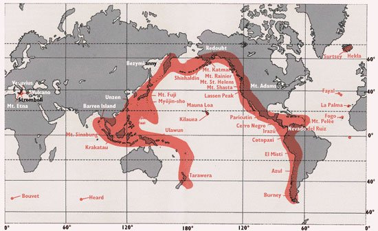
This is the name for the chain of volcanos around the edge of the Pacific Plate.
March Maddness
Earthquake Alley
Ring of Fire
Circle of Death
The rocky outermost layer of Earth is the:
crust
mantle
outer core
inner core
The lower mantle is made of :
solid rocks
hot molten rock

What is the theory of plate tectonics?
The theory that describes how Earth's outer layers is broken up into moving tectonic plates
Tectonic plates stay in one place
All of the continents were once apart of a Super Continent called Panthalassa
All of the plates were once a solid plate until they broke up and moved to their current position
Plates slide over the :
hot inner core
hot outer core
hot molten rocks of the mantle
crust
Where do Earth's plates meet?
At plate boundaries
At the crust
At the mantle
At the core
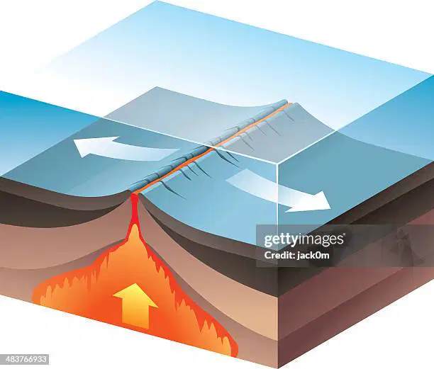
In the picture, plates move _______ each other.
away from
towards
underneath of
over-top of
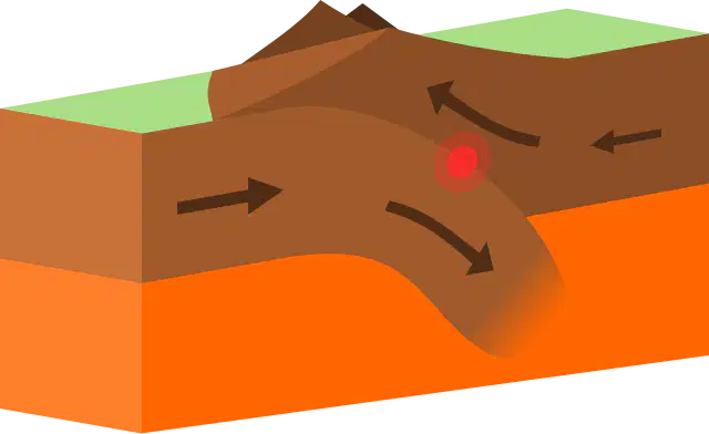
How are the plates moving in the picture?
Away from each other
Towards each other
To the left
Past each other
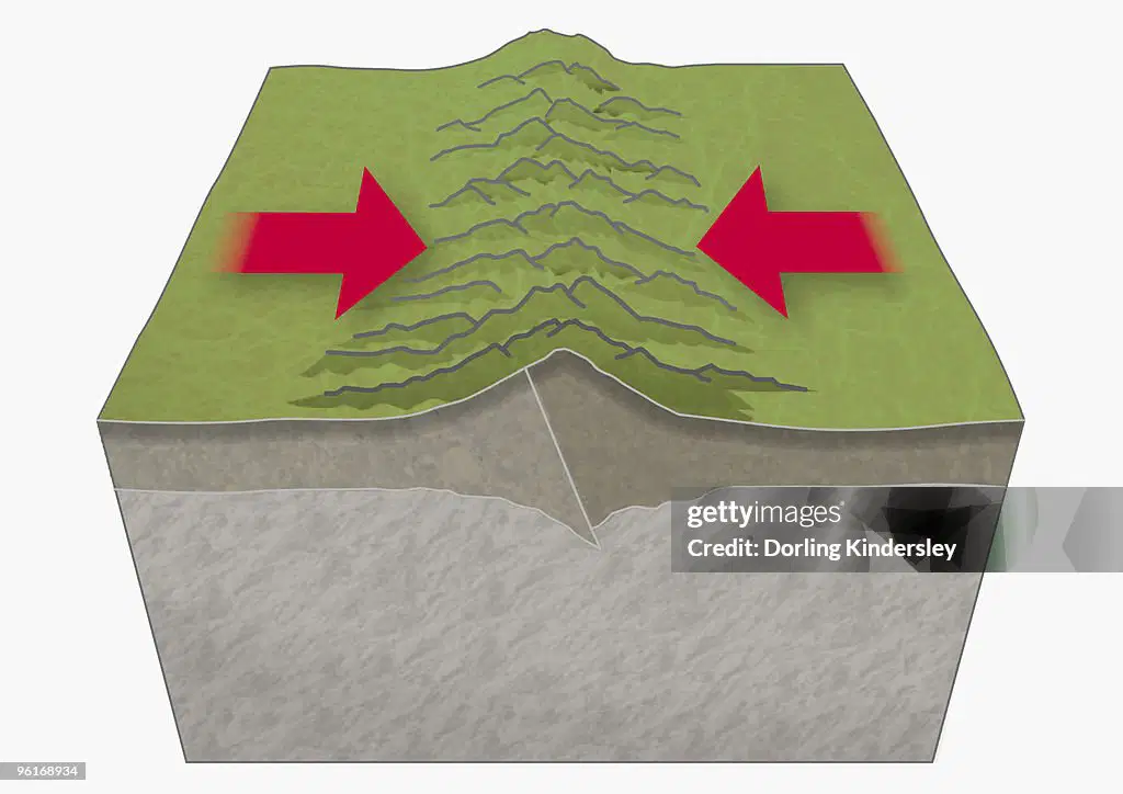
Which of the following represents plates moving past each other?


What is sediment?
A scientist who studies about fossils.
The harden part of an animal that died long time ago.
Different kinds of soil, rock, sand and clay that was built on fossils.

Look at the diagram.
Which fossil is the youngest?
A
B
C
D
Look at the diagram.
Which fossil is the oldest?
A
B
C
D

What was the environment for Layer W like?
A forest
Underwater
A desert
A jungle

What living things were fossilized in Layer N?
Dinosaurs
Monkeys
Fish
Plants
Fossils are usually found in _____________.
concrete
soil
grass
rock
Why do Paleontologist study fossils?
to get rich
to understand ancient life
to look for fossil fuels

Which fossil from the diagram is the oldest?
Ammonite
Shark Tooth
Baiera
Gastropod
Which fossil from the diagram is the youngest?
Ammonite
Shark Tooth
Baiera
Gastropod
Over time, processes on Earth like erosion and earthquakes can move layers or rocks?
True
False
How can scientists determine which animals lived during a certain period of time?
The older fossils are in the top layers
The older fossils are in the middle layers
The newest fossils are on the bottom layers
The oldest fossils are on the bottom layers of rock
Finding fossils of cold-weather plants in the rock layers of a warm southern area suggests that?
The climate used to be cold
the fossils used to be more resilient to cold
the island could be located farther south
the plants used to be harvested for food
Fossils are usually found in what kind of rock?
Sedimentary
Metamorphic
Volcanic
Sedimentary rock helps scientists piece together the history of Earth most likely using clues from?
humus
fossils
soil
gravel
_________ are the remains of plants or animals that lived long ago.
New rocks
Minerals
Fossils
Chemicals
If we are looking at fossils in a rock sequence such as sea stars that lived in the ocean, what kind of environment was this layer of rock?
Farm Land
Ocean
Desert
Jungle
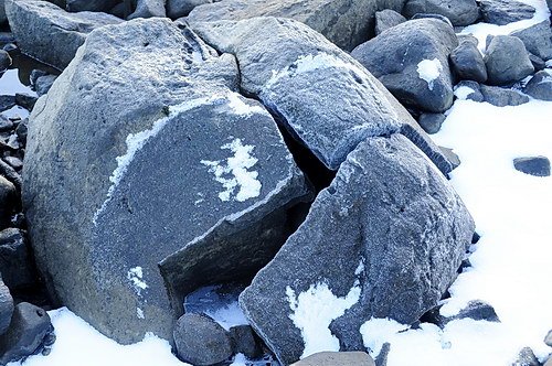
How does freezing water cause the weathering of rocks? The freezing water—
keeps the rocks in place.
makes the rocks last longer.
expands cracks and breaks rocks.
causes rocks to fall in landslides.
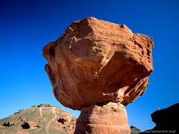
The process that breaks down rocks and other materials on Earth's surface is called
Weathering
Erosion
Deposition
Decomposition

Over long periods of time, deposition may change the Earth’s surface by _____.
forming new land features.
breaking down large rocks into smaller ones.
washing away beaches.
moving topsoil.


What causes the greatest erosion effect on our beaches?
Waves
Gravity
Glaciers
Wind
A delta is formed by the action of -
weathering
erosion
deposition
condensation

What are the small broken down pieces of rock called?
dirt
grime
sediment
popcorn

Rocks being picked up and carried downstream is an example of ____________.
weathering
erosion
deposition

Physical Weathering

Physical Weathering

Physical Weathering


What is an enormous mass of ice moving over land, causing weathering of rock and soil?
A glacier
An iceberg
An ice wedge
A sand dune
In the pictures below, choose a picture that shows physical weathering of rock that has abrasion caused by wind.


In the pictures below, choose a picture that shows chemical weathering of rock.

Physical Weathering

Physical Weathering

Physical Weathering

