
 Worksheets
Studying History
Total questions: 50
Worksheet time: 25mins
What is the study of the past called?
History
Biology
Geography
Mathematics
History is a collection of ________.
stories
numbers
recipes
songs
Why do we study the past?
To learn where we came from and decide where we’re going
To forget old events
To only remember big events
To ignore stories
There are plenty of stories that make up our history.
True
False
What are 'eras' in history?
Eras are time periods in history.
Eras are types of ancient buildings.
Eras are famous historical people.
Eras are scientific inventions.
What does studying 'patterns' in history help us do?
It helps us study the patterns in history.
It helps us ignore historical events.
It helps us forget the past.
It helps us predict the weather.
What does 'chronological' order mean in the study of history?
Chronological order means showing events in the order in which they happened.
Chronological order means showing events in reverse order.
Chronological order means grouping events by location.
Chronological order means organizing events by importance.
Which type of graph is used to compare numbers side by side?
Bar Graphs
Line Graphs
Pie Charts
Scatter Plots
Which type of graph is used to show changes over time?
Line Graphs
Bar Graphs
Pie Charts
Scatter Plots
Which type of graph is used to show parts of a whole?
Circle Graphs
Line Graphs
Bar Graphs
Scatter Plots
What is used to show information in a visual way?
Diagrams
Paragraphs
Songs
Recipes
What is used to organize lots of information for comparison?
Tables
Books
Paintings
Songs
What is used to show events in chronological order?
Timelines
Graphs
Tables
Maps
Geography is the study of the ______ and the people who live on it.
Earth
Ocean
Sky
Forest
Physical Geography refers to natural features, ______, and weather.
plant life
buildings
vehicles
languages
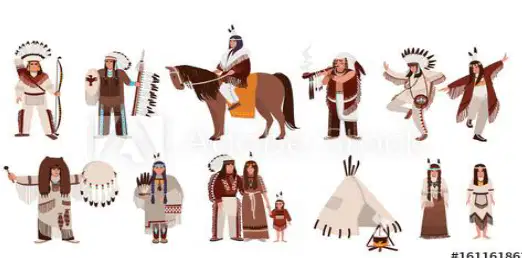
Human Geography is the study of ______ and their activities.
people
animals
plants
minerals
Which theme of geography is defined as 'where a place is [can be the exact spot on the earth, or where a place is compared to other places]'?
Location
Region
Movement
Human-Environment Interaction
Which theme of geography is defined as 'the physical and human characteristics of an area'?
Place
Region
Movement
Location
Which theme of geography is defined as 'between people and their environment'?
Interaction
Location
Region
Place
Which theme of geography is defined as 'how people move from one place to another'?
Movement
Region
Location
Place
What is a map? Fill in the blank: A map is a representation of ________.
an area
a person
a book
a song
What is a projection map? Fill in the blank: A projection map can show ________ surfaces on a flat map.
curved
flat
smooth
rough
What is a globe? Fill in the blank: A globe is a ________ with a map of the Earth printed on it.
sphere
cube
pyramid
cylinder
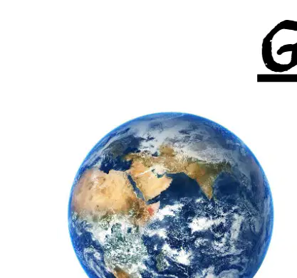
Which image shows a globe?
The first image (sphere)
The second image (flat map)
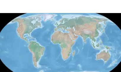
Which image shows a projection map?
The first image (sphere)
The second image (flat map)
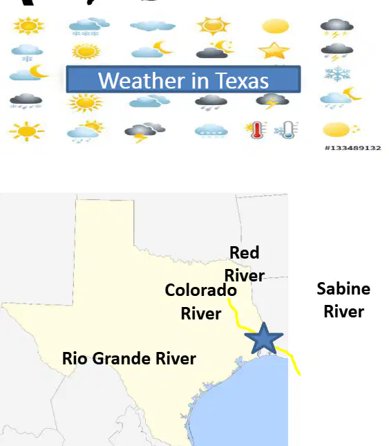
Texas weather can differ based on where you are located.
True
False
Texas is the ____ largest state in the United States. (Fill in the blank)
2nd
1st
3rd
4th
Which state is larger than Texas in the United States?
California
Alaska
Florida
New York
Texas is bordered by how many states?
2
3
4
5
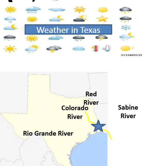
Name the four major rivers in Texas.
Red River, Colorado River, Rio Grande River, Sabine River
Mississippi River, Trinity River, Brazos River, Pecos River
Arkansas River, Nueces River, San Antonio River, Canadian River
Guadalupe River, San Jacinto River, Neches River, Frio River
According to the information provided, how many natural regions does Texas have?
Two
Three
Four
Five
Which of the following is a natural region of Texas?
Coastal Plains
Desert Plains
Forest Plains
River Plains
Fill in the blank: One of the four natural regions of Texas is the ________ Plains.
Coastal
Desert
Mountain
Prairie
Fill in the blank: The ________ Central Plains is one of the four natural regions of Texas.
North
South
East
West
Fill in the blank: The four natural regions of Texas are the Coastal Plains, the North Central Plains, the Great Plains, and the ________.
Mountains
Deserts
Forests
Valleys
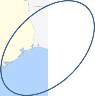
The Coastal Plains is the _______ in size and population among the regions of Texas.
largest
smallest
second largest
least populated
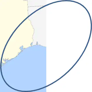
The Coastal Plains is located along the _______ of Mexico.
Gulf
Bay
Sea
River
The Coastal Plains has low _______ (height above sea level).
elevation
temperature
rainfall
population
The Coastal Plains has higher _______ compared to other regions.
precipitation
temperature
altitude
population
The North Central Plains are ______ just to the west of the Coastal Plains.
located
removed
divided
separated
The North Central Plains are a ______ area in the central part of Texas.
flat
mountainous
coastal
desert
The North Central Plains are used primarily for ______, which includes farming and ranching.
agriculture
mining
manufacturing
tourism
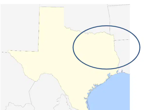
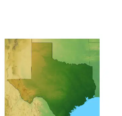
Which area of Texas is highlighted in the map shown?
North Central Plains
Coastal Plains
Mountains and Basins
Great Plains
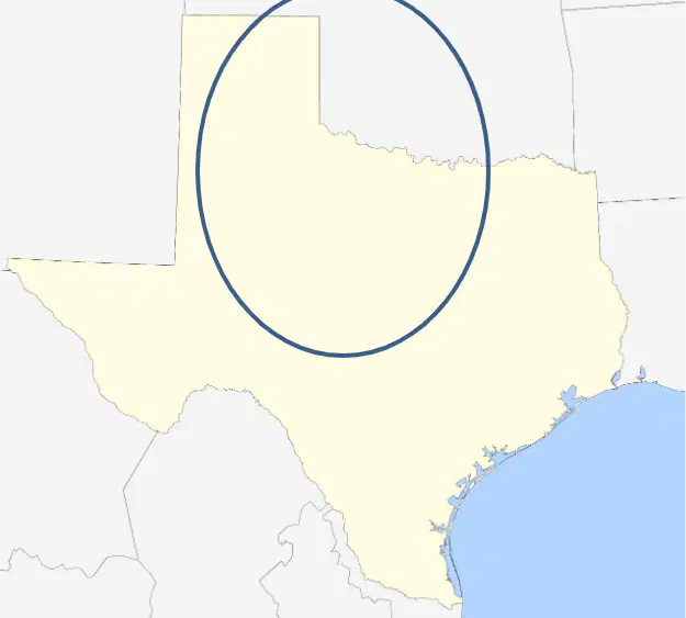
Refer to the map of Texas. The Great Plains are ______ to the west of the North Central Plains.
located
moved
hidden
separated
The Great Plains have lower average temperatures because the land is higher in ______.
elevation
humidity
latitude
precipitation
Why do the Great Plains have lower average temperatures?
Because it is closer to the ocean
Because the land is higher in elevation
Because it is to the east of the North Central Plains
Because it is a desert
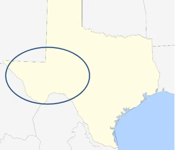
Mountains and Basins is ______ the farthest west in Texas.
located
created
divided
named
Mountains and Basins has the highest ______ in Texas.
elevation
temperature
rainfall
population
Mountains and Basins has the least ______ in Texas.
precipitation
population
elevation
vegetation
Mountains and Basins has the least ______ in Texas.
population
rainfall
mountains
rivers

