
NEW
Font size
 Worksheets
Unit 1, Lesson 1, "The Tools of Geography" Assessment
Total questions: 21
Worksheet time: 14mins
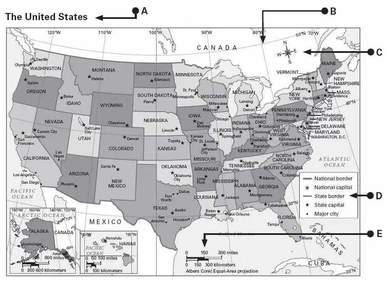
Using the U.S. Map: Which letter tells what the symbols on the map stand for?
What does a map's scale compare?
The changes in space, size, and position of features that occur when representing the Earth on a flat map take place because of
What do geographers use to indicate the absolute location of any place on Earth?
How much of Earth's surface is covered by ocean water?
What is the effect of Earth's tilt?
Which of the following tell you exactly where a place is located?
Lines of longitude
The line that marks 0 degrees longitude is the
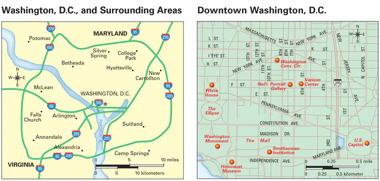
Using the Map Scales picture, answer the following question: If you walked from the U.S. Capital to the White House, approximately how far would you have traveled, (red dot to red dot)?
The area between the Arctic Circle & the North Pole or between the Antarctic Circle and South Pole is known as the
A ___ is half the earth.
degree
line of longitude
line of latitude
hemisphere


It is an imaginary line in the middle of a Globe.
Equator
Prime Meridian


What climate zone is the green area in the picture?
Polar zone
Temperate zone
Tropical zone

Which climate zone is represented by the green area in the picture?
Polar zone
Temperate zone
Tropical zone

