wayground logo

Free Printable Worksheets

Font size

S
M
L
XL
Worksheets

Test- Regions/ Native Americans

Total questions: 33

Worksheet time: 17mins
Name
Class
Date
1.
This region contains the area known as the Permian Basin-
a)
Coastal Regions
b)
North Central Plains
c)
Great Plains Region
d)
Mountains and Basins
2.
This region is known for tornadoes, and includes the Metroplex, which is what the Forth Worth and Dallas area is called-
a)
Coastal Regions
b)
North Central Plains
c)
Great Plains Region
d)
Mountains and Basins
3.
This region contains the Davis Mountains and borders both the Pecos and Rio Grande rivers-
a)
Coastal Regions
b)
North Central Plains
c)
Great Plains Region
d)
Mountains and Basins
4.
Houston, San Antonio, and Laredo are part of this region-
a)
Coastal Regions
b)
North Central Plains
c)
Great Plains Region
d)
Mountains and Basins
5.
What do all the regions in Texas have in common?
a)
They all have gold as part of their economy
b)
They all have natural disasters, including hurricanes in the Mountains and Basins
c)
They all have the same amount of rain in every region
d)
They all have the same economy of oil and gas and agriculture
6.
This region borders two both the Caprock and Balcones escarpments-
a)
Coastal Regions
b)
North Central Plains
c)
Great Plains Region
d)
Mountains and Basins
7.
This river borders three total regions-
a)
Pecos River
b)
Nueces River
c)
Red River
d)
Rio Grande River
8.
Despite this region getting the least amount of rainfall, one of their natural disasters can include mud and landslides-
a)
Coastal Region
b)
North Central Plains
c)
Mountains and Basins
d)
Great Plains
9.
These two regions are known for being hot, flat, windy, and have natural disasters like drought, tornadoes, and blizzards-
a)
Coastal Region and North Central Plains
b)
North Central Plains and Great Plains
c)
Mountains and Basins and Great Plains
d)
Great Plains and Coastal Plains
10.
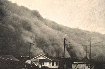
A combination of geography, drought, and the economy in this region helped lead to the Dust Bowl in the 1930's-
a)
Coastal Region
b)
North Central Plains
c)
Mountains and Basins
d)
Great Plains
11.
The cities of Midland and Odessa are located in this region, known for producing over $150 Billion in oil every year-
a)
Coastal Region
b)
Permian Basin
c)
Mountains and Basins
d)
Caprock Escarpment
12.
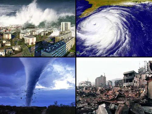
What natural disaster do all four regions of Texas have in common?
a)
Tornadoes
b)
Blizzards
c)
Drought
d)
Hurricanes
13.
This region covers 1/3 of Texas, and is known for having hurricanes-
a)
Coastal Region
b)
North Central Plains
c)
Mountains and Basins
d)
Great Plains
14.
Which of the following is NOT part of the Great Plains regions-
a)
Permian Basin
b)
El Paso
c)
Dust Bowl
d)
Pecos River, and the Balcones and Caprock Escarpment
15.
Which of the following regions of Texas does the Edwards Aquifer (which is how San Antonio gets their water) cover?
a)
The aquifer covers all 4 regions of Texas
b)
Only the Mountains and Basins and Great Plains Regions
c)
Every region except the North Central Plains (NCP)
d)
Mountains and Basins, Coastal, and the Great Plains
e)
Every region except the Coastal Plains
16.
Identify the river that is north of Laredo and will take you to the city of Corpus Christi
a)
Pecos River
b)
Nueces River
c)
Red River
d)
Rio Grande River
17.
This river separates Texas from Oklahoma (also known for as the big football game between the two schools)
a)
Pecos River
b)
Nueces River
c)
Red River
d)
Rio Grande River
18.
The further away from the Gulf of Mexico you get, the less _________ you get and the higher the ____________ gets.
a)
natural disasters; amount of oil and gas available
b)
amount of rain you get; elevation
c)
natural resources; population
d)
the elevation gets; rainfall total
19.
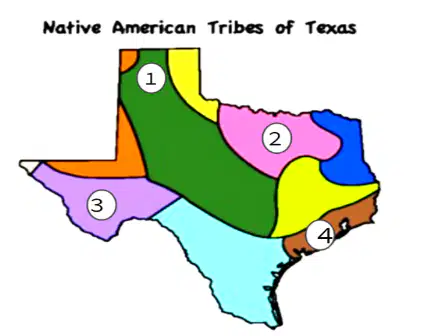
Based on the map: Which location on the map shows a culture that lived in adobe houses as an adaptation to their environment?
a)
1
b)
2
c)
3
d)
4
20.
How did Pueblo Indians differ from Gulf Indians?
a)
Both lived in adobe houses, but the Gulf were dome shaped, not pueblos
b)
Pueblo Indians were nomads while Gulf had permanent homes
c)
Pueblo Indians were the first tribe to use horses
d)
Pueblo Indians had permanent homes while Gulf Indians were nomads and lived in wigwams
21.
How did Plains Indians differ from Southeast Indians?
a)
Southeast Indians were the first to use horses
b)
Plains Indians lived in adobe houses
c)
Plains Indians lived in tepees and were the first to use horses
d)
Plains Indians were known for their pottery and jewelry since they had permanent homes
22.
What was the importance of the buffalo to Native Americans?
a)
Native Americans used every part of the buffalo, including the bones
b)
Native Americans hunted buffalo only for their skin
c)
Native Americans followed buffalo, allowing them to discover new part of Texas
d)
Native American rode buffaloes, giving them an advantage over other tribes during war
23.
How were nomadic tribes different from permanent home tribes?
a)
Nomadic tribes fished and hunted deer and bear
b)
Nomadic tribes lived in permanent homes like pueblos
c)
Nomadic tribes like the Karankawas and Coahulitecans used horses
d)
Nomadic tribes lived in tepees and permanent home tribes lived in homes made from adobe
24.
What did all Native American tribes in Texas have in common?
a)
In all tribes, only the men were allowed to hunt and fight
b)
All tribes used horses
c)
All tribes believed in agriculture, and were able to farm
d)
All tribes used their natural resources
25.
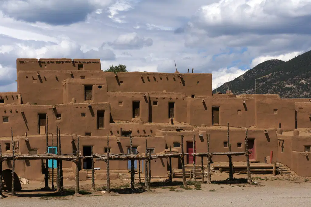
The picture is an example of which type of Native American home?
a)
Pueblo
b)
Domed hut made from mud
c)
Adobe
d)
Teepee
26.
This picture is an example of which tribe (look at the clues in the drawing) - (lived by the water, fished, were extremely tall and ate people)
a)
Karankawa
b)
Jumano
c)
Apache
d)
Caddo
27.
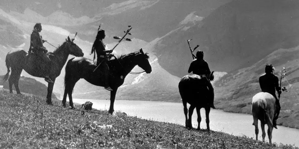
This group was the first to use horses, changing their culture forever-
a)
Gulf
b)
Plains
c)
Southeastern
d)
Pueblo
28.
The Jumano were a Native American group that lived in homes likes these, found in this region of Texas-
a)
Great Plains
b)
Coastal
c)
NCP
d)
Mountains and Basins
29.

What does "nomadic" mean?

a)

living in cold areas

b)

being nice, not mad

c)

an Indian tribe

d)

moving from place to place

30.

In which region did the Puebloan indians live?

a)

Coastal Plains

b)

Mountains & Basins

c)

Great Plains

d)

North Central Plains

31.

Why did many Karankawas die after contact with the Spanish?

a)

Spanish conquistadors killed off many Karankawas.

b)

They were not immune to the diseases from Europe carried by the Spanish

c)

The food that the Spanish offered was poisoned

d)

Karankawas didn't die, they flourished.

32.

In what ways did the Comanche depend on the buffalo?

a)

The Comanche didn't kill the buffalo, they worshiped them.

b)

The Comanche didn't like buffalo and never used them for anything.

c)

The Comanche kept the buffalo as pets.

d)

The Comanche used the buffalo meat for food. They also used the hides for shelter and clothing.

33.
The Indians in the Gulf Coast can be described as _________________ and _______________/________________
a)
Sedentary and farmers
b)
Sedentary and hunters/gatherers
c)
Nomadic and farmers
d)
Nomadic and hunters/gatherers