
 Worksheets
7th Grade Social Studies SKILLS Review
Total questions: 45
Worksheet time: 24mins

Which type of a map uses different colors to represent different states, or countries, or territories?
Physical Map
Population Density Map
Political Map
Special Purpose Map
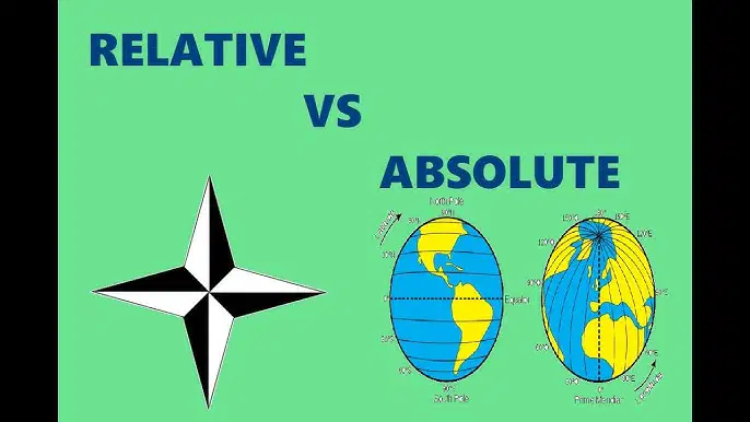
What is the difference between absolute location and relative location? (Choose two)
Relative location shows the exact spot where a place is located
Absolute location shows the exact spot where a place is located
Relative location shows where a place is compared to something else
Absolute location shows where a place is compared to something else
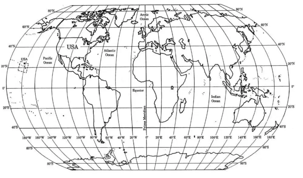
0° longitude is also known as the ________.
Equator
Tropic of Cancer
Arctic Circle
Prime Meridian

Which continent has 11% of the world's population?
Africa
North America
South America
Europe
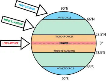
Which of the following statements is true of the zone where we live? (Choose all that apply).
We live in the polar region in winter and the tropics in the summer
We live in the middle latitudes; halfway between the equator and the poles
Our latitude zone has a great variation in temperature and seasonal change throughout the year
Our latitude zone has almost no change in temperature and seasons; it is always the same
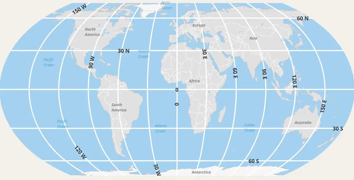
The continent located at 30°N and 100°E is
North America
Africa
Europe
Asia
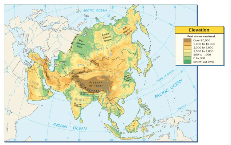
Which type of map uses different colors to indicate different elevations or geographic features?
Political map
Special Purpose map
Physical map
Elevation map
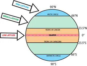
Which of the following statements are true of the low latitudes. Choose all that apply.
The low latitudes include the equator and are considered tropical
The low latitudes receive consistent heat from the sun all year
The low latitudes have the lowest temperatures as the sun does not heat this area
The low latitudes have the greatest variation in temperature and seasonal change
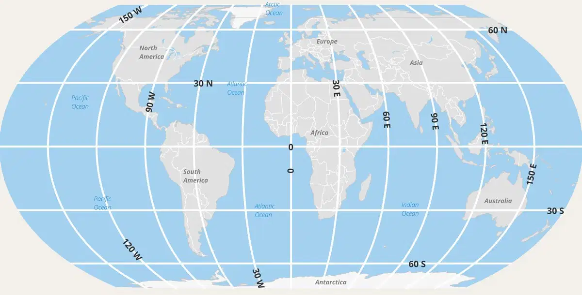
The continent of _________ is found at 0°, 60°W.
Australia
Antarctica
South America
North America
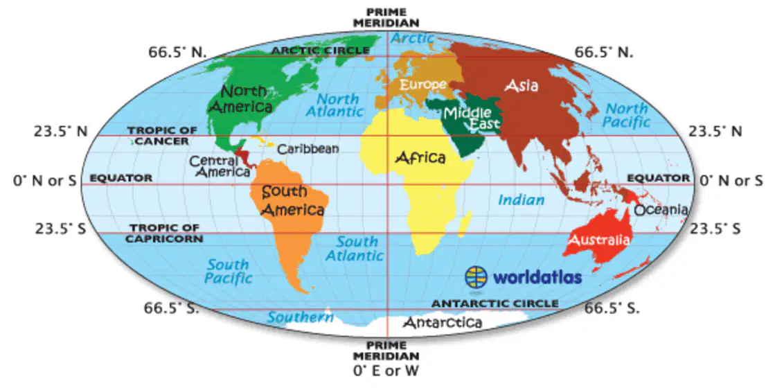
Europe is located
south of the equator
north of the equator
east of the equator
west of the equator

What is the coldest month in both cities?
December
January
February
November
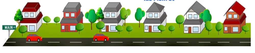
(Use this diagram to help) If you tell someone that your house is the fourth house from the corner (on Main Street), but don't give them the actual address, this is an example of _________location.
absolute
confused
relative
all of these are correct
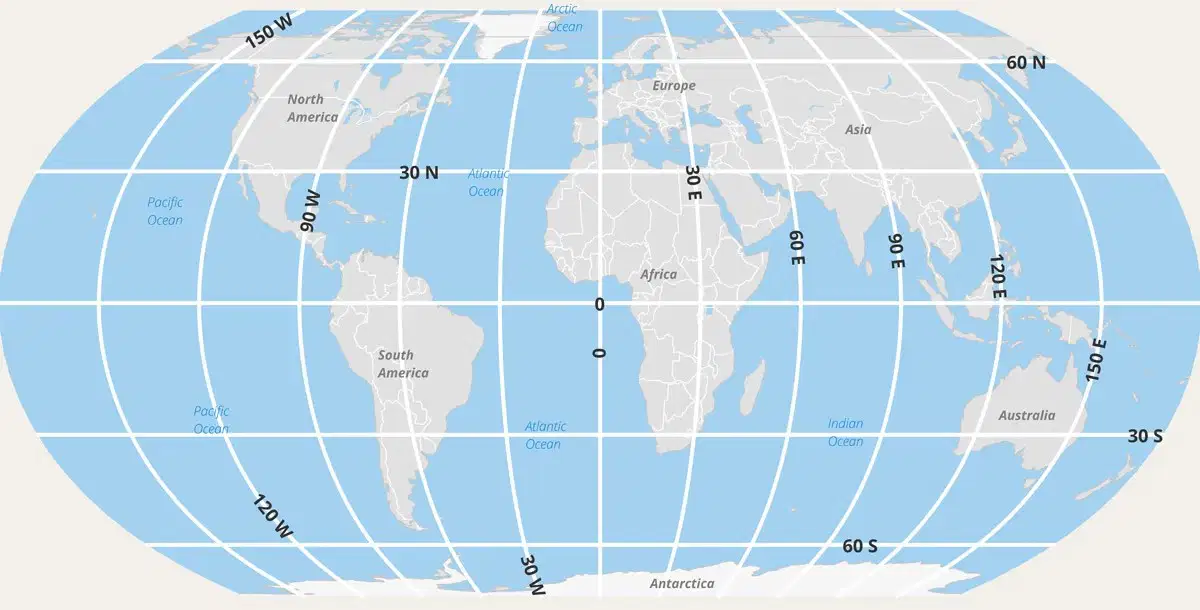
Which ocean is located at 30⁰S and 30⁰W?
Arctic Ocean
Pacific Ocean
Atlantic Ocean
Oceania
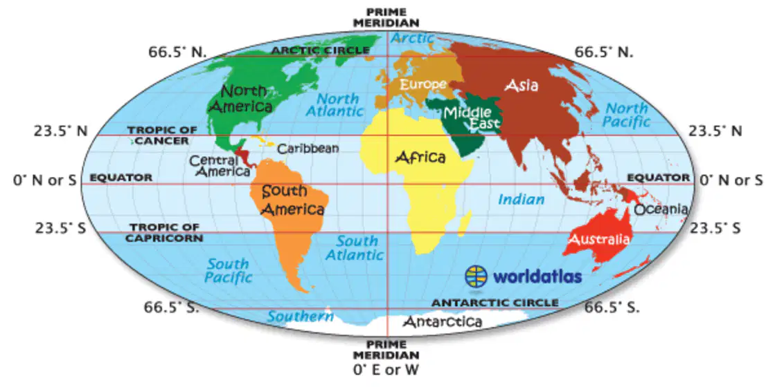
Asia is located
south of the Equator
west of the Prime Meridian
south of Australia
east of the Prime Meridian
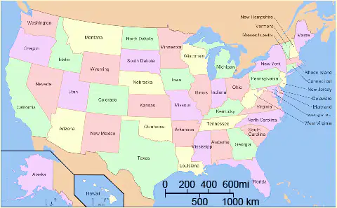
According to the scale of this political map, the distance indicated on the map is equal to _________ in reality.
2,000 miles
600 miles
3,000 km
1,200 miles

High concentrations of gold can be found in which of the following locations?
Monterrey, Mexico
Tijuana, Mexico
Mexico City, Mexico
Ciudad Juarez, Mexico

Which two countries import (buy) more than they export (sell)?
Netherlands / Germany
France / United Kingdom
United Kingdom / Netherlands
The are all the same
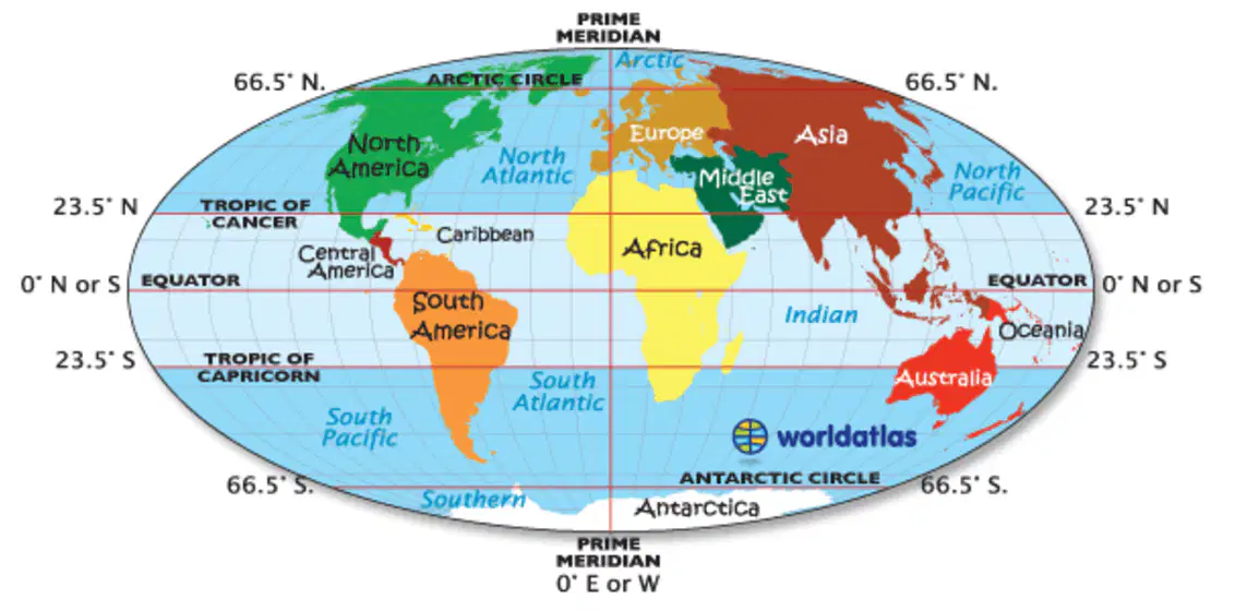
North America is located
west of the Equator
north of the Prime Meridian
east of the Equator
west of the Prime Meridian
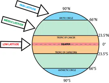
Choose the option that best explains which latitude zone would be the coldest (and why).
The middle latitudes would be coldest as they aren't in the tropics and don't get as much direct sunlight
The low latitudes would have the lowest temperatures and would be the coldest
There is no difference in the latitude zones as the heat from the sun will eventually reach all of them
The high latitudes would be cold all year as they do not receive as much sunlight as the tropics
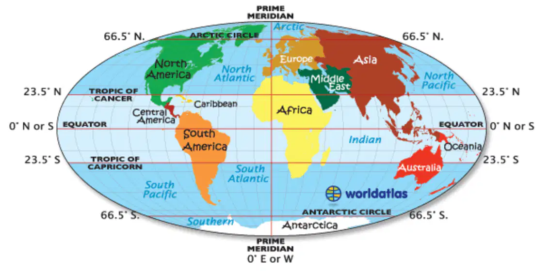
The region of Oceania is located
northwest of Europe
north of South America
southeast of Asia
south of Antarctica
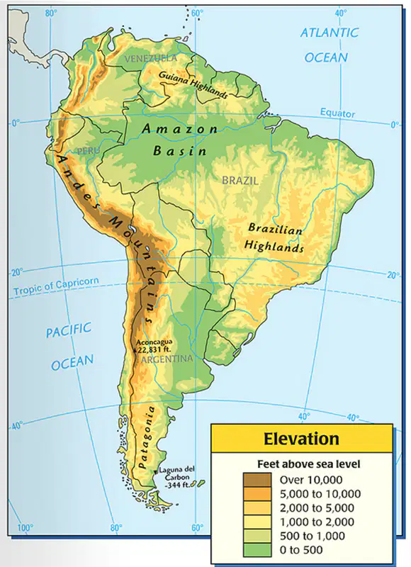
Which location listed on the map has the highest elevation?
Amazon Basin
Brazilian Highlands
Patagonia
Andes Mountains

Which city gets more precipitation?
Moscow, Russia
They are both the same
New York City, New York
All of these are true
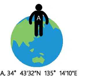
Which of the following choices best explains this diagram?
This is an example of absolute location as it gives the latitude and longitude of a spot of Earth
This is an example of relative location because it refers to a location in Asia, north of the Arctic Circle.
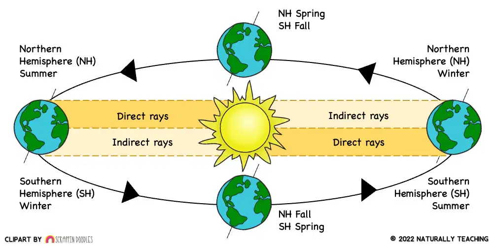
The process shown in this diagram would best be described as...
The Water cycle including collection, evaporation, condensation, and precipitation
Earth's rotation creating day and night
Earth's revolution or orbit around the sun
Earth's tectonic forces of the upper mantle
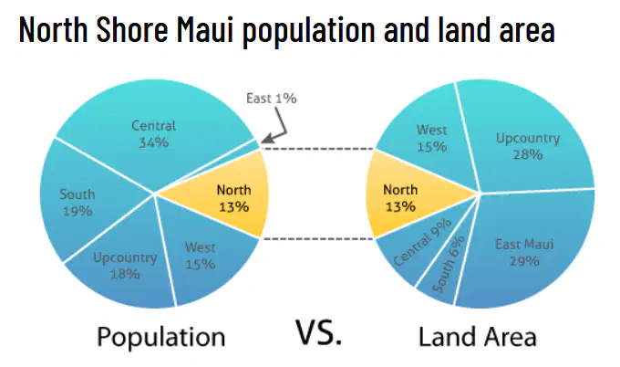
What percentage of citizens live on the Central region of Maui?
9%
34%
29%
13%

Which European country is both the highest importer AND the highest exporter?
Germany
Italy
France
United Kingdom
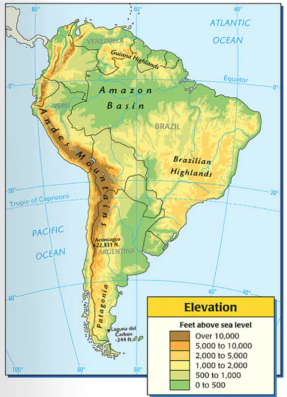
Of the locations listed on the map, which would be considered the lowest, or closest to sea level?
Guiana Highlands
Amazon Basin
Brazilian Highlands
Patagonia

The resource MOST plentiful in Mexico along the Gulf of Mexico is___.
Gold
Oil
Silver
Iron

Which two countries export (sell) more than they import (buy)?
Netherlands / Italy
France / Germany
Germany / Netherlands
United Kingdom / France
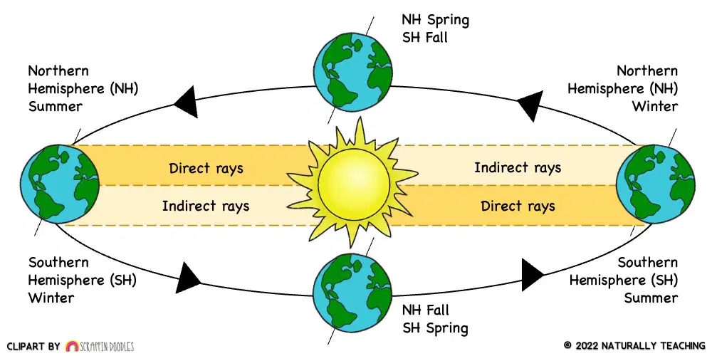
Which of the following statements are true for the NORTHERN hemisphere when the NORTHERN hemisphere is tilted toward the sun?
The Southern hemisphere will be receiving the most direct heat from the sun
The Northern hemisphere will be receiving the most direct heat from the sun
It will be summer in the Southern hemisphere and winter in the Northern hemisphere
It will be summer in the Northern hemisphere and winter in the Southern hemisphere
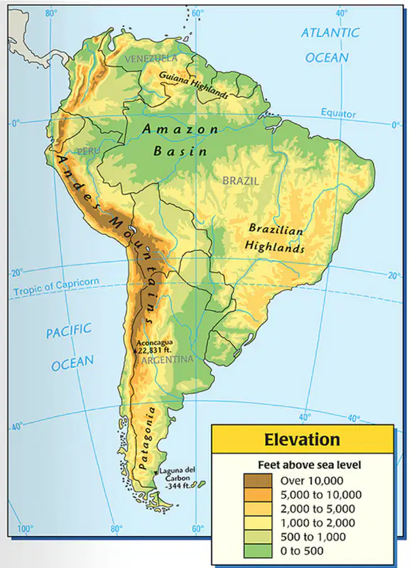
The Brazilian Highlands are shown on the map primarily in the orange color, which means their elevation would be......
0 - 500 feet above sea level
500 - 1,000 feet above sea level
5,000 - 10,000 feet above sea level
Over 10,000 feet above sea level
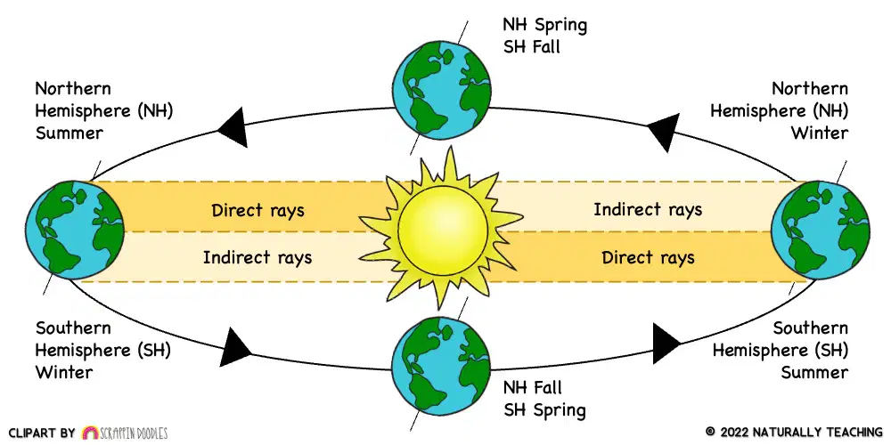
Which of the following statements are true for the NORTHERN hemisphere when the SOUTHERN hemisphere is tilted toward the sun?
The Northern Hemisphere is tilted away from the sun
The winter solstice of the Northern hemisphere is when the Southern hemisphere gets the MOST direct sunlight
The Northern hemisphere will be experiencing winter
All of these statements are correct
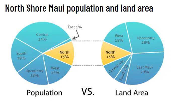
Which region of Maui has the most people but only 9% of the land?
South
East Maui
West
Central
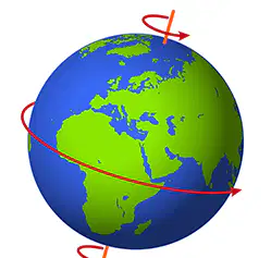
Which of the following processes below are related to Earth's ROTATION?
number of days in a single season
hours of daylight and darkness
distance from the equator
number of days in a year

What type of map, like this one, shows one specific theme like population density or precipitation?
Physical Map
Political Map
Special Purpose Map
Mercator Projection Map
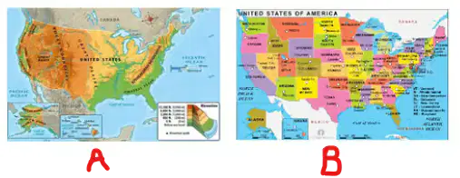
Map A is an example of a _______map
political
precipitation
land use
physical

Which of the following choices below best explains this photo?
This is an example of coordinates from the global grid
This is an example of relative location because it simply gives a direction to travel
This is an example of relative location as it doesn't give a specific location
This is an example of absolute location because it gives latitude and longitude coordinates.
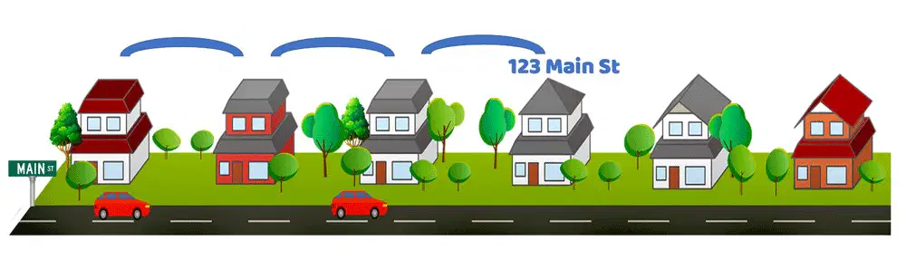
Much like using a latitude and longitude coordinate, an address is an example of _________ location.
relative
movement
absolute
regional
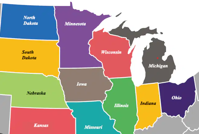
The relative location of Minnesota is that it is ______ of Iowa.
south
east
north
west
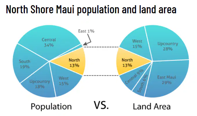
Which region of Maui has the smallest portion of the population AND the largest land area?
North
East Maui
West
Upcountry
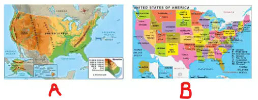
Map B is an example of a __________ map
Physical
Land use
Political
Resource
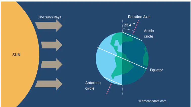
Which of the following statements are true of this diagram?
The Northern Hemisphere is tilted away from the sun
All areas of Earth will be experiencing equal amounts of sunlight
The Southern Hemisphere will be experiencing summer
The Northern Hemisphere will be experiencing colder temps and less daylight
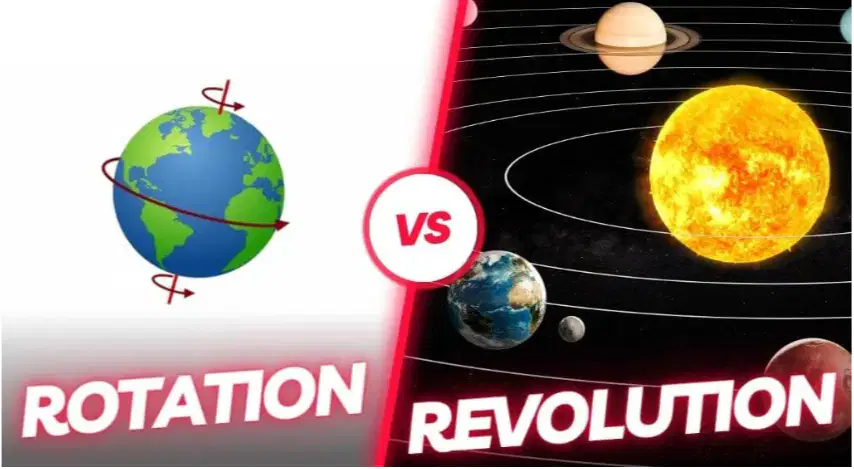
Which of the following statements are true?
Revolution is a planet's movement around the sun
Rotation is the number of days in a calendar year
Earth's revolution is 365.25 days or one year
Rotation is the planet spinning motion on its axis
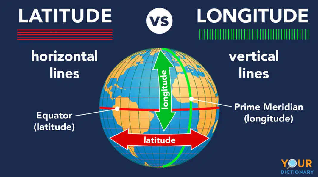
The 0° line of longitude is called _______
Equator
vertical lines
parallels
Prime Meridian
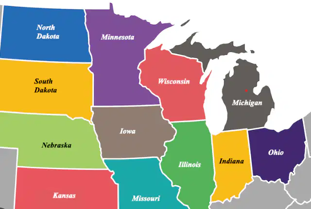
Which state would be southeast of Wisconsin?
Minnesota
Ohio
Kansas
Illinois

