
 Worksheets
Knowledge Check Review October 30
Total questions: 10
Worksheet time: 6mins
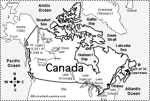
The capital city of Canada is Ottawa which is located
near the Pacific coast of Canada
near the United States border in Southeast Canada
near the mouth of the Hudson Bay
near the United States border in Southwest Canada
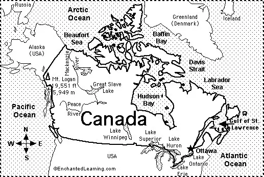
The Mackinzie River begins at ____________ and empties into the Beaufort Sea.
Great Slave Lake
Lake Superior
Gulf of St. Lawrence
Baffin Bay
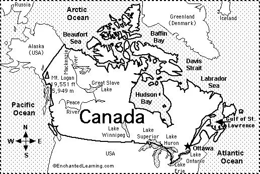
Canada has coasts on which of the following oceans?
Mark all that are true
Southern
Atlantic
Pacific
Arctic
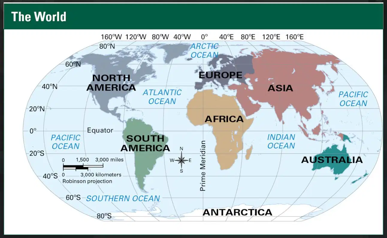
Lines of latitude run East and West
True
False

The Prime Meridian is an imaginary line that marks zero degrees
Latitude
Longitude

The equator is the imaginary line that circles the Earth at zero degrees
Latitude
Longitude

Missouri is in the ________ region of the U.S. which has a humid continental climate.
Southwest
Northwest
Northeast
Midwest
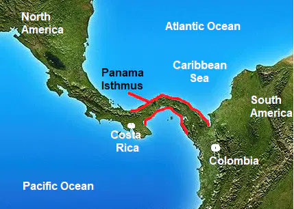
The narrow strip of land that connects Central America to South America
Gulf of Panama
Panama Canal
Isthmus of Panama
Gulf of Darien

The Great Plains in North America is a vast and mostly flat region that extends from which two mountain ranges?
Rocky Mountains
Cascade Mountains
Appalachian Mountains
Brooks Range
What is the official language of Canada?
Spanish
Italian
French
English

