
 Worksheets
Ch. 7 Review
Total questions: 20
Worksheet time: 10mins
The strong connection that people feel toward the region in which they live in is
Regionalism
Federalism
Nationalism
Urbanization
Leader of Canada’s national government is the
Governor
President
Prime Minister
King
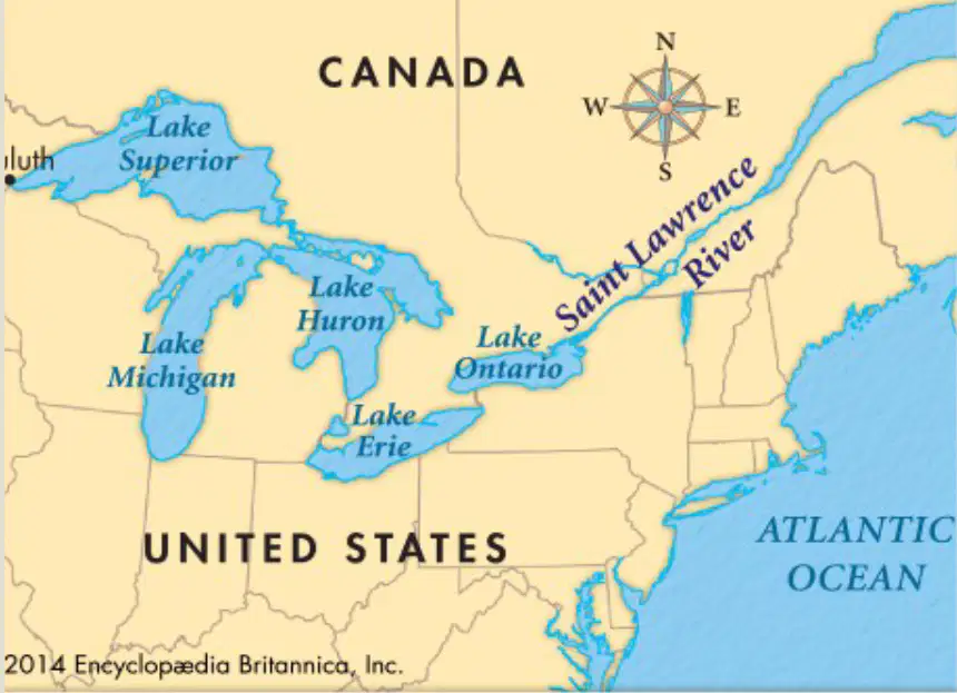
An important international waterway that links the Great Lakes to the Atlantic Ocean is the __________ (borders the U.S.)
Mississippi River
St. Lawrence River
Columbia River
Mackenzie River
A large fishing ground off the Atlantic coast near Newfoundland and Labrador is the ____________.
Gulf of St. Lawrence
Hudson Bay
Bay of Fundy
Grand Banks
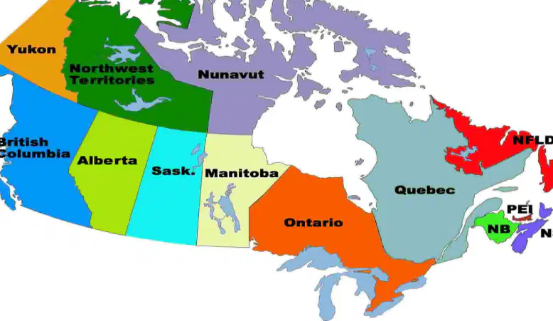
Administrative divisions of a country (Canada has 10, instead of states.) are called
Provinces
Counties
Regions
Prefectures
Means on or near the sea.
Inland
Continental
Maritime
Desert
What mountains extend north from the U.S. into western Canada, along the Pacific coast?
Appalachian Mountains
Rocky Mountains
Andes Mountains
Alps
Canada’s governing body which is made up of the House of Commons and the Senate is called what?
Parliament
Congress
Privy Council
Supreme Court
Economic activities that process raw materials and manufacture goods in factories are called what?
Services
Industries
Agriculture
Tourism
Canada’s national capital is what city?
Vancouver
Toronto
Montreal
Ottawa
Softened wood fibers used to make paper are called
Pulp
Lumber
Veneer
Sawdust
A region of rocky uplands, lakes, and swamps that surrounds Hudson Bay is the
Great Plains
Appalachian Highlands
Arctic Archipelago
Canadian Shield
Cheap paper used mainly for newspapers is called
Cardstock
Newsprint
Vellum
Parchment
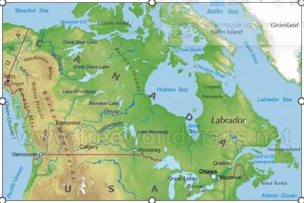
Canada has many physical features. Which physical feature is to the west of the Rocky Mountains?
Hudson Bay
Prairie Provinces
Coast Ranges
Great Lakes
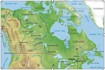
According to the list on Canada’s Physical Map, which large inland water body is included as a physical feature?
Great Slave Lake
Baffin Bay
Atlantic Ocean
Hudson Bay
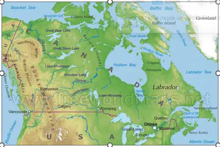
Which mountain system is located to the west of Canada?
Andes
Appalachian Mountains
Rocky Mountains
Himalayas
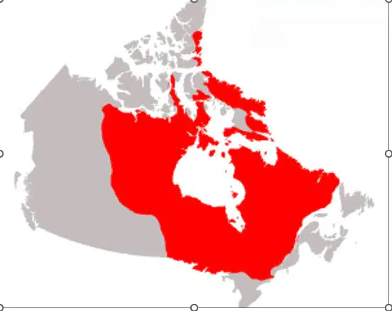
Which shield is named among the physical features on Canada’s Physical Map?
Canadian Shield
Baltic Shield
Arabian Shield
Brazilian Shield
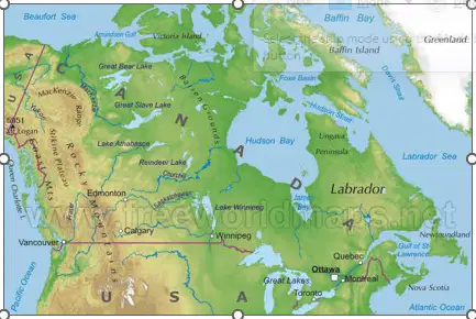
Which gulf appears in the list of physical features on Canada’s Physical Map?
Gulf of Alaska
Gulf of Mexico
Persian Gulf
Gulf of St. Lawrence
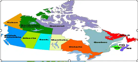
According to Canada’s Political Map, how many provinces and territories does Canada have?
10 provinces and 3 territories
9 provinces and 5 territories
10 provinces and 2 territories
12 provinces and 3 territories
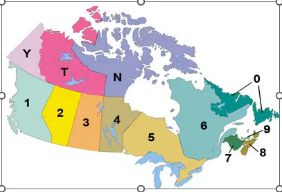
On the political map, which number refers to Prince Edward Island?
0
7
8
9

