
Font size
 Worksheets
EDW: 8th Grade: World Geo: Q2T4, Physical Geo of Latin America
Total questions: 82
Worksheet time: 45mins
Latin America is made up of _______, ________, ________ and the islands countries of the ______ sea.
Mexico, Central American, South America, Caribbean
People from _____ and _____ settle mostly in Latin America?
Spain and Portugal
Spanish and Portuguese are still the official _______ of most of the countries of Latin America?
Because these languages are based on _______, the region became know as Latin America.
Geographers often divide Latin America into three sub regions?
Middle America, Caribbean, South America
Middle America consist of what areas?
Mexico and Central America's seven countries

True or False:
Central America is the narrow land link between North and South America?
True
False
also know as the West Indies
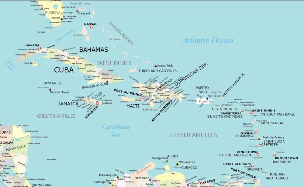
The Caribbean also know as the West Indies can be divided into three sections: Name them?
Southern Antilles, Eastern Antilles, Caribbean Island
Eastern Antilles, North America, South America
Northern Antilles, Lesser Antilles, Cuba
The West Indies is the site of _______ landing, later Spanish base for main land conquest?
Cortez's
Iberville's
Bienville's
Columbus'
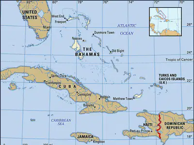
Hundreds of island off southern Florida, North of Cuba; Nassau is largest city and capital

Larger islands in the Caribbean: Cuba, Jamaica, Hispaniola, Puerto Rico
Greater Antilles
Lesser Antilles
Bahamas

Hispaniola is an island divided between _______ and the ________?
The continent of ________ is the largest land area of Latin America?
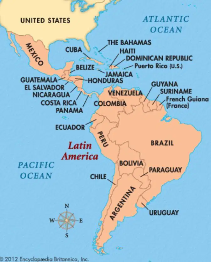
________ is the largest country of South America and the entire region?
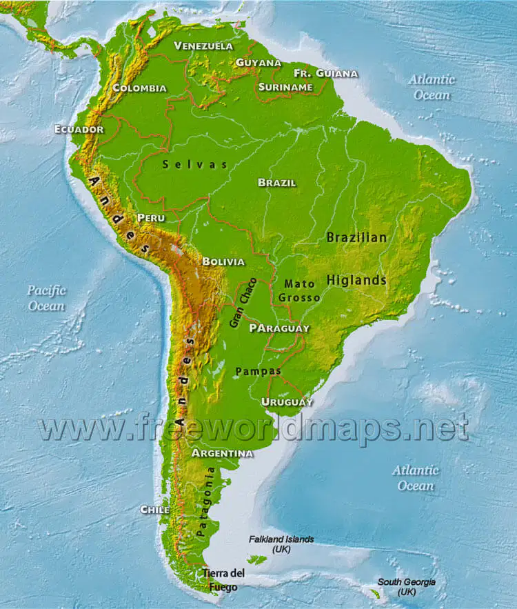
On the western coast of south America are the ______ Mountains.
True or False:
The Andes Mountain are the worlds longest mountain chain?
True
False
How long are the Andes Mountains?
3,000 miles long
4,000 miles long
4,500 miles long
5,000 miles long
The Andes Mountain are the ______ highest mountain ranges in the world?
The Andes Mountains were once home to the _______ civilization in Peru?
Incan
The Andes Mountain have many active ______?
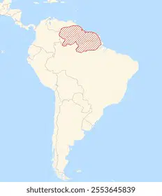
The ________ highlands are in the northeast section of South America?
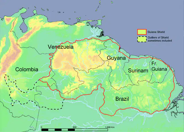
The Guiana Highlands cover parts of _______, _______, _______ and _______?
Venezuela, Guyana, French Guiana, Suriname

The eastern edge of the ________ Highlands drops sharply to the Atlantic Ocean,
Brazilian

The eastern edge of the Brazilian Highland drops sharply to the Atlantic Ocean, forming an _______, a slope or long cliff between a higher and lower surface.
These Brazilian highlands are important for raising ______ because of the warm climate and open spaces.
livestock

There are two prominent mountain ranges in Mexico? Name them?

The Sierra Madre Occidental is located on the _____ side of Mexico?

The Sierra Madre Oriental are located on the _____ side of Mexico?

The Sierra Madre Occidental and Sierra Madre Oriental meet near ________, to form the ________?
Mexico City; Sierra Madre del'sur
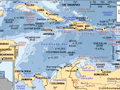
Many exposed peaks (some volcanic peaks) of an underwater mountain range created ________?
Caribbean island
Mexcio
Grand Island, Louisiana
Venezuela
Located in Mexico, between the Sierra Madre Oriental and Sierra Madre Occidental, is the heavily populated _______.
Mexican Plateau
The _________ has some of the highest population densities of the region (Mexico).
Mexican Plateau
The __________ is the largest lowland area of South America?
Amazon River Basin
Cattle have been raised on the large fertile plain areas called _______, which run along the Caribbean coast of south America (Columbia and Venezuela).
A grassy, treeless plains of Argentina and Uruguay, known as ______, is an area also known for its cattle industry.
What physical features have attracted settlers to Latin America?
What are the three sub regions of Latin America?
Middle America, South America, Caribbean
What helped create Latin American's rugged mountains?
The Andes consist of cordilleras. What are cordilleras?
What is the significance of Chimborazo?
What Latin American country has the largest strip of coastal plains?
Where does a majority of Brazil's population live?
Northern Brazil
(mountain)
Western Brazil
(valley)
Southern Brazil
(plateau)
Southeastern Brazil (coast)
Why are Llanos and Pampas important?
Central America and the Caribbean island are bordered by water. They have _______ river systems and are less dependent on rivers for transportation.
fewer
Most of the major rivers in Latin America are in _________.
Caribbean
Middle America
South America
The ________, is the longest river in the Western Hemisphere (4000ft), is the most extensive river system in South America and drains much of Brazil and other nearby lands.
The Amazon river is fed by over ______ and carries more water than the next seven largest rivers combined.
700 tributaries
1,000 tributaries
What three rivers form the second largest river system in South America?
Purana, Paraguay and Uruguay river system provide an important water route as was as _______ for the area.
hydroelectric power
The Paraguay and Uruguay rivers join to become the ________, which means "river of silver".
The Orinoco River runs through northern South America to the Atlantic Ocean. It flows partly along the Venezuela-Colombia border and drains interior lands. It is home to the continent's few remaining _______?
native people
The _________ River serves as part of the border between the United States and Mexico.
The __________, constructed in the early 1900's, connects the Atlantic Ocean with the Pacific Ocean and divides North and South America. The canal cuts across the Isthmus of Panama and is important for trade since it greatly reduces the time for ships to ravel between the Atlantic and Pacific oceans.
Latin America DOES NOT have many large lakes;
matter the following Lakes and Waterfalls
is the world's highest large navigable lake
Lake Titicaca
in Venezuela, is the regions' largest lake. It contains the most important oil fields in that country
Lake Maracaibo
the largest lake in Central America, lies on the border between Nicaragua and Costa Rica
Lake Niccagua
in Venezuela, is the world's highest uninterrupted waterfall, drooping 3,212 feet
Angle Falls
Lake Maracaibo in Venezuela, is the region's largest lake. it contains the most important ______ in the country.
oil fields/reserves
Where are Latin America's major rivers located?
Western Hemisphere
Eastern Hemisphere
Northern Hemisphere
Southern Hemisphere
What is the western hemisphere's longest river?
How does the Amazon River and the Mississippi River compare in water volume?
The Amazon River has a much larger water volume than the Mississippi River. 12x's larger
The Amazon River and the Mississippi River have similar water volumes.
The Mississippi River has a larger water volume than the Amazon River. 12x's larger
What is Latin America's second largest river system and which area does the river drain?
Purana, Paraguay & Uruguay Rivers, draining areas of Brazil
What is Rio de la Plata?
Why is the Panama Canal a significant waterway?
Much of Latin America lies in the _______, between the Tropic of Cancer and the Tropic of Capricorn.
low latituides
mid latituides
high latitudes
Much of Latin America has some form of ______ climate.
Latin American's broad range of climate and vegetation is due to 3 factors.
it spans great distances on either side of the equator
it has big changes in elevation due to the mountains
its climate's affected by both warm Atlantic, and cold Pacific currents
it has a very large river system that helps regulate the over climate and water needed
A tropical wet climate occurs in southern Mexico, eastern Central America, the eastern shores of the Caribbean Island, and large parts of South America.
rain forest
Savanana
Desert
Tropical wet rain forest climates are located on the ________ and _________ give these areas high temperatures and abundant year around rainfall.
equator; Prevailing winds
The world's largest tropical rainforest, covering about _________ of South America and 2 million sq. miles, is in Brazil in the Amazon River Basin.
2/6
1/2
1/4
1/3
What is the worlds largest rainforest that covers 1/3 of South America, in Brazil?
In the tropical rain forest, the tops of evergreen trees form a ______, or covering, that keeps the sun from reaching the forest floor.
True or False:
More kinds of trees and species of animals live in these rain forest than in any other area of the world?
True
False
A tropical dry or ________ climate can be found in most of Central America and the Caribbean Island as well as the coast of southwestern Mexico. the temperature is hot with seasonal rain.
rainforest
desert
savanna
An example of a tropical dry savanna in Central America is a _______?
llanos
treeless grassland
Atacama Desert
Amazon Rainforest
Humid Subtropical climate is found mainly in southeastern South America, from Rio de Janeiro to northern Argentina. Natural vegetation includes (a) , and prominent crops are (b) , (c) and (d) .
The ______ is one of the driest places in Latin America. In some parts of this desert area ______ rainfall has ever been recorded.
Sonoran Desert, heavy
Patagonian Desert, moderiate
Atacama Desert, no
Chihuahuan Desert, very little
_______ from the Pacific Ocean allows some limited vegetation to grow in the desert areas of Latin America. Prickly cacti and drought resistant shrubs grow in Latin America's other deserts.
Fog
A steppe climate occurs in Northern Mexico, highland areas in South America near the Andes, and coastal areas of South America. Some areas of Latin America have a steppe climate of hot summers, cold winters and light rainfall. Vegetation consist of __________?
treeless grasslands
Highland climates are found along the _______ Mountains of Mexico and the _____ Mountains of Colombia, Ecuador, Peru, Bolivia, Argentina and Chile.
In the highland climate Central and Latin America ; how warm, cool or cold an area is depends on _______, or distance from the equator and ________?
latitdue, elevation
Highland climates are commonly arrange vertically into _______ major zones?
Name the five major zones of the highland climates?
Tierra Helada (frost/frozen)
Puna
(high elevation, motion sickness)
Tierra Fria
(Cold)
Tierra Templada
(Temperate)
Tierra Caliente
(Hot)
Match the 5 Highland Climate zones:
Frozen Country, 16,000 ft and above, less than 20o F, permanently covered in snow and ice year round
Tierra Helada
Mountain sickness, 12,000-16,000 ft, no trees, 20o to 55o F, grasses for grassing sheep, llama and alpacas
Puna
Cold country, 6,500-12,000 ft, 55o to 66o F, above sea level, potatoes, barley, highest climate zone in Middle America
Tierra Fria
Temperate Country, 2,500-6,500ft above sea level, 65o to 75o F, coffee, corn & where most people settle
Tierra Templada
Hot country, sea level to 2,500ft, 75o to 91o F, Bananas, sugar, rice cacao
Tierra Caliente

