
 Worksheets
Site investigation 1
Total questions: 18
Worksheet time: 9mins
Which statement best explains why site investigation is essential in construction projects, as shown in the visuals?
It replaces the need for structural calculations entirely
It ensures material deliveries are always on time
It guarantees permits are approved without delays
It supports design decisions by revealing ground conditions

A project team aims to minimize risks and predict project outcomes. Which action aligns with the highlighted role of site investigation?
Waiting until construction to inspect the site
Using systematic steps to collect site data
Skipping subsurface testing to save budget
Relying solely on past projects’ assumptions
Which item is part of initial site data gathering to inform design feasibility?
Geotechnical investigation including borehole reports
Post-construction commissioning and handover plan
Detailed interior fit-out specification for tenants
Marketing strategy for selling residential units
A proposed city-centre project faces narrow streets and limited access. Which site feature most directly affects construction logistics?
Long-term building maintenance scheduling
Architectural style preferences of investors
Regional climate and seasonal rainfall patterns
Configuration of the site and access relationships
Which building orientation strategy best supports passive heating in a cold winter climate as shown in the diagram?
West-facing glass to warm afternoons
East-facing glazing to catch morning sun
South-facing windows to absorb solar gain
North-facing clerestories to avoid glare
A rural site has sloped terrain and a stream crossing the parcel. Which factor primarily describes these physical land characteristics?
Building code fire ratings
Topography of the project site
Easement agreements for neighbors
Traffic capacity of adjacent roads
What is the most accurate definition of a right of way relevant to site access?
A covenant restricting exterior materials
A privilege allowing passage over another’s land
A tax reduction for construction work
A permit to increase building height
Which statement best defines a site investigation in civil engineering?
A non-intrusive review of maps for land purchase
An intrusive assessment of subsurface conditions and strata
A visual check of building aesthetics and layouts
A financial appraisal of construction costs and contracts
Which activity is typically part of the desk study stage of site investigation?
Drilling boreholes to sample deep soil layers
Reviewing existing records, maps, and prior reports
Walking the site to note visible hazards and access
Excavating trial pits to test foundation bearing
A project team plans the three primary stages of a site investigation. Which sequence supports effective risk reduction?
Desk study, walk-over survey, physical exploration
Intrusive exploration only, skipping preliminary stages
Physical exploration, desk study, walk-over survey
Walk-over survey, physical exploration, desk study
Which statement best describes a desk study in site investigation?
Conducts a walk-over visual inspection
Performs boreholes and trial pits on site
Collects and analyzes existing site information
Designs structural foundations directly
During the desk study, which sources are most relevant to understand historical site use and potential hazards?
Topographic maps and old land records
On-site drilling and sampling reports
Contractor bid submissions and invoices
Real-time sensor monitoring data
You are planning the initial investigation for a proposed building. Outline the most appropriate sequence for early stages to identify ground risks.
Physical exploration, then desk study
Physical exploration, then walk-over survey
Walk-over survey, then desk study
Desk study, then walk-over survey
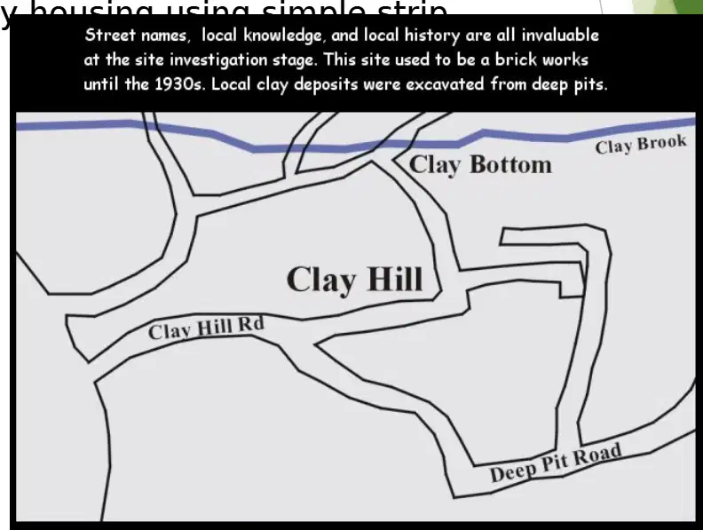
Which source is most appropriate to identify the likely nature of subsoil at the start of a desk study?
Utility service layouts and manhole surveys
Geological maps and local knowledge records
Historic land-use registers and aerial photos
Building elevations and architectural drawings
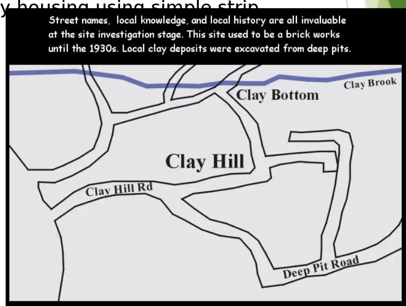
A housing developer plans two- and three-storey buildings. Which subsoil condition would most likely support simple strip foundations without special measures?
Soft alluvium near watercourses
Firm clays, compact sands, gravels
Highly fractured shale beds
Loose peat and organic silts
You are reviewing old maps and utility plans before designing foundations. Which risk should be flagged for further investigation during the desk study?
Seasonal changes in building materials
Potential filled or contaminated ground
Solar exposure variations across site
Availability of skilled local contractors

During a walk-over survey, which activity best supports hazard identification on site?
Recording photographic evidence systematically
Estimating soil bearing capacity visually
Calculating structural loads from drawings
Selecting construction materials off-site
You arrive for a walk-over survey with a site plan and camera. Which step should you take first to build a reliable visual record?
Mark utility lines from county records
Sketch drainage layouts from memory
Interview the site vendor for historical issues
Establish a route covering all topography features

