
Pittman's Geography Review
Presentation
•
Social Studies, Geography
•
5th Grade
•
Practice Problem
•
Medium

Courtney Pittman
Used 1+ times
FREE Resource
11 Slides • 34 Questions
1

2

3

4


5


6
Labelling
7
Dropdown
8
Dropdown
9
Dropdown
10
Multiple Choice
11
Multiple Choice
12
Multiple Select
13
Fill in the Blanks
14
Multiple Choice
15
Multiple Choice
16
Multiple Choice

17
Multiple Choice

What geographic feature does this image show?
18
Multiple Choice

19
Multiple Choice

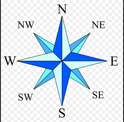
What is this showing?
20
Multiple Choice

What is this showing?
21
Multiple Choice

22
Multiple Choice

23
Multiple Choice
24
Multiple Choice
25
Multiple Choice
26
Multiple Choice
27
Multiple Choice
28

29

30
31
Multiple Choice

Name that continent!
32

33
Multiple Choice

Name that continent!
34

35
36
Multiple Choice

True or False
Antarctica has the world's largest desert.
37
Multiple Choice

Name that continent!
38
Multiple Choice

What is this continent called?
39
Multiple Choice

Which continent is this?
40
Multiple Choice

Which continent is this?
41
Multiple Choice

Which continent is this?
42
Multiple Choice

Which continent is this?
43
Multiple Choice

Which continent is this?
44
Multiple Choice

Which continent is this?
45
Multiple Choice

The United States of America is a continent
Show answer
Auto Play
Slide 1 / 45
SLIDE
