
第八课时 现代化的农场
Presentation
•
Geography
•
6th - 8th Grade
•
Easy
•
思维模型
Standards-aligned

chao liang
Used 3+ times
FREE Resource
11 Slides • 21 Questions
1
2
3
Word Cloud
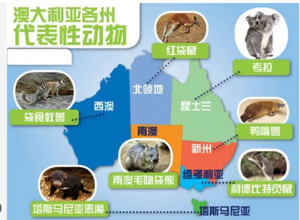
本课所学的国家名称是(四个字)
4
5
Dropdown

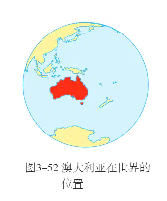
结合课本地图,分析澳大利亚的相对位置:
澳大利亚位于
占据整个
澳大利亚位于
半球的
,是世界上唯一
占据整个
的国家。西邻
,东临
。
6
Labelling
7


8
Hotspot
9
Drag and Drop

结合图片,分析澳大利亚的绝对位置。
澳大利亚的经度范围约
澳大利亚的经度范围约
,属于
半球,纬度范围约
,穿过
(回归线),温度带有热带和
带。
10
Hotspot
11
12
Drag and Drop
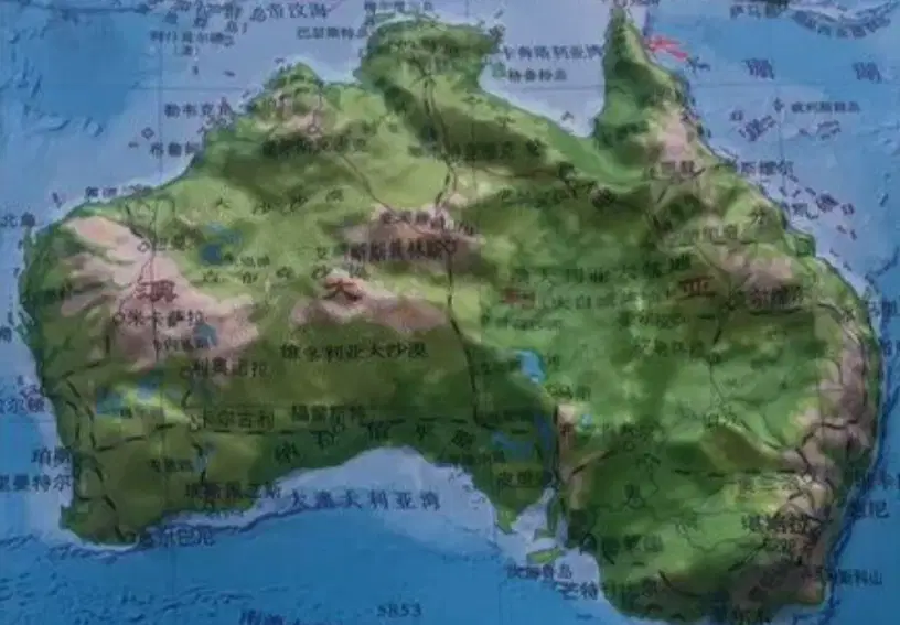
地形:西部
、中部
、东部
,地势上总体较
。
13
Labelling
14

15
Drag and Drop

分析澳大利亚的气候,东部最适宜的气候是
,中部是
,西部是
,南部是
,
16
Dropdown

澳大利亚整体气候分布特征:气候比较
,降水量呈
,自北、
、南三面向西部沿海和
减少。
17


18
Drag and Drop
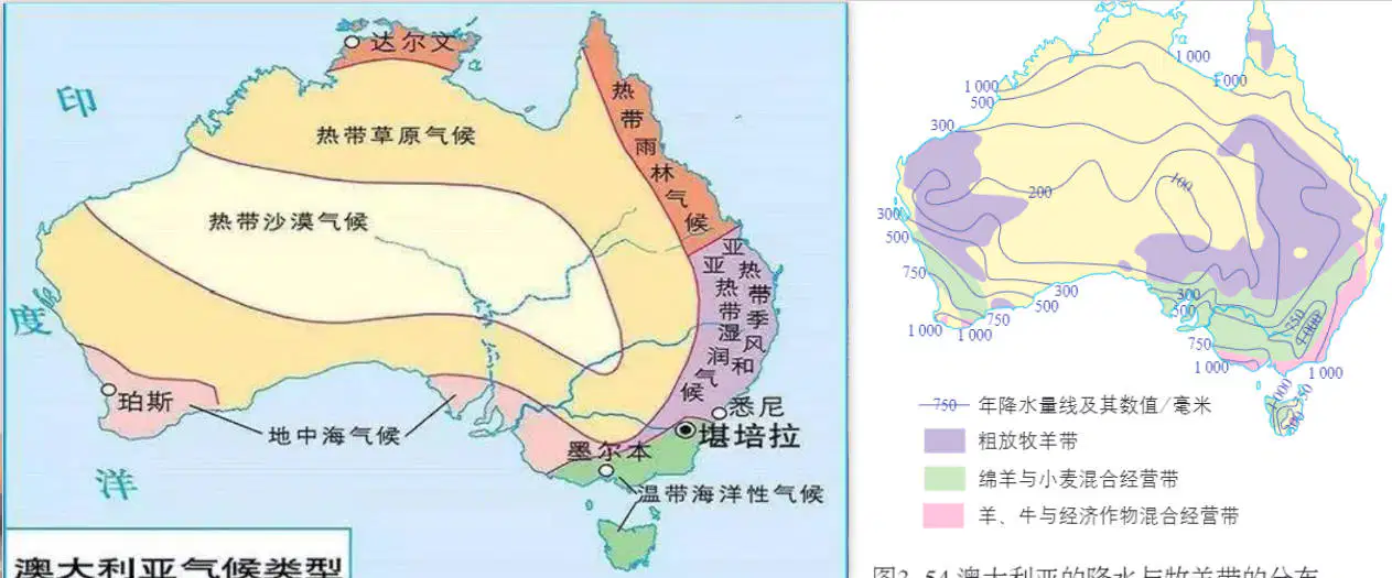
牧羊带与
基本吻合,大致呈
分布。主要畜种是
。
19

20
Dropdown
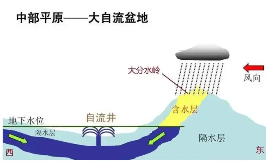
水文:澳大利亚
宜发展
缺乏,
资源却十分丰富。地下水含盐量
、温度高,不适
宜发展
,却适于
。
21
Drag and Drop

植物资源:澳大利亚幅员辽阔,气候比较干热,近2/3的土地属于
。天然
占陆地国土总面积的一半左右。集中分布在
和西部的草原上,牧场规模很大,一般可以达到几千公项。
22
Drag and Drop
动物资源:没有大型
动物,牲畜可以
。
23
24
Multiple Choice

澳大利亚属于
25
Drag and Drop
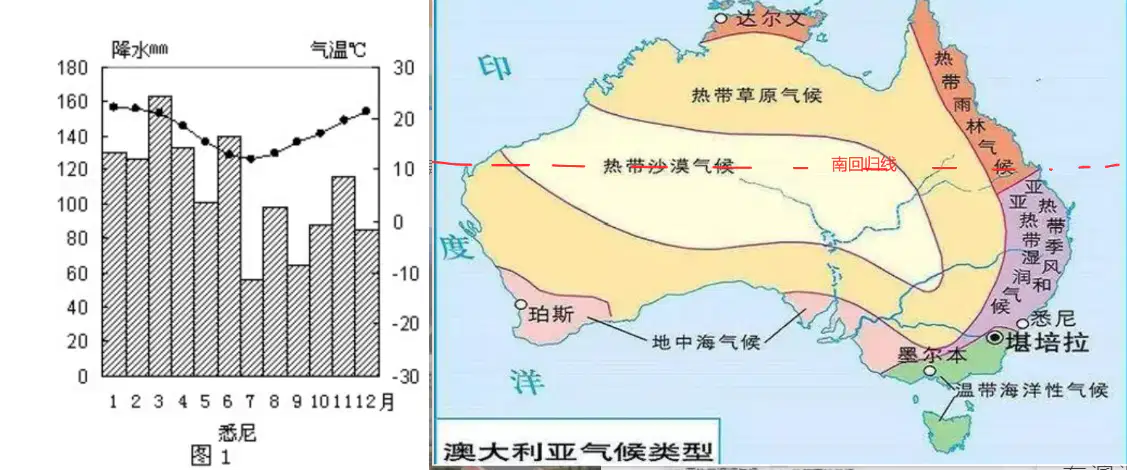
观察澳大利亚气候图,可知主要人口和城市集中在澳大利亚西南方向和东南方向,首都是
,最大城市是
,悉尼气候类型是
,特征是
高温多雨,
温和湿润。
26
Labelling
27

28
Multiple Choice
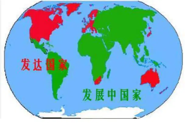
观察图片,可知澳大利亚属于
29
Drag and Drop

澳大利亚畜牧业的迅速发展,除了得益于有利的自然条件,还离不开先进的科技与现代的
应用,在全国设有许多专门从事畜牧业研究的
。澳大利亚政府十分重视畜牧业的研究与技术的
应用,在全国设有许多专门从事畜牧业研究的
,许多大学中也有专门的畜牧业研究机构。西澳大利亚大学研制出世界上第一个全自动的
。如今,牧民在放牧、打草、投料、剪毛、挤奶、屠宰等环节上都使用了
的机械。澳大利亚的牧民过着现代化的定居生活。(畜牧业)
30
Drag and Drop
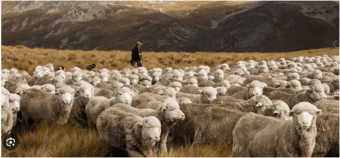
澳大利亚养羊业产业化、机械化程度高,耗用劳动力少。所产羊肉和羊毛主要用于
,
很高。澳大利亚是世界上绵羊数量和出口羊毛
的国家,被称为“
”。“
是澳大利亚的真实写照。
31
32
Labelling
Show answer
Auto Play
Slide 1 / 32
SLIDE
