
World Map
Presentation
•
Social Studies
•
5th Grade
•
Medium

Laura Nutt
Used 3+ times
FREE Resource
0 Slides • 10 Questions
1
Multiple Choice

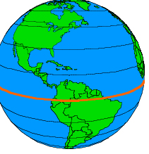
The red line on this map represents the imaginary line at zero degrees latitude.
2
Multiple Choice
3
Multiple Choice
4
Multiple Choice

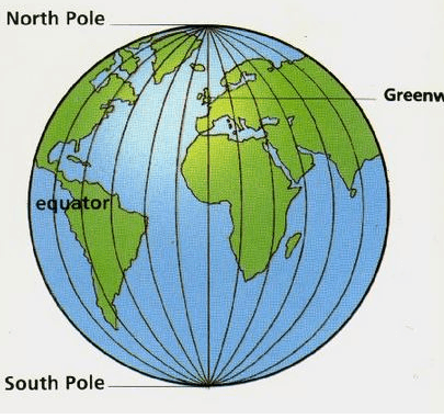
Which continents are ENTIRELY above the equator?
5
Multiple Choice

How many continents does our Earth have?
6
Multiple Choice
7
Multiple Choice
8
Multiple Choice
9
Multiple Choice
10
Multiple Select
The red line on this map represents the imaginary line at zero degrees latitude.
Show answer
Auto Play
Slide 1 / 10
MULTIPLE CHOICE
